
DOWNLOAD MY NEW FREE JOESTRADAMUS WEATHER APP FOR ANDROID

THE APP IS ABSOLUTELY FREE TO ALL BUT CONSIDERING SUBSCRIBING TO PATREON FOR A WEATHER EXPERIENCE FREE OF ADS, EXCLUSIVE VIDEOS FOR MEMBERS ONLY AND MUCH MORE…STARTS AT $2 A MONTH..MESSAGE ME AT ANY TIME

Snow North Jersey Hudson Valley Western Connecticut
Weekend Rain 1 to 2 Inches Colder Dry Next Week
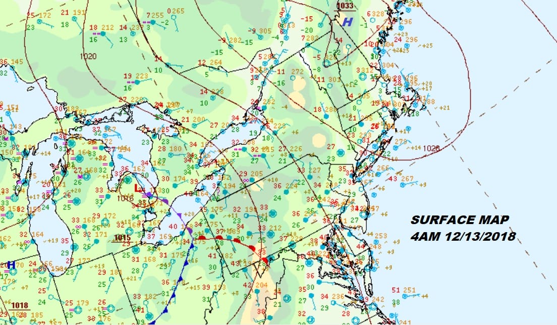
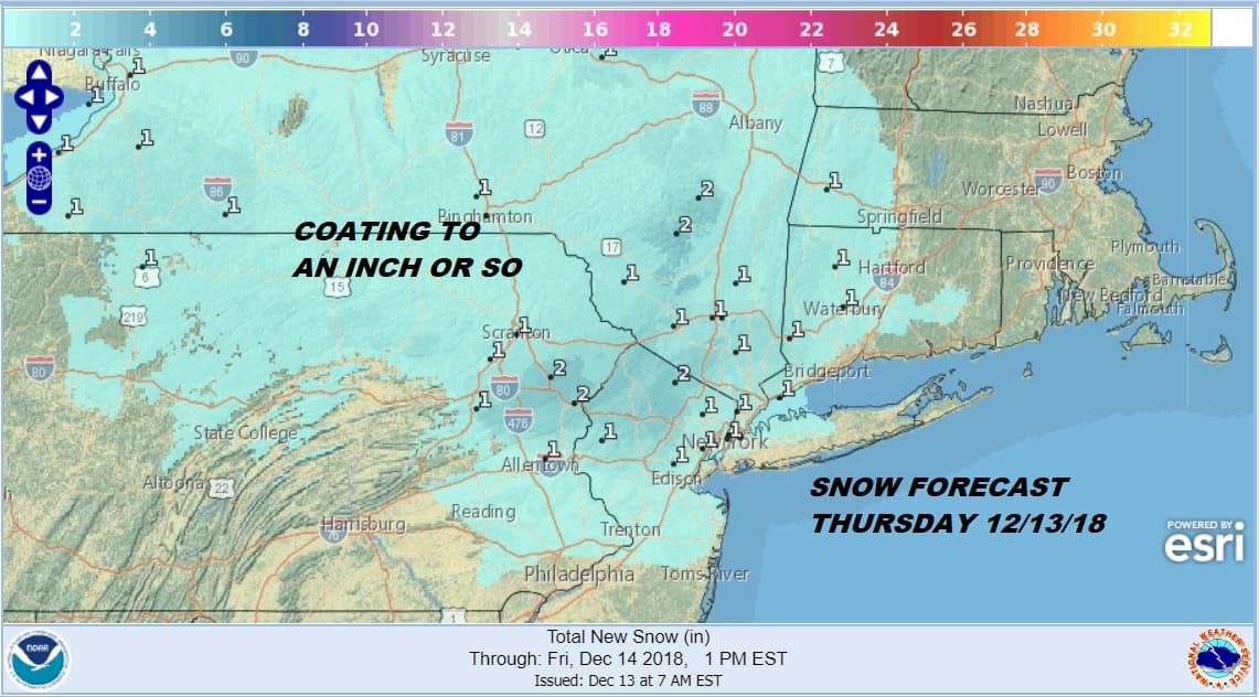
We are seeing cloudy skies this morning and some light snow that has broken out on the regional and local radars. The areas of snow are light and rather patchy. They will continue into this afternoon. This is in response to warmer air trying to head northeastward into a cold high that has built southward into New England. This will all play through today with snow gradually ending from west to east this afternoon. Some areas along the coast and in New Jersey south of Route 78 will likely see any light snow end as light rain or drizzle. Snow accumulations will be on the order of a coating to an inch or so in most places with accumulations patchy from place to place.
Temperatures are sitting below freezing this morning but we should start to rise as the day wears on. Inland areas might night get above freezing during the daylight hours but we should see temperatures everywhere go above freezing overnight as milder air from the off the ocean beings to have impact. Whatever falls today should not refreeze tonight.
EASTERN SATELLITE

REGIONAL RADAR

Regional and local radars are showing snow. Most of it is on the light side and some of it isn’t even reaching the ground. The southern edge of the snow on the radar is expanding at the moment into the Northern New Jersey counties while all of this is moving to the northeast. Another band to the west could get involved this afternoon as it is also moving to the east.
LOCAL RADAR NEW YORK CITY

LOCAL RADAR PHILADELPHIA


As all of this gets out of the way tonight we will remain cloudy right through Friday. Temperatures will rise through the 40s on Friday and we will be staying in the 40s over the weekend. Rain is coming thanks to low pressure from the Southern Plains that heads into the Appalachains and then redevelops along the Virginia coast. There is no cold air wedging down the East Coast this is all rain and it is a long event. Rain arrives Friday night and lasts on and off through Sunday. A raw east wind will prevail through Sunday until the low begins to move away to the northeast.

Rainfall amounts of 1 to 3 inches are possible. The NAM model to me has the best fit with this regarding rainfall amounts. Once this storm moves away on Monday another shot of cold air drops into the Northeast on a strengthening northwest wind. Next week about the only place that will be cold east of the Mississippi will be the Northeast as we have a northwest flow from Canada bringing down a couple of cold fronts and a couple of shots of cold air. The week does look dry however for the most part.
MANY THANKS TO TROPICAL TIDBITS FOR THE USE OF MAPS
Please note that with regards to any tropical storms or hurricanes, should a storm be threatening, please consult your local National Weather Service office or your local government officials about what action you should be taking to protect life and property.

