DOWNLOAD MY NEW FREE JOESTRADAMUS WEATHER APP FOR ANDROID

THE APP IS ABSOLUTELY FREE TO ALL BUT CONSIDERING SUBSCRIBING TO PATREON FOR A WEATHER EXPERIENCE FREE OF ADS, EXCLUSIVE VIDEOS FOR MEMBERS ONLY AND MUCH MORE…STARTS AT $2 A MONTH..MESSAGE ME AT ANY TIME

Another Nice Day Sunshine Cold, Light Snow Rain Thursday
Rain Friday Night Weekend
We begin another day with sunshine and cold conditions. We do have a weak cold front dropping southward from Eastern Canada. The front doesn’t have much with it other than some patchy clouds. It should be a nice day overall with sunshine and some patchy clouds. Temperatures should reach the upper 30s and lower 40s this afternoon. The satellite loop is showing just a few patchy clouds around. There is no rain or snow threat today as the regional radar is going to be very quiet today.
EASTERN SATELLITE

REGIONAL RADAR

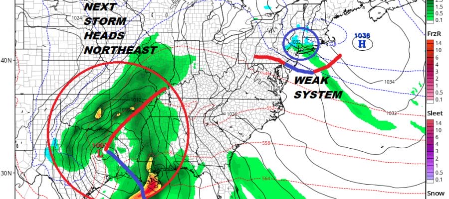
Once the front passes we will attempt to clear out but there is a little wave on the front over the Great Lakes that moves southeastward tonight and Thursday. Clouds will increase overnight. Thursday morning there could be a little light snow shower activity developing in the morning and lasting into early afternoon. This should not amount to much as the precipitation is forecast to be very light. We could see a coating of snow in some areas but barely enough to sweep away with a broom. By afternoon as the precipitation ends some rain could mix in. Thursday’s highs will be in the 30s.

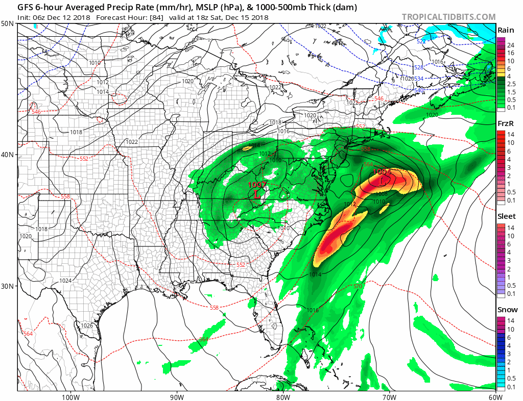
While this weak system sits overhead a stronger low develops in Northeast Texas and begins its move northeast. Friday will be cloudy and it will be a bit warmer with highs reaching the mid to upper 40s. Rain arrives Friday night and lasts into at least part of Saturday with highs in the 50s. Rainfall amounts will be on the order of 1 to 2 inches here. The first low moves out later Saturday but the upper air support lags to the west. This could allow room for a second low to bring more rain Saturday night and Sunday.
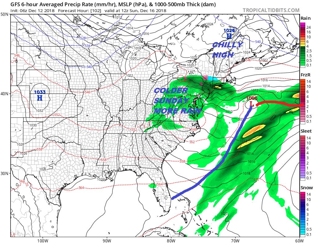
It isn’t a lot of cold air to the north with high pressure in New England Sunday but it does make for a raw cold day with rain or showers and temperatures just into the 40s. There might even be some cold air bleeding southward to chance rain to a little sleet or snow in the lower Hudson Valley & Northwest New Jersey or Sunday. We will keep an eye on this. Even if it happens it is likely to be something that falls from the sky but doesn’t really stick except for perhaps colder surfaces.
 This system still will be just offshore on Monday when it will turn colder and there is a chance we could see some backside snow here especially from NYC eastward. This could be more of an accumulating snow for Southern New England eastward. There is also a chance that ll this could be squashed further southeast. Meanwhile the overall pattern continues to evolve as we head toward Christmas with shots of cold air coming into the Northeast every couple of days. We do not see any kind of warm up of consequence in the long range. The pattern in fact could turn progressively colder late in the month and there will be opportunities for snow as Christmas nears.
MANY THANKS TO TROPICAL TIDBITS FOR THE USE OF MAPS
Please note that with regards to any tropical storms or hurricanes, should a storm be threatening, please consult your local National Weather Service office or your local government officials about what action you should be taking to protect life and property.

