
Snow Threats Arctic Air Weather Model Analysis

Snow Threats Arctic Air Weather Model Analysis
Over the last several days I have been saying here as well as on my videos that it was important not to focus too much on the specifics of the short range but rather to get an idea of the broader pattern and watch it play out. Often times weather models suggest things that appear and disappear only to reappear in the short range. That appears to be happening tonight as the GFS & Canadian weather models both seem to be zeroing in on a threat for snow early next week along with the prospect for very cold air later in the week (more so the GFS and yesterday’s European than the Canadian) and more storm threats down the road. The first comes on Monday.
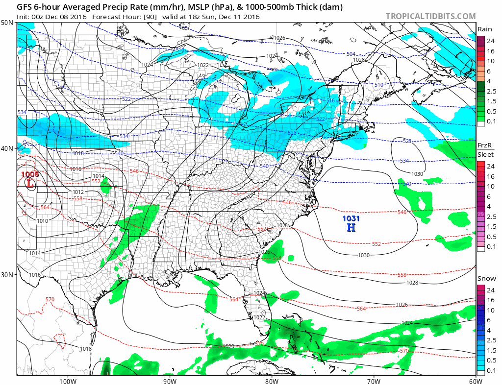
GFS WEATHER MODEL SNOW THREAT MONDAY
CANADIAN MODEL SNOW THREAT MONDAY
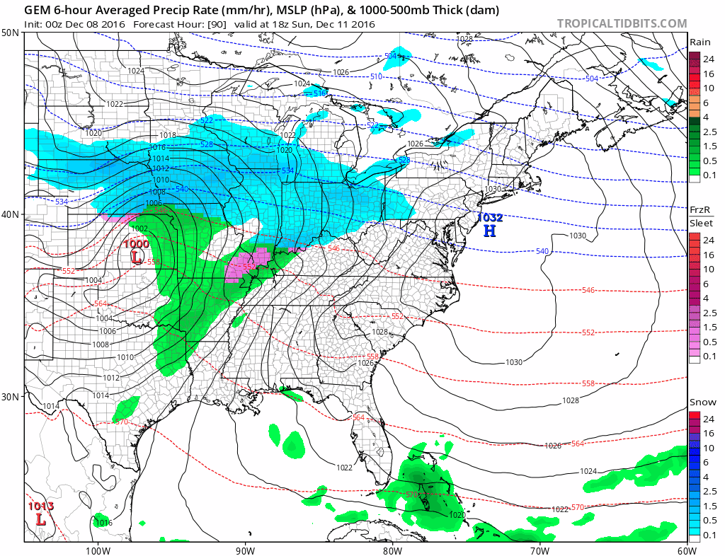
Both models bring out energy from the west however the GFS brings out a weaker piece than the Canadian and holds back stronger energy with the arctic front for Tuesday night into Wednesday. The Canadian does the reverse where it brings out the stronger piece first and the weaker piece with the arctic front. It also as a weaker arctic intrusion for later next week than the Canadian but it was similar to the dayside European model. The system as depicted on the GFS model is rather similar to what happened yesterday except that there is more cold air around to play with. Recently some models particularly the European and Canadian have been way too strong with weather systems moving into the east and the GFS up until now has performed better in this regard. One of the keys may be the North Atlantic Oscillation which earlier today was forecast to go slightly positive early next week. Perhaps this series of model runs is suggesting that the NAO may stay negative for a longer period than earlier forecast. Ensemble forecasts are mixed but seem to be supportive of the GFS idea. We will of course wait to see how the European model sees all this later this morning.
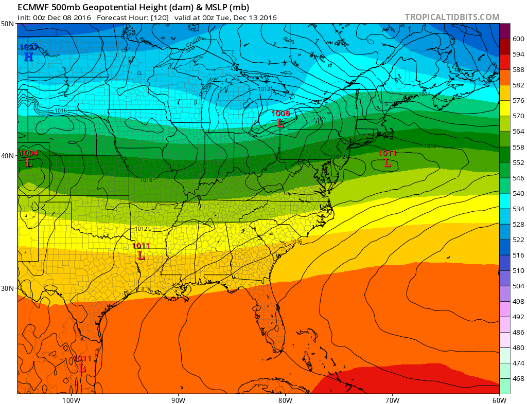
LATE DEVELOPMENT..THE EUROPEAN AND THE GFS MATCH UP RATHER WELL!!!
MANY THANKS TO TROPICAL TIDBITS FOR THE WONDERFUL USE OF THE MAPS
SNOW REMOVAL COMPANIES FOR YOUR WINTER NEEDS
LONG ISLAND ROCKLAND COUNTY Connecticut

![]()


JOHNSTOWN PA
COLOSIMO LAWNCARE

FiOS1 News Weather Forecast For Long Island
FiOS1 News Weather Forecast For New Jersey
FiOS1 News Weather Forecast For Hudson Valley
NATIONAL WEATHER SERVICE SNOW FORECASTS
LATEST JOESTRADAMUS ON THE LONG RANGE
Weather App

Don’t be without Meteorologist Joe Cioffi’s weather app. It is really a meteorologist app because you get my forecasts and my analysis and not some automated computer generated forecast based on the GFS model. This is why your app forecast changes every 6 hours. It is model driven with no human input at all. It gives you an icon, a temperature and no insight whatsoever.
It is a complete weather app to suit your forecast needs. All the weather information you need is right on your phone. Android or I-phone, use it to keep track of all the latest weather information and forecasts. This weather app is also free of advertising so you don’t have to worry about security issues with your device. An accurate forecast and no worries that your device is being compromised.
Use it in conjunction with my website and my facebook and twitter and you have complete weather coverage of all the latest weather and the long range outlook. The website has been redone and upgraded. Its easy to use and everything is archived so you can see how well Joe does or doesn’t do when it comes to forecasts and outlooks.
Just click on the google play button or the apple store button on the sidebar for my app which is on My Weather Concierge. Download the app for free. Subscribe to my forecasts on an ad free environment for just 99 cents a month.
Get my forecasts in the palm of your hand for less than the cost of a cup of Joe!
![]()
