Colder Air Moving In Snow Threat Sunday
Colder Air Moving In Snow Threat Sunday
A cold front is moving through and offshore which marks the leading edge of cold air. That cold air will take the next 48 hours or so to move in. Temperatures changes will be gradual with this first shot of cold Canadian are. Clouds with the front and a few very light sprinkles will give way to some sunshine this afternoon with temperatures in the 40s.
Due to a system upgrade satellite loops are not available at the moment but it may reappear at any time.


The weather will be dry through Saturday night with chilly morning lows each of the next three mornings. Clouds will be on the increase by Sunday morning as the first in a series of weather systems begins to move in.
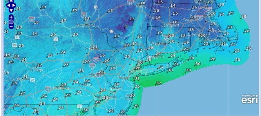
Colder Air Moving In Friday Forecast Lows
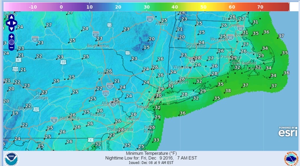
Colder Air Moving In Saturday Forecast Lows
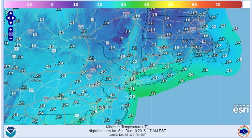
Colder Air Moving In Sunday Forecast Lows
Right now it appears that we will see some snow on Sunday as system number 1 moves in. That has a threat for a coating to an inch or so. Then a second round of moisture comes in Later Sunday night into Monday and that has the potential to produce a few inches of accumulation. The atmosphere will be colder and it looks a lot like the event on Tuesday except that the atmosphere will be much colder and much more supportive for snow in a larger geographic area. We will have more on this later today as new weather models begin coming out with their opinions.
Overnight models were bullish for snow and cold going forward and JOESTRADAMUS has more on this in his latest post.
SNOW REMOVAL COMPANIES FOR YOUR WINTER NEEDS
LONG ISLAND ROCKLAND COUNTY Connecticut

![]()

FiOS1 News Weather Forecast For Long Island
FiOS1 News Weather Forecast For New Jersey
FiOS1 News Weather Forecast For Hudson Valley
NATIONAL WEATHER SERVICE SNOW FORECASTS
LATEST JOESTRADAMUS ON THE LONG RANGE
Weather App

Don’t be without Meteorologist Joe Cioffi’s weather app. It is really a meteorologist app because you get my forecasts and my analysis and not some automated computer generated forecast based on the GFS model. This is why your app forecast changes every 6 hours. It is model driven with no human input at all. It gives you an icon, a temperature and no insight whatsoever.
It is a complete weather app to suit your forecast needs. All the weather information you need is right on your phone. Android or I-phone, use it to keep track of all the latest weather information and forecasts. This weather app is also free of advertising so you don’t have to worry about security issues with your device. An accurate forecast and no worries that your device is being compromised.
Use it in conjunction with my website and my facebook and twitter and you have complete weather coverage of all the latest weather and the long range outlook. The website has been redone and upgraded. Its easy to use and everything is archived so you can see how well Joe does or doesn’t do when it comes to forecasts and outlooks.
Just click on the google play button or the apple store button on the sidebar for my app which is on My Weather Concierge. Download the app for free. Subscribe to my forecasts on an ad free environment for just 99 cents a month.
Get my forecasts in the palm of your hand for less than the cost of a cup of Joe!