
Snow Showers Winding Down Colder Tonight Wednesday
Snow Showers Winding Down Colder Tonight Wednesday
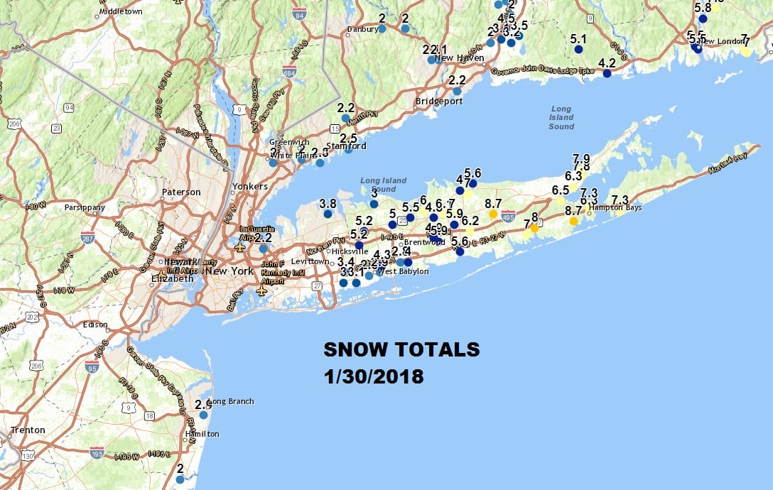
The storm offshore that brought a coating to 8 inches depending on where you were (Long Island Suffolk County got the 8″). is now offshore. The upper air trough that is swinging through that is producing some snow showers in a few places is winding down. Before too long skies will clear out and we will see temperatures by Wednesday morning drop to the teens to near 20 in most places. The overall pattern is going to be cold (most of the time ) and busy with weather systems approaching every couple of days.
US SATELLITE

REGIONAL RADAR

Local radars as well as the regional radar show the upper trough that is moving through with the light snow showers. Some spots could get the ground whitened and some could get a bit more but this won’t evolve into anything problematic.
LOCAL RADAR NEW YORK CITY

LOCAL RADAR PHILADELPHIA


Wednesday will be cold and sunny with highs back into the 30s. Then we will begin a rather fast pattern with the first of 3 systems coming through Thursday night into Friday. This is a cold front so we will see clouds and temperatures back into the 40s on Thursday. There will be a few showers Thursday evening and then as colder air comes in and a weak wave goes by Friday morning a change to snow before ending is possible. Then it is a shot of very cold air for the weekend. Another front arrives on Sunday and stalls to our south.
GFS FORECAST FRIDAY 7AM 02/02/2018
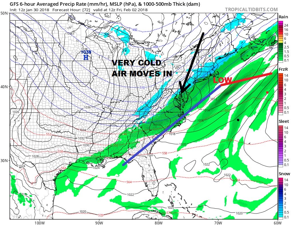
A stronger wave will develop and move northeast Sunday night into Monday much like what we just saw today so we will watch for a round of accumulating snow. We may do it a third time later next week. The overall pattern going forward looks favorable for snow events with cold air masses setting up in between and around them. It is going to be an interesting next few weeks at least.
 GET JOE A CIGAR IF YOU LIKE

FiOS1 News Weather Forecast For Long Island
FiOS1 News Weather Forecast For New Jersey
FiOS1 News Weather Forecast For Hudson Valley


