Snow Late Tonight Mostly Rain Sunday
Snow Late Tonight Mostly Rain Sunday
Tonight’s weather system is very simply a strong cold front with a shot of bitter cold air behind it. The question is how fast does the cold air come in before the precipitation shuts off. This basically gives you a couple of hours to put down whatever you can put down. Based on the some of the latest models coming out a coating to an inch or so seem possible and I would not be surprised if there are some isolated amounts that get 2 inches. It will be almost like a summer cold front with the snow somewhat convective in nature and it could snow hard for a very brief time in some places. Clouds are rolling in now. There isn’t much happening on the radar at the moment except in parts of upstate NY where the frontal boundary is already set up.
US SATELLITE

REGIONAL RADAR

I’m not expecting much to happen today until later this afternoon with some rain breaking out in time for the evening commute. Then look for the rain to change over to snow around or after midnight and it should be done before 7am on Friday. Temperatures today will be in the 40s and than fall rapidly into the 20s by morning. They will stay in the 20s all day Friday with wind chills in the single digits. Temperatures will bottom Saturday morning in the teens and single digits.
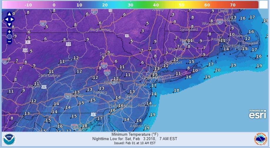
Temperatures recover back to the upper 20s and lower 30s by Saturday afternoon. Then the next weather system follows for Sunday which is beginning to look more and more like another cold front and not much else. Some snow will develop Sunday across Pennsylvania and move into Northern New Jersey and the Hudson Valley by afternoon and then changing over to rain everywhere. Along the coast from Long Island south it could be just rain all the way through.
GFS SNOW FORECAST FOR SUNDAY INTO MONDAY MORNING
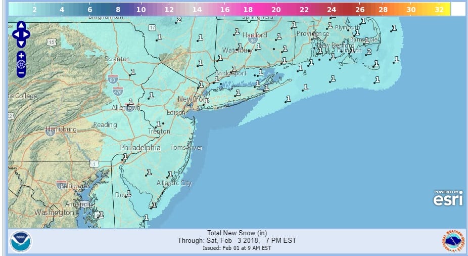
 Right now as far as accumulations are concerned, I think there could be a few inches across Northeast Pennsylvania, Northwest New Jersey, to the Hudson Valley and Connecticut north of Route 84 before a change to rain occurs. Once this system moves out Sunday night it should turn colder and drier on Monday. I also think models could be a bit too aggressive in areas to the north but on the whole this is a 3-6″/4-8 inch event for areas well north in upstate NY and interior New England.
 GET JOE A CIGAR IF YOU LIKE

FiOS1 News Weather Forecast For Long Island
FiOS1 News Weather Forecast For New Jersey
FiOS1 News Weather Forecast For Hudson Valley


