
Snow Ice Well Inland Super Bowl Sunday
Snow Ice Well Inland Super Bowl Sunday
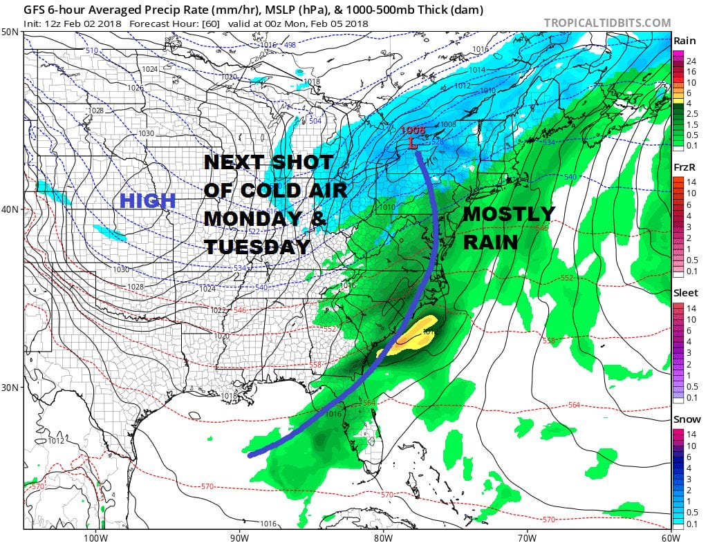
The next weather system will be arriving Sunday. It seems odd that it could be as cold as it is on Saturday and that many areas won’t see a flake or an ice pellet on Sunday. The reality is the cold high moving overhead tonight will be passing offshore to the south and east. There is nothing to hold the cold air in. Southwest winds will develop and this will bring temperatures up along the coast. The southwest wind however will not warm the inland areas up as quickly so some cold air will be trapped for awhile. This means areas north and west of the coast from Northwest New Jersey into Northeastern Pennsylvania north and east into the Hudson Valley (mainly north of Route 84) and in Northwest Connecticut will see some snow before a change to mix and then rain.
US SATELLITE

In the meantime it is going to be a cold night especially if winds drop off after midnight. It might allow some inland spots to drop an extra degree or two. Lows will be in the single digits to the low teens in most areas. The satellite does show the last of the clouds around this afternoon moving out and skies should be mostly clear. Winds have been gusty all day with wind chills in the single digits. The winds will be relaxing quickly later this evening and overnight. Radars are quiet and should remain so through Saturday night.
REGIONAL RADAR

Saturday will be nice and sunny with not much wind and highs should reach back into the 30s. Then clouds roll in Saturday night and we set up for Sunday’s round of precipitation. Rain develops by afternoon along coastal areas. Inland north and west of 287 in New Jersey and the Hudson Valley north of 287 we could start off as some snow or sleet. There is an outside chance for a coating to an inch or so in these areas but as we move into the Northwestern Counties of New Jersey and in the Hudson Valley north of Route 84 a few slushy inches are possible. Even in these areas a change to rain is likely by Sunday evening. All precipitation ends by midnight or during the early morning hours on Monday. Another shot of cold air comes in for Monday and Tuesday as we dry out.
GFS FORECAST LATE TUESDAY NIGHT
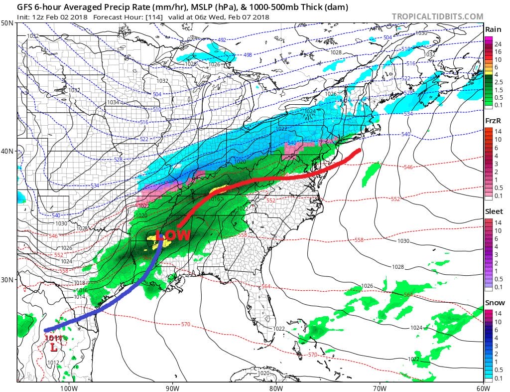
The next in a series of waves of low pressure will come out of the Gulf States and heads northeastward. This looks to be another snow to rain situation for our area unless this winds up being a weaker flatter system and the cold air to the north is a little more important then currently advertised.
 GET JOE A CIGAR IF YOU LIKE

FiOS1 News Weather Forecast For Long Island
FiOS1 News Weather Forecast For New Jersey
FiOS1 News Weather Forecast For Hudson Valley


