Showers Passing Through Mostly Dry Until Friday Weekend Dry Chilly
In a time of year where you can set up and set in raw rainy conditions for days at a time it is a positive that weather systems continue to move along from west to east. Our great weather of the last two days is done. We have a cold front moving through today with clouds and the risk for a few showers.
SATELLITE

REGIONAL RADAR

Regional and local radars are picking up on showers though when you look at the closely at the radar they show up as two lines moving eastward. There appears to be a very narrow line of heavier downpours and possibly a thunderstorm or two showing up. I would not expect those to last as they move eastward. They should weaken once they get close to the coast.
LOCAL RADAR NEW YORK CITY

LOCAL RADAR PHILADELPHIA


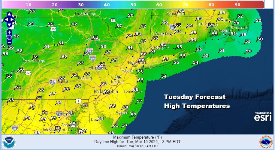
We still have warm air around today leftover from yesterday so highs will reach the mid and upper 60s today. Once the front passes slightly cooler air will begin to arrive overnight into Wednesday. Much of Wednesday and Thursday will be dry though there will be cloud cover to deal with. We have a weak system passing well to our south Wednesday night into early Thursday but that system probably does nothing in terms of rainfall. Highs Wednesday and Thursday will be in the 50s both days
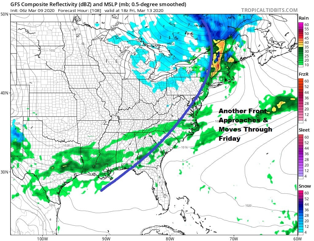
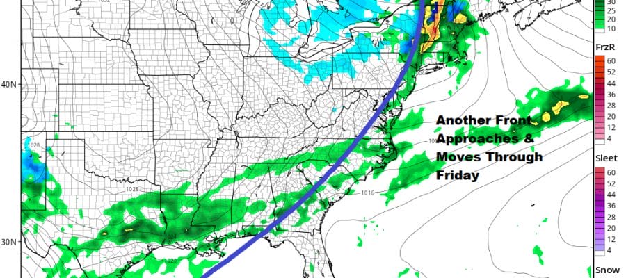
The next weather front will bring showers late Thursday night into at least part of Friday before it moves offshore. Highs Friday will be into the 60s ahead of the cold front. Rain from this system doesn’t look to amount to much nor will the rain from today’s weather system that is moving through. Weekly rainfall totals from both systems will be in the order of a quarter to at most a half inch.

The upper air jet stream pattern this week and this weekend is really a wash rinse repeat of the last couple of months. There is nothing new here. Weather systems continue to move along from west to east. The jet stream dips down in the west keeping it cooler and wetter there while we have a ridge in the Eastern US. Look closely near the end of then of the loop (Saturday into early Sunday) and you will see a kink in the flow. That is a weak weather system that is moving through through the upper ridge. That trough is weakening as the ridge is overpowering.
Saturday we will see sunshine and arriving clouds with highs in the 40s. There is a slight chance we could see a few rain or snow showers move through Saturday night into Sunday morning as the weak system moves eastward and falls apart. Later Sunday some sunshine returns but it will be chilly with highs just in the 40s.
BE SURE TO DOWNLOAD THE FREE METEOROLOGIST JOE CIOFFI WEATHER APP &
ANGRY BEN’S FREE WEATHER APP “THE ANGRY WEATHERMAN!
MANY THANKS TO TROPICAL TIDBITS FOR THE USE OF MAPS
Please note that with regards to any severe weather, tropical storms, or hurricanes, should a storm be threatening, please consult your local National Weather Service office or your local government officials about what action you should be taking to protect life and property.


