Showers Linger Into Midday Before Weather Improves Summer Weekend Sunshine Low Humidity
We are almost there folks. Last night’s cold front has moved offshore but it is sinking southward slowly. It is oriented northeast southwest and it is as if the low developing offshore has a a bit of a tail and we are in it right now. We see lots of clouds but we also see dry air in Southeastern Canada poised to head southward which it will do later today. We should see clouds and showers lingering into midday before clouds begin to decrease from northwest to southeast this afternoon. This should allow for some developing sunshine later today. Temperatures will be in the 70s.
SATELLITE

REGIONAL RADAR

We can see the rains that are left on the radar making their final pivot southeastward. It won’t belong before it will all be offshore and weather conditions finally get better. The good news is that we have no rain in the forecast for the entire weekend and into Monday of next week.
LOCAL RADAR NEW YORK CITY

LOCAL RADAR PHILADELPHIA


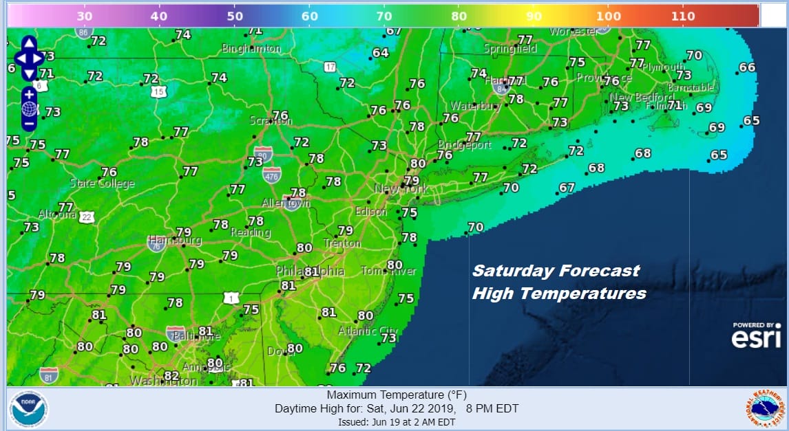
Skies will clear out tonight and it will be nice with low humidity and temperatures in the 50s to near 60. Saturday looks good with mainly sunny skies. There may be a few clouds over Eastern Long Island as a disturbance drops southeastward off Cape Cod. Other than that it is a good day with highs in the 70s to near 80 in most places. We will have a gusty breeze from the northwest especially along the coast so if you are beach bound prepare to be sandblasted a bit.
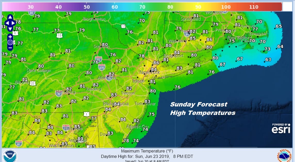
Sunday looks great with lots of sunshine. Humidity will still remain low with highs reaching into the 80s in most places. The dry air will hold on into Monday morning before it begins to give way to warmer and more humid air coming in from the southwest.
Monday I think we see a mix of sun and clouds. It will be warmer and it will be more humid with highs reaching the 80s. I think there is a low chance for a shower or thunderstorm Monday evening, mainly well inland and west of the coast. For the vast majority Monday there are no issues.
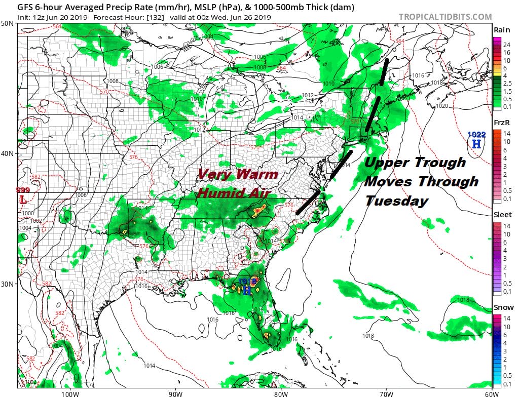
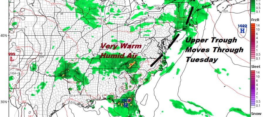
Tuesday Wednesday and Thursday will be very warm and humid with the occasional risk for a shower or thunderstorm. Right now Tuesday will see some scattered activity and a cold front late in the week might bring a better chance for showers and thunderstorms However the vast majority of the time next week will be rain free. Highs Tuesday and Wednesday will be in the 80s to near 90 in some hot spots depending on clouds. One upside to all this rain is the high moisture content in the soil will actually help to keep tempertures down by a degree or two..so it might be very warm..and it might even push to 90 degrees from time to time but the heat in general should be contained and not get out of hand.
MANY THANKS TO TROPICAL TIDBITS FOR THE USE OF MAPS
Please note that with regards to any tropical storms or hurricanes, should a storm be threatening, please consult your local National Weather Service office or your local government officials about what action you should be taking to protect life and property.


