
Thunderstorms This Evening On Off Showers Into Friday Morning Nice First Summer Weekend
Radars are getting very busy this afternoon. We have 3 separate lines of thunderstorms that are developing. One is in Southeastern Pennsylvania and moving into Southern New Jersey. We have already seen as of 3pm Flash Flood Warnings and Severe Thunderstorm Warnings for some counties in Southeastern Pennsylvania and Southern New Jersey. A second line is developing in Northeastern Pennsylvania and that is moving slowly east and showing signs of strengthening. There is a third line behind that one in Western NY extending into North Central Pennsylvania and that is moving east as well.
REGIONAL RADAR

LOCAL RADAR NEW YORK CITY

The line in Southeast Pennsylvania looks impressive as it moves eastward. The Northern part of that line if it holds together could extend northward to Route 78 and then eventually reach NYC and the New Jersey coastal counties as the evening commute gets underway.
LOCAL RADAR PHILADELPHIA


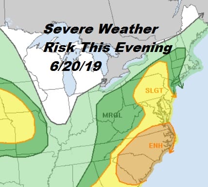
The Storm Prediction Center has extended the slight risk areas northward up into the Hudson Valley west of the Hudson while the eastern flank of the marginal risk remains in about the same area. From here on we just watch the radars. Look for additional warnings to be issued this evening.
Once this cold front passes we will finally be on the road to weather improvement though there will still some leftover clouds and perhaps some leftover scattered showers Friday morning before we see decreasing clouds and increasing amounts of sunshine. Look for temperatures on Friday to be in the 70s to near 80. Gusty winds will develop during Friday bringing down cool Canadian air.

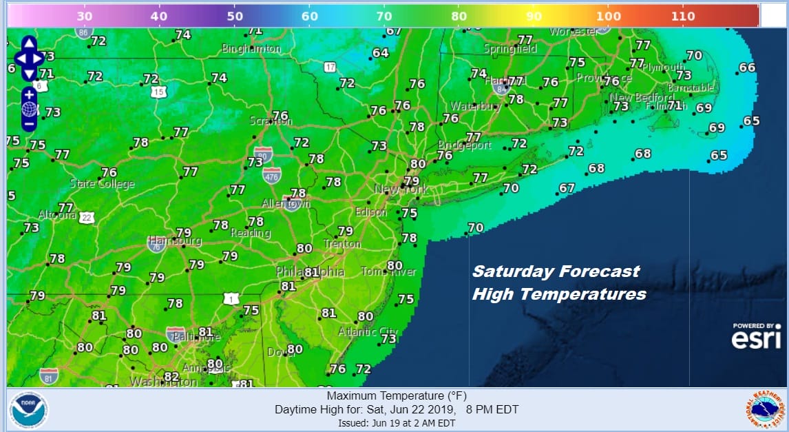
On to the weekend which is looking good. Saturday we will see plenty of sunshine with a gusty breeze and highs mostly in the 70s. The core of the dry air mass from Canada will be overhead Saturday night with a nice clear sky and most lows in the 50s to lower 60s.
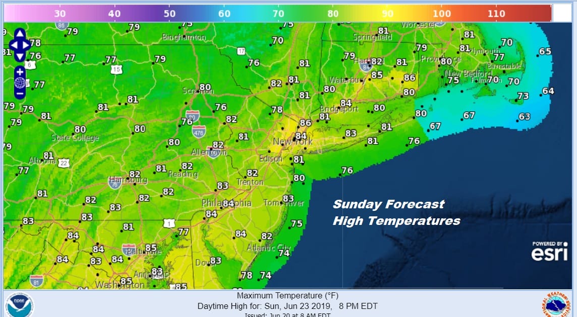
Sunday brings a bit of a bounce higher in temperatures as a warm front begins to approach from the southwest. We should see sunshine for most of the day. Some high clouds could come in later in the afternoon or evening but other than that, we are going to see a good day. Temperatures should reach up into the 80s in most places and humidity will remain low.
Next week we will be seeing an entirely different kind of weather pattern. We won’t be returning to a stalled frontal boundary to the south. Instead it is a west to east pattern where systems move along for a change we will be dry much of the time with at least some sunshine each day and temperatures into the 80s. There may be the occasional chance for showers and thunderstorms along the way but they should be minimal and much of the time next week will be rain free!
MANY THANKS TO TROPICAL TIDBITS FOR THE USE OF MAPS
Please note that with regards to any tropical storms or hurricanes, should a storm be threatening, please consult your local National Weather Service office or your local government officials about what action you should be taking to protect life and property.