Weather Conditions Improving First Summer Weekend Nice Next Week Warmer More Humid
Finally this miserable week is over with and we can move on to the weekend which is looking very good. Clouds on the satellite picture continue to sink southeastward. The tail end of low pressure in the Gulf of Maine and its cold front are now far enough to the east and south to allow skies to clear tonight. There is a nice northwest breeze. Dew points are dropping which means nice dry air from Canada that settles in for the entire weekend.
SATELLITE

REGIONAL RADAR

The last remnants of the rain are now off the coast and there is nothing upstream or to the west to worry about for tonight and through the weekend. Temperatures tonight will settle in the 50s to near 60.
LOCAL RADAR NEW YORK CITY

LOCAL RADAR PHILADELPHIA


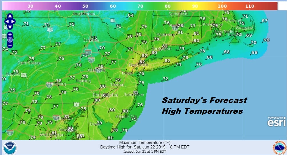
There are no changes to the weather outlook for the weekend. The only issue for Saturday is an upper air disturbance swinging southeast across Southeastern New England might produce a few clouds later in the day on Saturday mainly over the East End of Long Island and Eastern Connecticut. This would only be a for a few hours and won’t completely eliminate the sun. Otherwise for everyone else it is a nice sunny breezy day with highs in the upper 70s and lower 80s. There will be a northwest wind up to 20 mph at times along the coast so no sea breeze issues are going to develop Saturday.
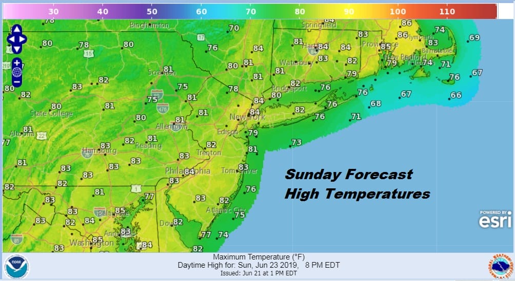
Sunday looks great with lots of sunshine all day long. Temperatures will reach into the 80s in most inland spots and 70s to near 80 along the coast. No rain is forecast anywhere in the Northeast into the Middle Atlantic States.
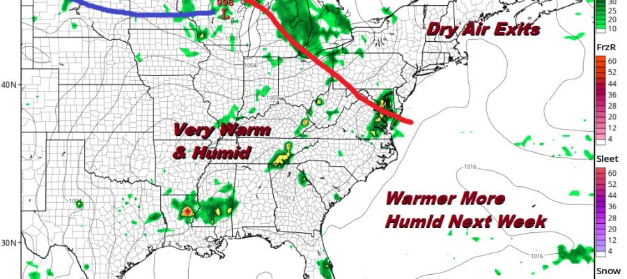
The dry air mass will begin to move out on Monday as warmer more humid air pushes eastward. Unlike last week we are not dealing with any kind of onshore flow here or a stalled frontal boundary to the south. Instead a warm front will push eastward on Monday and the humid air will increase gradually. Also there shouldn’t be any showers in the transition on Monday into Monday evening. Much of day we will see a mix of sun and high clouds. Overnight into early Tuesday morning there is the chance for a scattered passing shower or thunderstorm. Temperatures on Monday will be in the 80s.
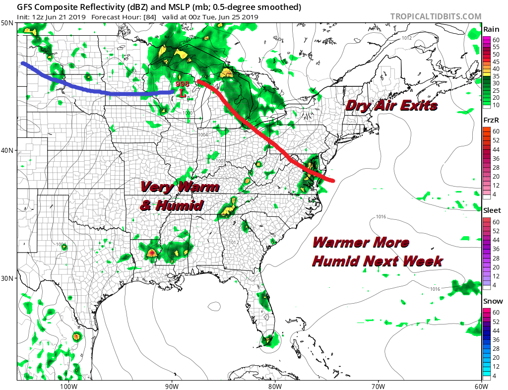
Tuesday through Saturday of next week it looks like we will be very warm and somewhat humid. Some days we will have the chance for a scattered shower or thunderstorm. On other days we won’t. We don’t see any widespread activity anytime next week so beach weather seems to be settling in just in time. The next cold front of importance may not come until next Saturday. Again with the absence of any kind of stalled out frontal boundary to the south, weather systems will be weak and just move right along so there should be no problems much of next week.
MANY THANKS TO TROPICAL TIDBITS FOR THE USE OF MAPS
Please note that with regards to any tropical storms or hurricanes, should a storm be threatening, please consult your local National Weather Service office or your local government officials about what action you should be taking to protect life and property.


