Showers Into Tonight Slow Improvement Wednesday Thursday
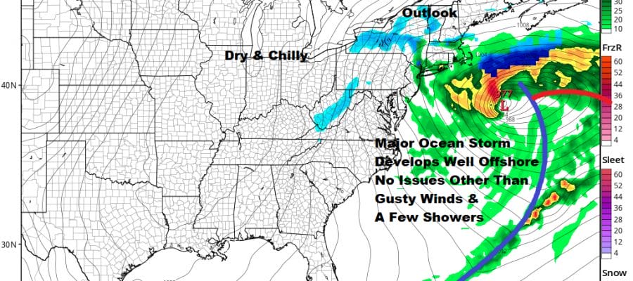
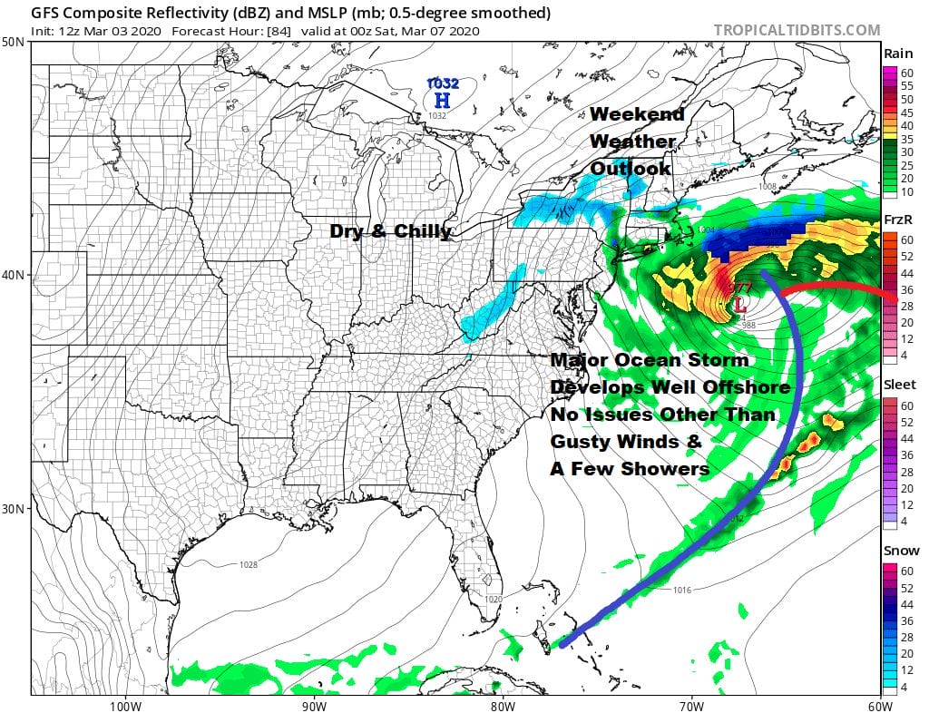
Coastal Storm Offshore Friday Saturday
We seem to be holding in a range between 50 & 55 degrees this afternoon. Lots of clouds dominate on the satellite pictures this afternoon as a cold front moves its way eastward. We are also dealing with an area of rain which is showing up on the regional radar below that is heading to the northeast across New Jersey and into Southern New England.
SATELLITE

REGIONAL RADAR

Local radars are picking up on this area of rain as low pressure begins to develop on the cold front and eventually heads into New England. The threat for showers will continue for a few hours into this evening and then the rain is done with as the front passes and moves offshore.
LOCAL RADAR NEW YORK CITY

LOCAL RADAR PHILADELPHIA


Weather conditions will attempt to improve somewhat on Wednesday. We should see sunshine and reasonable highs in the low to mid 50s. There really isn’t much cold air around so temperatures while down trending will still be a bit above average. Thursday looks good too with sunshine giving way to some arriving clouds later in the day. Highs will be in the upper 40s and lower 50s.

There are no important changes in the outlook for Friday into Saturday. A wave develops on a stalled frontal boundary that lies east west across the Gulf States. The northern and southern parts of the jet stream phase together too little tool late for any real impact to the Northeast and Middle Atlantic states. The upper trough swinging through might produce a few rain or snow showers Friday night into Saturday. Other than that look for clouds for Friday with highs in the low to mid 40s and Saturday’s highs will be in the upper 30s and lower 40s. We see no chance of this developing closer to the coast or creating any problems for us this weekend. Sunshine returns Sunday with highs in the 40s to near 50.
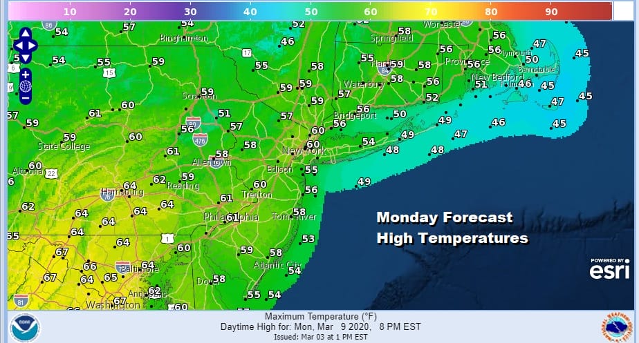
Everything is on course for a warm up early next week as an upper ridge builds along the east coast. As long as we have at least some sunshine, highs next Monday will reach into the 60s and we could even go a bit we get enough sun.
BE SURE TO DOWNLOAD THE FREE METEOROLOGIST JOE CIOFFI WEATHER APP &
ANGRY BEN’S FREE WEATHER APP “THE ANGRY WEATHERMAN!
MANY THANKS TO TROPICAL TIDBITS FOR THE USE OF MAPS
Please note that with regards to any severe weather, tropical storms, or hurricanes, should a storm be threatening, please consult your local National Weather Service office or your local government officials about what action you should be taking to protect life and property.


