
Warm Monday Highs Reach 60 Showers On & Off Into Wednesday
Ocean Storm Offshore Late Week

We are on our way to a nice early spring late day as we are starting off with temperatures in the upper 20s to mid 30s this morning. That is certainly launching pad enough to take highs through the 50s and even into the low 60s in some places. Based on the satellite views this morning any clouds will hold off until later in the day and that should give us enough sunshine on this Monday to take temperatures nicely higher. Radars are quiet for now and we don’t expect any showers to pop up until later this evening.
SATELLITE

REGIONAL RADAR

Overnight weather models didn’t really produce any material changes in the outlook as we go through this week. A cold front will be moving toward us Tuesday and offshore early Wednesday. Some on and off scattered showers will be around tonight and again later Tuesday into Tuesday night. Temperatures Tuesday will be a bit lower than today with highs just in the 50s.
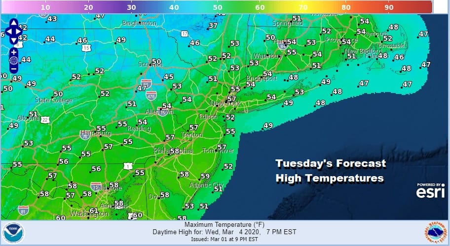
Rainfall amounts here will amount to a quarter of an inch or less in most places and some might be under a tenth of an inch. We will dry out and turn cooler Wednesday and Thursday. Some sunshine returns for both days. Wednesday’s highs will be in the upper 40s and lower 50s. Thursday’s highs will be in the low to mid 40s.
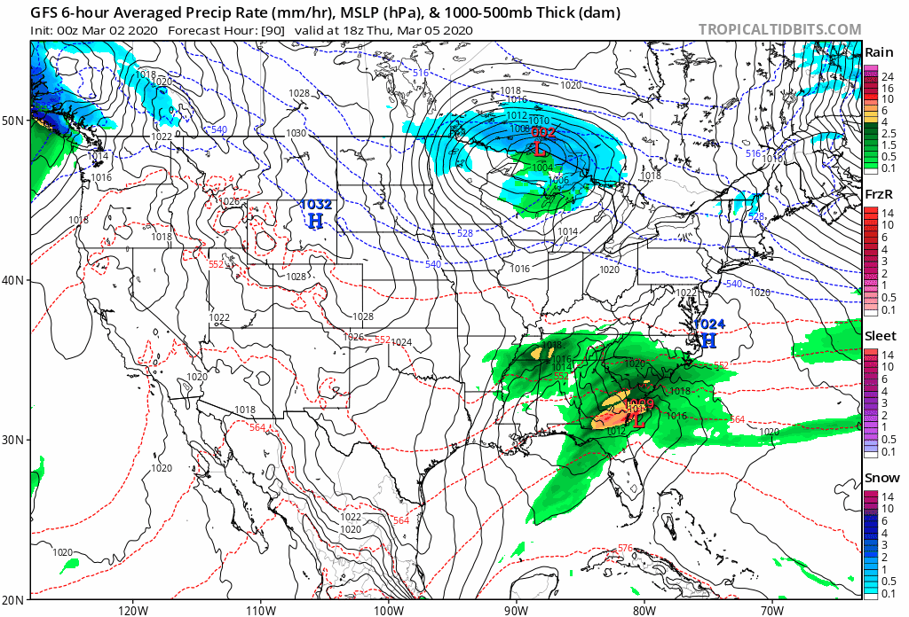
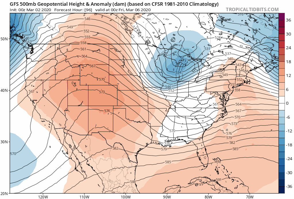
We discussed yesterday two separate jet streams attempting to come together along the East Coast forming an ocean storm and this continues to be the case today. The issue is the timing between the northern and southern jet streams as they remain too little too late for anything thing of consequence to happen. The upper trough might pull back enough moisture to produce some rain and snow showers Friday and Friday night but as of right now we would need to see those two separate areas to come together sooner and I do not believe that is likely to happen.
Once this storm departs weather conditions will improve over the weekend. While it will be on the cool side for the weekend we could warm up nicely for the start of next week. 60s for highs could be commonplace and perhaps a bit higher than that is not out of the question.
BE SURE TO DOWNLOAD THE FREE METEOROLOGIST JOE CIOFFI WEATHER APP &
ANGRY BEN’S FREE WEATHER APP “THE ANGRY WEATHERMAN!
MANY THANKS TO TROPICAL TIDBITS FOR THE USE OF MAPS
Please note that with regards to any severe weather, tropical storms, or hurricanes, should a storm be threatening, please consult your local National Weather Service office or your local government officials about what action you should be taking to protect life and property.


