Monday Brings Warmer Temperatures Showers Later Monday Night Into Tuesday
We managed to gain higher highs Sunday as thermometers went to the upper 30s and lower 40s. Now it is on to a solid bounce in temperatures on Monday. The cold air mass from the weekend is moving out and a southwest flow comes in its place and that should send temperatures shooting higher.
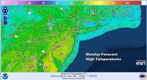
With mainly clear skies tonight and light winds we should see lows in the 20s except for low and mid 30s in the warmer urban areas. That should set us up for highs in the mid 50s to even some lower 60s on Monday. The highs will depend on how much sun we get. For now it seems there should be enough sun to hit those targets on Monday though clouds will be rolling in during the afternoon.
SATELLITE
REGIONAL RADAR
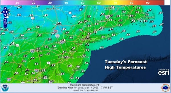
Radars will remain quiet locally during the day Monday but some scattered showers will likely pop up on the regional radar. A few spots could see some passing showers Monday night into Tuesday morning. Tuesday will see more clouds and some scattered showers around and that will hold temperatures down a bit but highs should still make the 50s just about everywhere.
A cold front moves through Tuesday night thanks to a strengthening low to the northeast moving into New Brunswick. This should mean cooler temperatures for Wednesday through Friday with nothing worse than seasonal. That puts highs in the upper 40s and low 50s Wednesday, 40s Thursday and probably in the mid 30s to lower 40s on Friday.
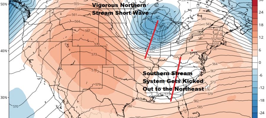
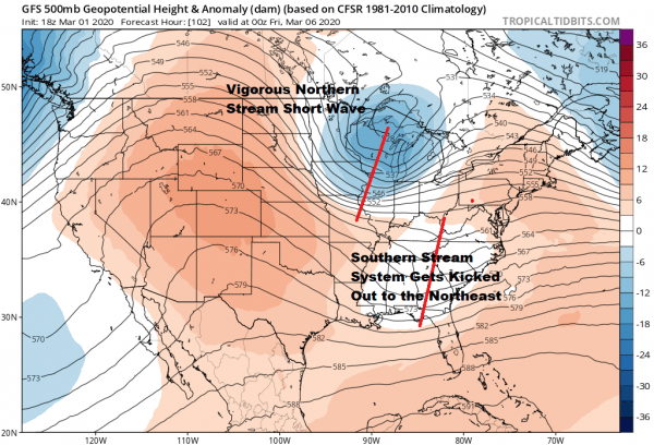
The upper air pattern for the end of the week is an interesting one in that we have two jet streams with two short wave troughs trying to get together. Snow lovers shouldn’t hold their breath here because once again the issue is timing in a short window of opportunity. We have vigorous energy coming down in the northern part of the jet stream and a southern stream system which gets kicked out to the northeast. The two systems would phase together too late for any real consequence for the area.
The GFS shows a well developed ocean storm coming out of this but it is too far east really and we might see some rain or snow showers from the upper trough going by. We will keep our eyes on this but the general feeling is that this system will be no different then some of the others. Not enough cold air and a jet stream pattern along the East Coast that is unfavorable for systems to move north than east.
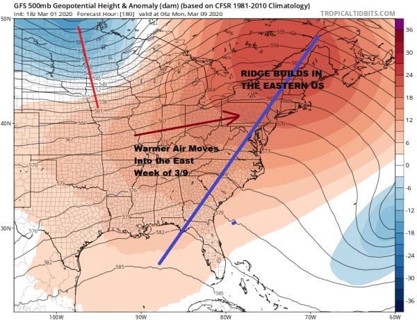
If this plays out according to plan we will be chilly for a day or two behind that ocean storm but warmer temperatures follow early on the week beginning Sunday March 8th. We could see 60s Monday and Tuesday 3/9-10 provided we get at least some sun. With a ridge building in the Eastern US and a deep trough in the west, the odds of a few warm springlike days are rather high.
BE SURE TO DOWNLOAD THE FREE METEOROLOGIST JOE CIOFFI WEATHER APP &
ANGRY BEN’S FREE WEATHER APP “THE ANGRY WEATHERMAN!
MANY THANKS TO TROPICAL TIDBITS FOR THE USE OF MAPS
Please note that with regards to any severe weather, tropical storms, or hurricanes, should a storm be threatening, please consult your local National Weather Service office or your local government officials about what action you should be taking to protect life and property.

