Showers Exit This Morning Cool Dry Weekend Chance Rain Sunday Night Monday
WEATHER IN 5 FRIDAY 10/2/2020 8AM
JOE & JOE WEATHER SHOW THURSDAY 10/1/2020 7PM
A cold front is moving through with some showers this morning but we should see these showers move out to the northeast and weather conditions will improve this afternoon with decreasing clouds and some sunshine developing. Another cool high is set to build in for the weekend setting us up for cool dry autumn weather and there are no changes in the outlook going forward. Temperatures today will likely be in the 60s all day.
SATELLITE

REGIONAL RADAR

The showers on the radar are on the light side and they are moving along to the northeast rather quickly. Rainfall amounts should generally be a tenth of an inch or less from all this.
LOCAL RADAR NEW YORK CITY

LOCAL RADAR PHILADELPHIA


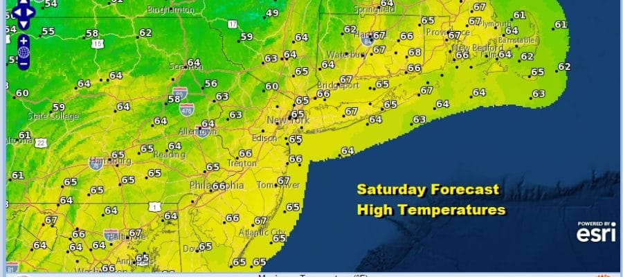
Cool air comes in tonight under a clear sky. Expect lows to be in the 40s just about everywhere except near 50 in the warmer urban settings. Saturday look for lots of sunshine with highs mostly in the low to mid 60s.

Saturday night we will see clear skies again with lows in the 40s to near 50 with some 30s in cool spots well north and west of th coast. Sunday look for sunshine to start followed by some arriving clouds later in the day. Highs on Sunday will be much like Saturday in the low to mid 60s.

The next chance for rain comes Sunday night into Monday with high pressure to the northeast and low pressure weakening as it moves across the Great Lakes and redevelops off the Virginia coast heading northeastward. A period of rain is possible into Monday morning before the low moves away to the northeast.

Afterwards we dry out and weather conditions improve. A sharper cold front will approach and move through late Wednesday of next week followed by a quick shot of very cool air. The weather pattern is one where everything seems to be moving along with no major weather systems having impact. The tropics show a tropical system in the Northwest Caribbean moving into the SW Gulf of Mexico. We don’t see this system having any impact to the US this weekend or during the first part of next week as it is expected to meander for several days due to a weak upper flow in the Gulf of Mexico.
BE SURE TO DOWNLOAD THE FREE METEOROLOGIST JOE CIOFFI WEATHER APP &
ANGRY BEN’S FREE WEATHER APP “THE ANGRY WEATHERMAN!
MANY THANKS TO TROPICAL TIDBITS FOR THE USE OF MAPS
Please note that with regards to any severe weather, tropical storms, or hurricanes, should a storm be threatening, please consult your local National Weather Service office or your local government officials about what action you should be taking to protect life and property.


