Nice Cool Weekend Underway Not Much Rain In Forecast Week Ahead
JOE & JOE WEATHER SHOW THURSDAY 10/1/2020 7PM
The weekend begins with a sunny Saturday. High pressure is building over the northeast. Cool air arrived and we bottomed this morning in the 40s inland and lower 50s in the warmer urban areas. We will see mostly sunny skies today with cool highs in the low to mid 60s. No weather issues appear on the radar as the air is dry up and down much of the east coast.
SATELLITE

REGIONAL RADAR

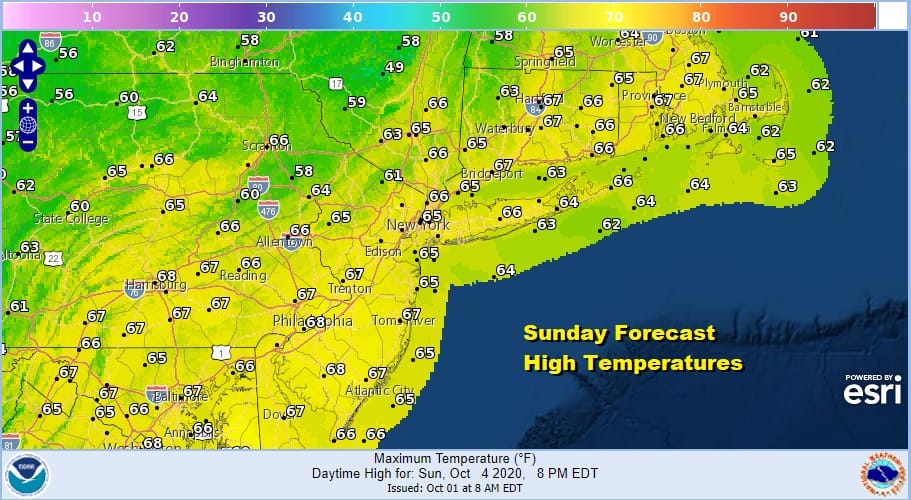
We are headed for a mostly clear night with Sunday morning lows much like this morning, in the 40s to near 50 in most places however there will be a few 30s in colder spots inland. We should avoid frosts Sunday morning. Sunday shapes up to be another fine day of mostly sunny skies though some high clouds will move in during the afternoon. Highs again will be in the low to mid 60s.
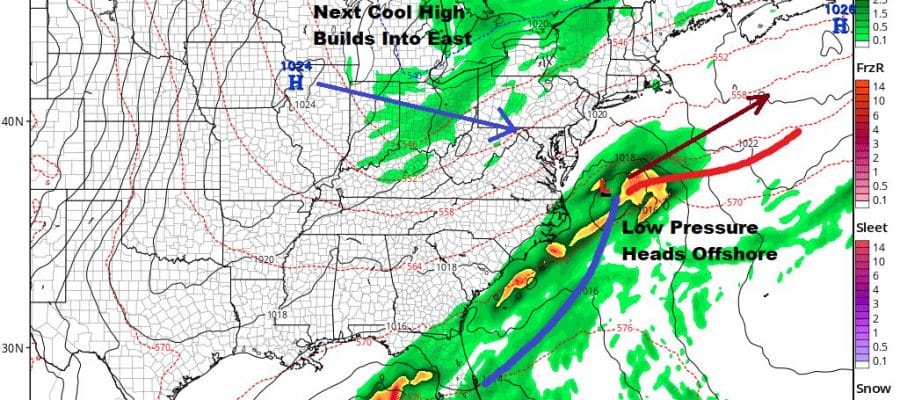
The old frontal boundary from yesterday is stalled off the east coast down to offshore the Carolinas. Low pressure developing on the front and a weak upper trough swinging in from the Great Lakes will trigger a developing wave offshore. This looks much weaker than it did a few days ago. We will forecast clouds Sunday night into Monday. Most of the rain with this should stay offshore but a shower or two is possible overnight into Monday morning.
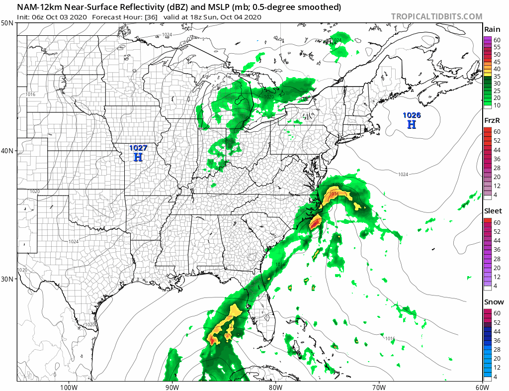
The upper trough from the west doesn’t generate much in the way of showers and the low is too far east to pose any bring problems so we will see clouds around on Monday and the chance for a shower. Best chances appear to be along the coast as the NAM model shows. Highs will be just into the 60s. Tuesday should be nice and sunny with highs 65 to near 70 in most places.
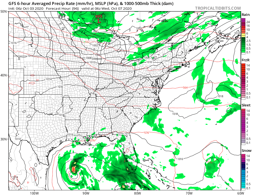
Wednesday brings another cold front through but again it is somewhat moisture starved. We should warm up into the 70s Wednesday with a mix of sun and clouds and the chance for a late day shower or two. Once the front passes another shot of dry air comes in.

The air mass behind this front is colder than the current one so we will see lower temperatures behind it Thursday and Friday. The coldest air will be up in New England but some of that cold air drains southward into the Mid Atlantic states. We will see some sunshine Thursday with a gusty breeze with highs just into the 60s. Friday will be sunny with a cold start in the 30s and 40s and highs just into the 60s again. Next weekend looks uneventful as another weak cold front probably comes through Saturday night with not much weather with it.
BE SURE TO DOWNLOAD THE FREE METEOROLOGIST JOE CIOFFI WEATHER APP &
ANGRY BEN’S FREE WEATHER APP “THE ANGRY WEATHERMAN!
MANY THANKS TO TROPICAL TIDBITS FOR THE USE OF MAPS
Please note that with regards to any severe weather, tropical storms, or hurricanes, should a storm be threatening, please consult your local National Weather Service office or your local government officials about what action you should be taking to protect life and property.


