Week Ahead Mostly Quiet Dry No Major Weather Issues
WEATHER IN 5 SUNDAY OCTOBER 4, 2020
Our weekend continues to roll along rather quietly with nothing major going on. In fact the week ahead will be a quiet one with not much rain and just some ups and downs in temperature. Today sees a weather system to the west in the Great Lakes and Ohio Valley. We also have a stalled frontal boundary offshore that extends south to Florida. Tropical moisture is moving along it but it is far enough east to bring rain here. However there will be a wave developing on that front that will pass to our south and east tonight and Monday morning. In the meantime we have sunshine to start the day and just some clouds will come in later today and into tonight. Temperatures today will be mostly in the 60s.
SATELLITE

REGIONAL RADAR

Radars are silent for now but we will see some activity develop on radars well to the south later today and tonight as that low goes by. Look for clouds tonight into Monday morning. Some rain might touch a few coastal areas so we will throw in the chance for some sprinkles or showers for places like Long Island and Coastal New Jersey as the wave goes by. The system to the west might generate a shower or two inland overnight into Monday morning. Lows overnight will be in the 50s to near 60.

Once the wave goes by Monday there will be leftover clouds. Perhaps some sun could break through the clouds in the afternoon. Highs will be mostly in the 60s. Weak high pressure builds in for Tuesday which looks like a decent day of sun and highs 65 to near 70.
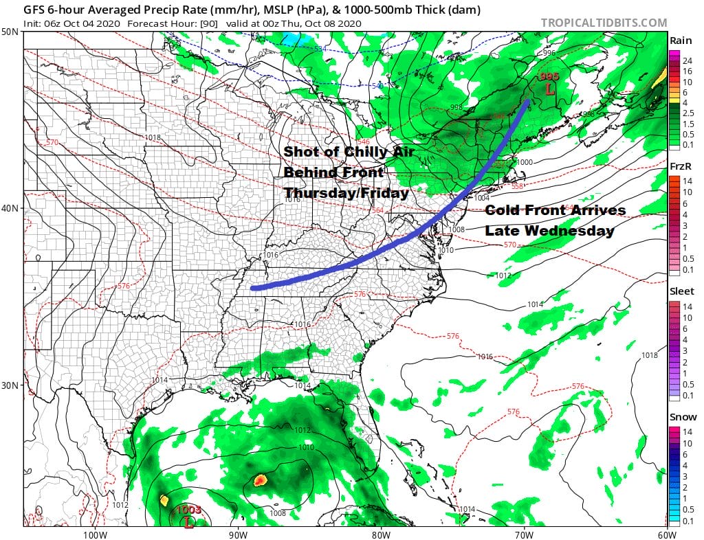
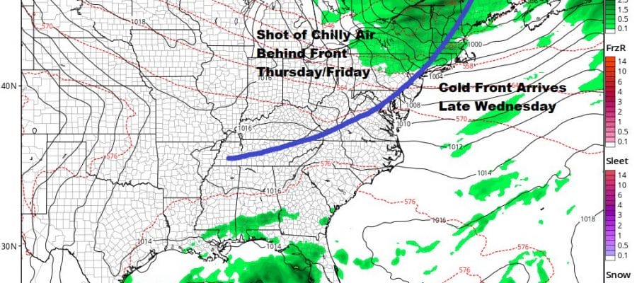
The next cold front arrives Wednesday but the atmosphere is moisture starved. We will warm ahead of it with some sunshine and clouds. Perhaps there could be a late day shower or two as the front goes by. Highs Wednesday will be back into the 70s, Behind the front is a shot of chilly air from Canada as high pressure drops southeastward. Thursday and Friday will see some sunshine but it will be on the chilly side both days. Highs will be in the low to mid 60s Thursday followed by a cold Thursday night into Friday morning.
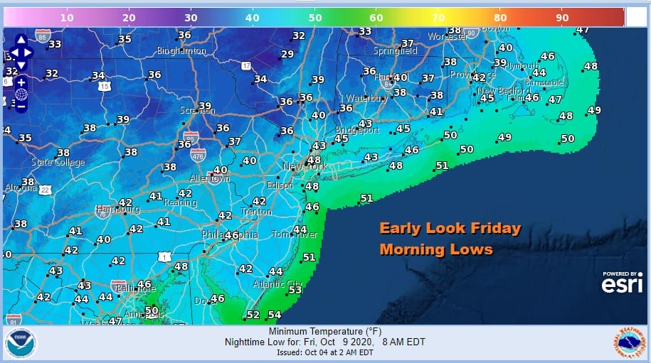
An early look at Friday morning lows show we could be down in the low to mid 40s with lots of 30s inland. Areas that avoided frosts from the late September round of cold might see their first frosts this go around. Friday highs will be chilly with highs in the upper 50s and lower 60s!

Everything should move along so after Friday temperatures should rebound next weekend. For now it looks to be dry for next Saturday and Sunday.
BE SURE TO DOWNLOAD THE FREE METEOROLOGIST JOE CIOFFI WEATHER APP &
ANGRY BEN’S FREE WEATHER APP “THE ANGRY WEATHERMAN!
MANY THANKS TO TROPICAL TIDBITS FOR THE USE OF MAPS
Please note that with regards to any severe weather, tropical storms, or hurricanes, should a storm be threatening, please consult your local National Weather Service office or your local government officials about what action you should be taking to protect life and property.


