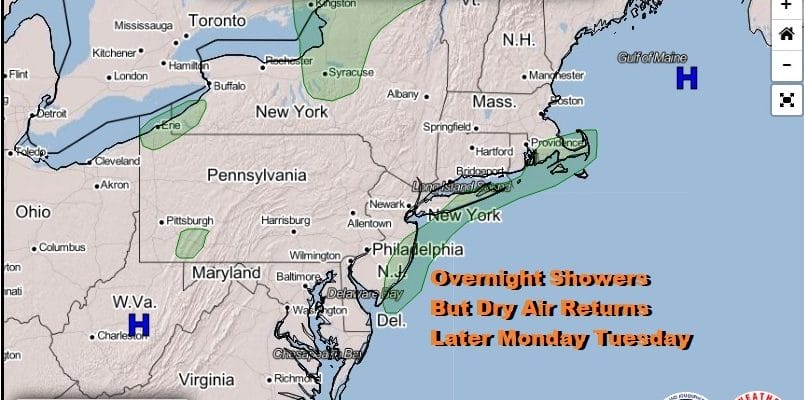
Shower Or Two Overnight And Late Wednesday Dry Week Otherwise
WEATHER IN 5 SUNDAY OCTOBER 4, 2020
The frontal boundary is buckling a bit this evening as low pressure develops offshore. To the west and northwest an upper trough is moving eastward and headed for New England. Both systems will act separately and that keeps much of the rain from either system away from us for the most part. Clouds are around tonight as the wave goes by. Temperatures overnight will be in the 50s. There might be a couple of showers in a few places during the early morning hours into daybreak.
SATELLITE

REGIONAL RADAR

Radars are picking up on the offshore rain as well as some showers on the regional radar to the northwest. Most of the area however is not seeing any showers on the regional and local radars and I don’t expect that to change much overnight. For most of you, there won’t be any rain overnight.
LOCAL RADAR NEW YORK CITY

LOCAL RADAR PHILADELPHIA


Dry air returns Monday with clouds giving way to some breaks of sunshine. Highs will be in the 60s. We will stay dry into Wednesday which is when the next front will approach. Skies will be clear Monday night with lows in the 50s along the coast and 40s inland. Tuesday should be nice and sunny with highs in the upper 60s to some lower 70s.

Wednesday we see the next cold front and there isn’t much moisture around for it to work on. High Wednesday will be in the low to mid 70s with some sunshine though there is the chance for a late day shower or two as the front passes. Chilly air follows from Canada setting up for a breezy Thursday with a mix of sun and clouds . Highs will be back into the 60s. Thursday night into Friday morning sets up as a cold night with clear skies. Lows will be in the low to mid 40s along the coast and in warmer urban areas with many inland areas in the 30s.
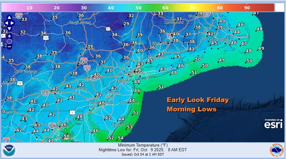
Friday will be a sunny chilly day for this time of year. Highs will be in the upper 50s to around 60 degrees making it the coldest day of the Autumn season so far. Temperatures will bounce next weekend which is a holiday weekend. At first glance the weekend looks dry but it may depend on a new tropical storm that is likely to develop in the Northwest Caribbean.
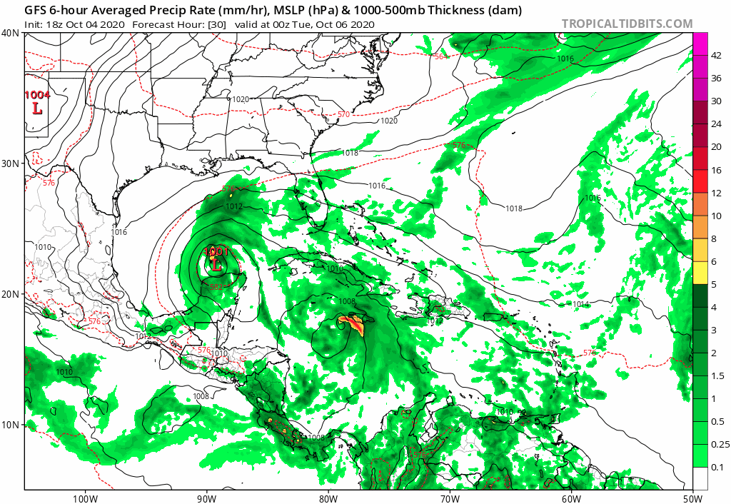
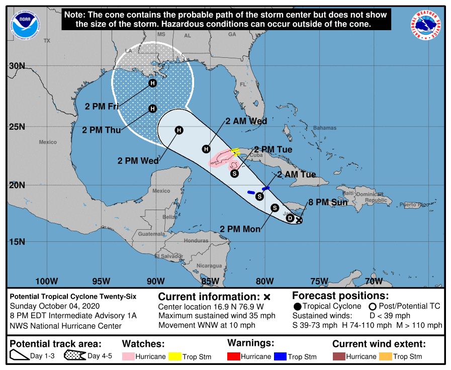
There is a lot of uncertainty here. Tropical Storm Gamma is sitting just north of the Yucatan Peninsula and it will turning west and then southwest into the Southwest Gulf of Mexico. The new tropical storm (assuming the system in the Caribbean strengthens will become Tropical Storm Delta. While conditions for Gamma favor it staying weak, Delta on the other hand will be in a favorable environment for strengthening. Latest model runs suggest that the new storm will strengthen and eventually absorb Gamma and then track northward in the Gulf of Mexico to the Central Gulf coast late week, possibly as a hurricane.
Should this occur that moisture may wind up coming up into the Eastern US Sunday into Monday of next week. It is a long way from now until then and until the uncertainty is resolved with the tropical development we will lean to the more optimistic idea for next weekend for the time being.
BE SURE TO DOWNLOAD THE FREE METEOROLOGIST JOE CIOFFI WEATHER APP &
ANGRY BEN’S FREE WEATHER APP “THE ANGRY WEATHERMAN!
MANY THANKS TO TROPICAL TIDBITS FOR THE USE OF MAPS
Please note that with regards to any severe weather, tropical storms, or hurricanes, should a storm be threatening, please consult your local National Weather Service office or your local government officials about what action you should be taking to protect life and property.