
Chance Few Showers Friday Morning Turning Cooler Weekend Rain Sunday Night into Monday
JOE & JOE WEATHER SHOW THURSDAY 10/1/2020 7PM
WEATHER IN 5 THURSDAY 10/1/2020 8AM
The next cold front is on the way for Friday morning but this front is not like the one from Tuesday. We won’t see much of this rain wise. Clouds are slowly rolling in this evening and we should go overcast later on tonight as temperatures hold mostly in the 50s to around 60. Friday morning as the front goes by there might be a few scattered showers. Showers could be a bit more numerous in New England into Friday afternoon which is a good thing for that area given the drought. As you go south into the Northern Middle Atlantic states showers should be few and far between. A few showers are popping up in Western NY and Northwest Pennsylvania on the regional radar but nothing impressive.
SATELLITE

REGIONAL RADAR

Once the front passes it is going to be rather cool for Friday. Temperatures will settle in the 60s during the afternoon. We should see clouds and whatever showers get out of the way by midday at the latest with leftover clouds and maybe some breaks of sunshine in the afternoon.
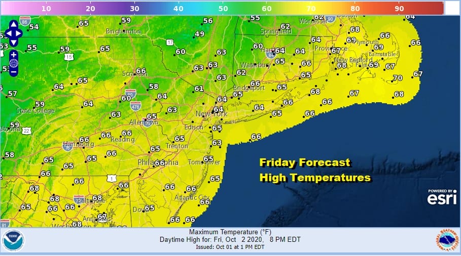
Skies will clear Friday night and it will be nice and cool by Saturday morning with most lows in the 40s. Saturday looks like a day of sunshine but it will be cool with highs generally in a range of low and middle 60s.

Skies will be clear Saturday night with high pressure overhead. We will take a trip back down into the 40s with some 30s in cool spots well north and west of the coast and warmer urban settings. Sunday look for sunshine though there may be some arriving clouds later in the day. Highs again will be in the low to mid 60s.

Sunday night into Monday we see the next round of wet weather though it doesn’t appear especially threatening. We do have an amplifying short wave trough that will be moving along from the Ohio Valley and pass off the coast of New England later Monday.
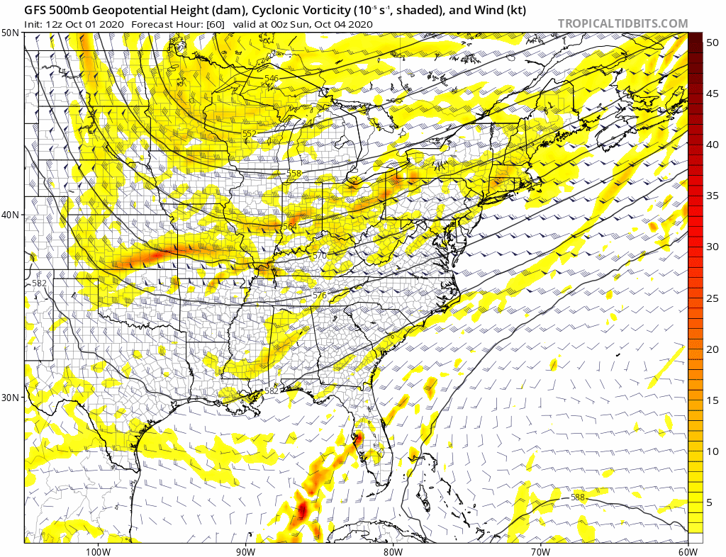
You can see the shortwave amplify a bit but the trough (lower pressures in the East) hang around as another stronger trough approaches midweek with a cold front. More on that in a moment. First things first we will probably see low pressure in the Great Lakes head eastward as a secondary low forms off the Virginia coast and heads northeast. This will probably create cool or raw conditions Sunday night into Monday with a northeast wind and some rain.

Most of the development with the low is offshore as it moves away so weather conditions should improve later Monday if everything moves along. It might be in the 50s while it is raining in many areas but if weather improves fast enough we could see 60s in the afternoon. You will notice that the next weather system with the stronger trough mentioned earlier arrives Wednesday with a cold front and some showers. The shot of cold air behind this front is a bit more impressive than the one for this weekend.
BE SURE TO DOWNLOAD THE FREE METEOROLOGIST JOE CIOFFI WEATHER APP &
ANGRY BEN’S FREE WEATHER APP “THE ANGRY WEATHERMAN!
MANY THANKS TO TROPICAL TIDBITS FOR THE USE OF MAPS
Please note that with regards to any severe weather, tropical storms, or hurricanes, should a storm be threatening, please consult your local National Weather Service office or your local government officials about what action you should be taking to protect life and property.


