Showers Cold Front Nears Colder Air Follows
SHOP THE JOESTRADAMUS STORE
Showers Cold Front Nears Colder Air Follows
We have a cold front marching rather quickly eastward across the Ohio Valley this morning as the birth wide clouds on the satellite loop show rather impressively. Strong low pressure is moving into Southern Canada just north of Lake Superior. Cold dry air follows it in the upper Midwest. Ahead of the front we have showers on the radar to the west that are increasing and moving eastward. We should see a few of those showers developing later this morning into this afternoon.
SATELLITE LOOP

REGIONAL RADAR

The showers are there on the regional radar view and should begin to appear on the local radar views in the next few hours. Look for showers to become more numerous late today and tonight with some locally heavy downpours.
LOCAL RADAR NEW YORK CITY

LOCAL RADAR PHILADELPHIA


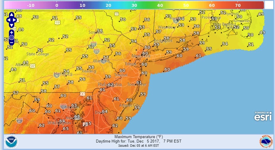
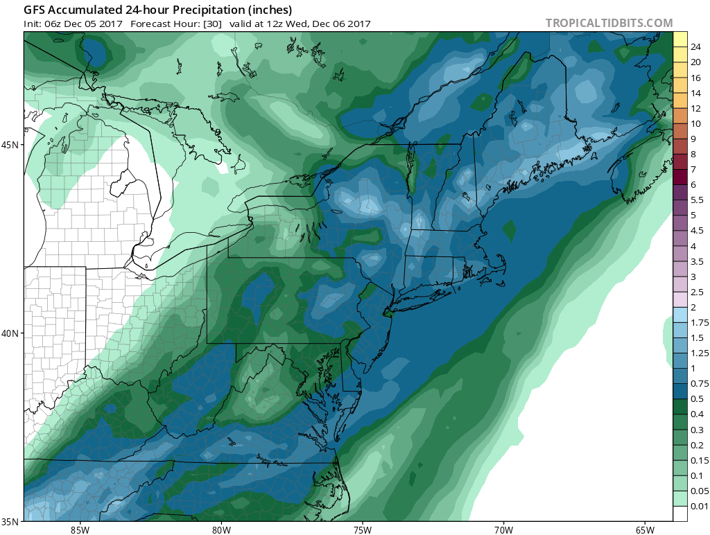
Temperatures today will be warm as we reach the 50s to near 60 in some places and hold in the 50s overnight until the front passes through sometime Wednesday morning before daybreak. After the front passes look for temperatures to fall into and through the 40s as the day wears on. Clouds may be slow to clear as the front slows down offshore but there should at least be a few breaks of sun on Wednesday at some point. Rainfall amounts look like a solid half to three quarters of an inch.
SHOWERS COLD FRONT GFS FORECAST RAINFALL ENDING WEDNESDAY MORNING
The well advertised winter pattern begins to settle in Wednesday and by Thursday morning we will see lows down in the 20s to near 30 everywhere. Thursday will be dry with sunshine and a few clouds with highs in the upper 30s to some lower 40s.
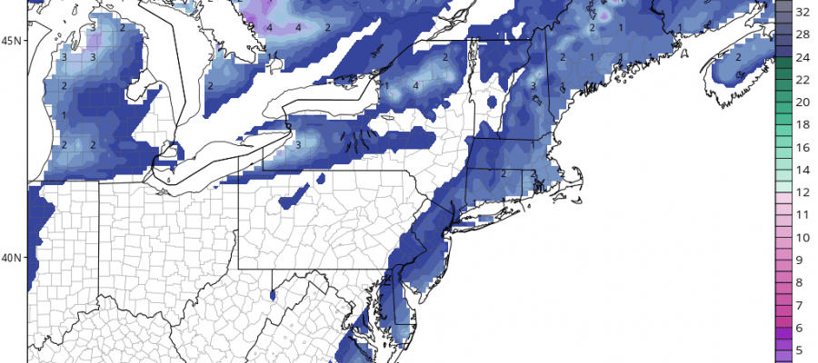
SNOW POSSIBILITIES FRIDAY THROUGH SUNDAY
The front that is passing through overnight will be stalling offshore and extending southwestward into the Gulf of Mexico. A series of waves will develop on the front and weather models are still all over the place with regards to whether we get into any of the moisture. The air aloft is cold so it would probably be in the form of snow but there are questions regarding how far north and west of the coast line does all of this get. Obviously this is not going to be anything major and might fall into the cheap thrill category. This would all fall late Friday into early Saturday morning.
GFS SNOW FORECAST ENDING SATURDAY MORNING
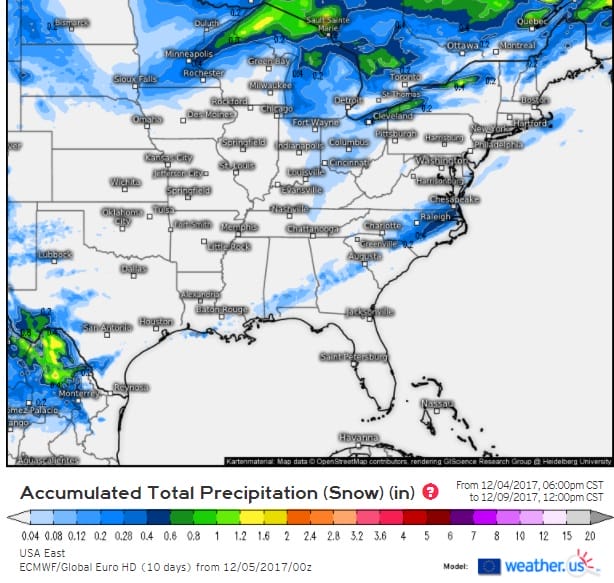
The GFS & European models are the only ones that go far enough out to cover this time frame at the moment. The NAM model will be there later today. As for the European snow forecast map it shows very little as it continues to shift west and east at different times.
EUROPEAN SNOW FORECAST MAP COURTESY OF WEATHER.US
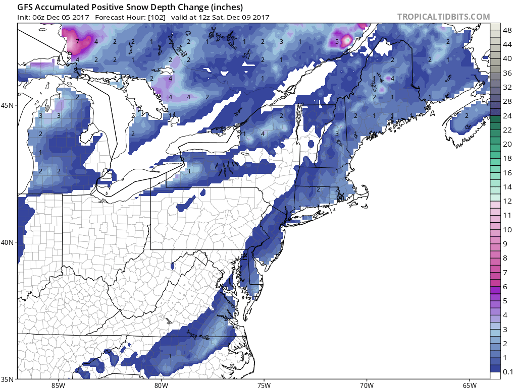
Following this is another disturbance that will be dropping southeastward from the Great Lakes which could cause a period of snow on Sunday. Weather models here have also been all over the place with this idea and a third system follows for the middle of next week with all sorts of confusion that go with that. Regardless of snow or no snow it will be cold with temperatures below average until further notice and there could be one or 2 days later next week where it turns very cold with temperatures possibly not out of the 20s.
 GET JOE A CIGAR IF YOU LIKE

FiOS1 News Weather Forecast For Long Island
FiOS1 News Weather Forecast For New Jersey
FiOS1 News Weather Forecast For Hudson Valley


