Showers Before Daybreak Windy Colder Thursday Very Cold Friday Snow To Rain Saturday
Wind Advisory Posted for Thursday
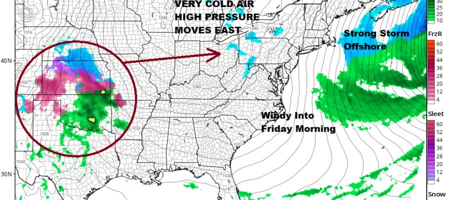
Our fast moving weather pattern continues tonight as another cold front will be passing through during the early morning hours. Low pressure will be moving through upstate NY with snow across Northern New York to Northern New England. An area of 3 to 6 inches will fall from the Adirondacks eastward to Northern Vermont, New Hampshire and Maine. For us a few showers will likely pass through during the early morning hours but they will be gone before day break. Meanwhile the nice weather today with highs in the 50s will give way to some arriving clouds this evening but no showers are forecast until after midnight.
SATELLITE

REGIONAL RADAR

The current satellite picture shows clouds are still a ways away from us so it should be clear this evening. The regional radar is beginning to pick up some scattered showers on the western edge of the range of the view above but local radars will remain quiet through the evening and shouldn’t start to pick up on anything until most of you are asleep. Temperatures topped in the 50s today and will likely hold in the 40s overnight.
LOCAL RADAR NEW YORK CITY

LOCAL RADAR PHILADELPHIA


Thursday we will see strong gusty winds develop rather quickly during the morning as the storm system to the north heads into the Gulf of Maine and strengthens while a strong high from Canada begins its move toward the Great Lakes. The tight pressure gradient will bring northwest winds of 20 to 30 mph with some gusts to 40 mph at times during the day on Thursday. Temperatures will likely hold in the 40s all day long and ease a bit late in the day.

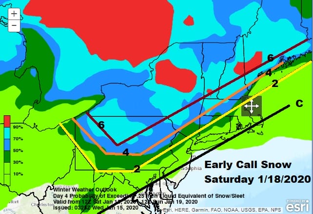
Friday will be a nice day with lots of sunshine but by Friday morning we will be down in the 20s and highs on Friday will be just barely back to the upper 20s to lower 30s. This cold high will hold in the cold air into Saturday morning when lows will be in the teens to low 20s. Then low pressure moves across the Lower Great Lakes on Saturday setting us up for snow that will change over to sleet and then rain.
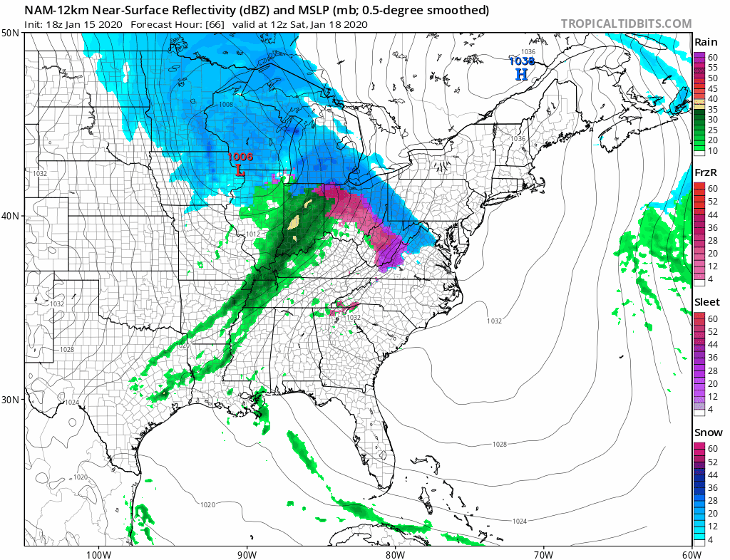
How much snow we get will depend on how stubborn the cold air is. It will give way eventually but here will be a solid band of moderate snow that will develop across Pennsylvania and move through Saturday afternoon. An extra hour or two of snow could mean an extra inch or two for somebody. The early call remains the same for now. Day side weather models were a touch colder but not enough to make a big difference regarding the early call.
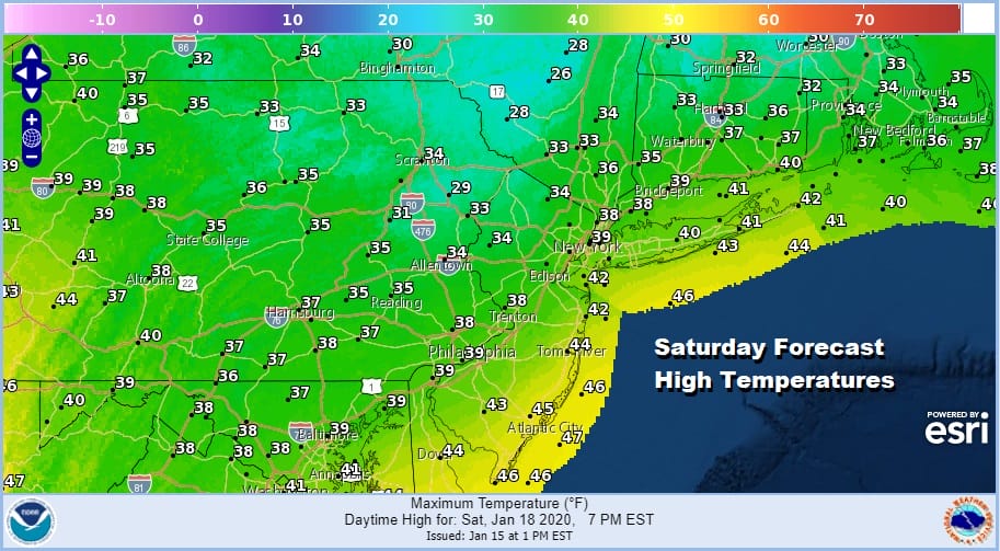
The change over to rain will occur from southwest to northeast during the mid to late afternoon on Saturday and the we will see some rain into Saturday evening before the rain ends from west to east. Temperatures Saturday will slowly rise to the mid and upper 30s along the coast.
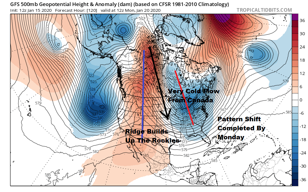
The storm system will be in New England and moving away on Sunday but it completes the pattern shift we have been talking about this week. Pattern changes take time and this one took about a week to complete from start to finish which is a little faster than average.
Sunday begins a cold stretch of weather that will last for much if not all of next week with below average temperatures and mostly dry conditions all week long. There are some vague hints of another important storm system for next weekend but it is WAY to early to even remotely speculate about it.
BE SURE TO DOWNLOAD THE FREE METEOROLOGIST JOE CIOFFI WEATHER APP &
ANGRY BEN’S FREE WEATHER APP “THE ANGRY WEATHERMAN!
MANY THANKS TO TROPICAL TIDBITS FOR THE USE OF MAPS
Please note that with regards to any severe weather, tropical storms, or hurricanes, should a storm be threatening, please consult your local National Weather Service office or your local government officials about what action you should be taking to protect life and property.


