Severe Weather Risk New Jersey Pennsylvania South, Weekend Looking Good

Severe Weather Risk New Jersey Pennsylvania South, Weekend Looking Good
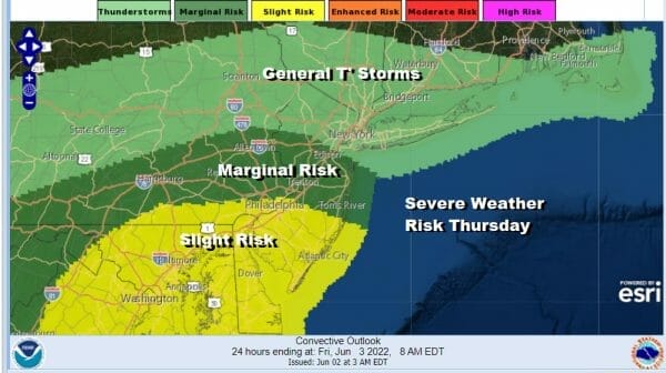
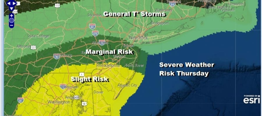
Last night’s cold front was especially active with thunderstorms and heavy rains. It is now stalled out temporarily right along the coast. This is going to set up another round of severe weather late today into tonight as a wave develops on the front and gets it to move east and eventually out of here. The risk area today is more to the south from New Jersey and Pennsylvania mainly south of Route 78 where we have a marginal risk. A slight risk of severe weather is from Southern New Jersey and Southeastern Pennsylvania southward into Maryland.
SATELLITE

WEATHER RADAR

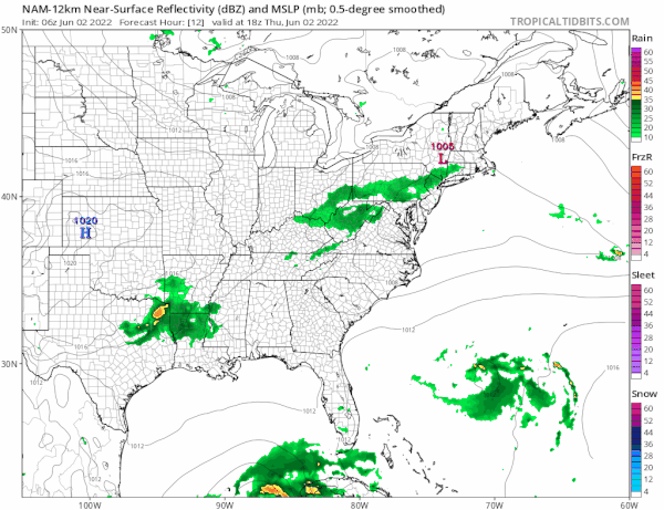
There are some clouds around in an east west band but some areas in the slight risk zone have broken out into some sunshine and daytime heating will destabilize the atmosphere. Temperatures today are going to be in the upper 70s and lower 80s in most places. The time threat for thunderstorms will be late this afternoon and evening. The NAM loop starts at 2pm this afternoon and runs through 2am Friday.
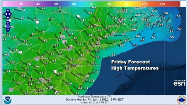
Once this cold front moves out we are done with rain through the weekend. High pressure will be building into the east and it will not only keep us dry from systems coming from the west, it will also keep any tropical system that develops near Florida from moving up the east coast. Sunshine Friday is the forecast with temperatures just in the cooler 70s.
Of the two weekend days, Saturday looks a little better than Sunday. Not that Sunday is going to be an issue but there might be a little less sunshine for Sunday as a warm front begins to set up to the northwest. We might get into some clouds later in the day from that. Otherwise the weekend is good. Temperatures both days will top out in the 70s.
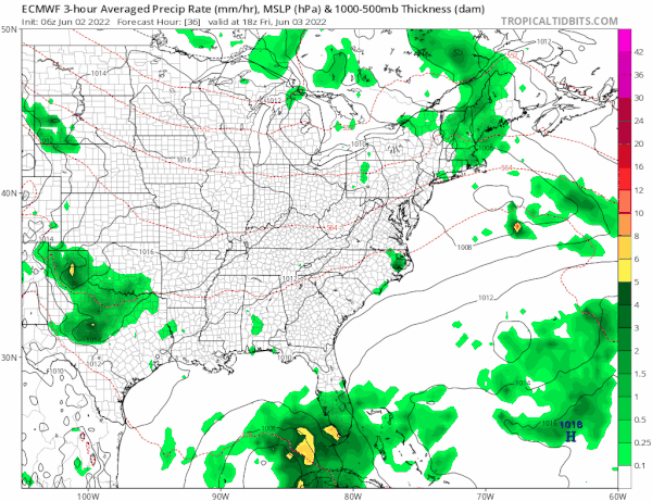
With regards to the possible tropical depression or tropical storm that might develop over the next 2 days, heavy rains will be moving over Central and South Florida. There is no mechanism to drive this northward as the upper flow remains in west to east mode. The next cold front is not due here until Tuesday when we could see some showers and thunderstorms when that front passes through.
BE SURE TO DOWNLOAD THE FREE METEOROLOGIST JOE CIOFFI WEATHER APP &
ANGRY BEN’S FREE WEATHER APP “THE ANGRY WEATHERMAN!
MANY THANKS TO TROPICAL TIDBITS & F5 WEATHER FOR THE USE OF MAPS
Please note that with regards to any severe weather, tropical storms, or hurricanes, should a storm be threatening, please consult your local National Weather Service office or your local government officials about what action you should be taking to protect life and property.


