Severe Weather Risk Elevated Thunderstorms Later Today
Severe Weather Risk Elevated Thunderstorms Later Today

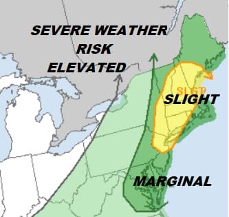
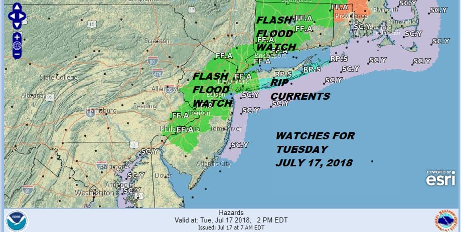
We have a cold front and a rather strong one that is moving eastward and headed our way for this afternoon and evening. Everything seems to be pointing to a round of strong to possible severe thunderstorms. The Storm Prediction Center has elevated the risk area this morning putting areas from Central & Northern New Jersey to NYC, Hudson Valley, Long island & much of New England in a slight risk for severe thunderstorms. In addition we have a Flash Flood Watch which matches up close to the severe weather risk area.
As usual with thunderstorms there will be a variation in rainfall amounts. If the strong thunderstorm hits your area you could get several inches very fast while other areas will see less. This front looks like it should produce downpours for most of you and the main action will be after 2 or 3pm with the peak time right around 5pm as we are heading into the heart of the evening commute.
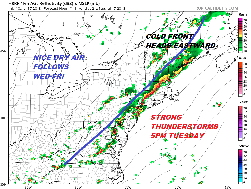
Most of the cloud cover and thunderstorm activity this morning is occurring well to the north in Upstate NY & New England. There isn’t too much happening yet across Pennsylvania but look for cells to beginning firing up there later this morning. It appears that we will be getting those thunderstorms timing with maximum daytime heating. Highs should reach the mid to upper 80s this afternoon and a few 90 degree readings are possible away from the ocean.
EASTERN SATELLITE

REGIONAL RADAR

Other than a few renegade showers nothing is in range of the local radars as of 8am. This will obviously change later today.
LOCAL RADAR NEW YORK CITY

LOCAL RADAR PHILADELPHIA


The dynamics here are impressive enough with an already unstable atmosphere becoming even more unstable. The Storm Prediction Center points to the possibility of a supercell though they rate the best chances for that in New England. Regardless keep you eye to the sky this afternoon. Nothing should happen until after 2pm. It should be over with by 8pm. Improving weather conditions follow with dry weather low humidity and sunshine Wednesday through Friday with highs in the 80s.
The weather pattern developing for this weekend and early next week looks to take a wetter turn beginning Saturday night and lasting through much of next week. JOESTRADAMUS takes a look at this in his long range post.
Also in case you missed it here is the latest from the Joe & Joe Show
Please note that with regards to any tropical storms or hurricanes, should a storm be threatening, please consult your local National Weather Service office or your local government officials about what action you should be taking to protect life and property.
 GET JOE A CIGAR IF YOU LIKE

LATEST JOESTRADAMUS ON THE LONG RANGE


