Severe Thunderstorm Watch Hudson Valley Connecticut Severe Risk Expands
Severe Thunderstorm Watch Hudson Valley Connecticut
Severe Risk Expands
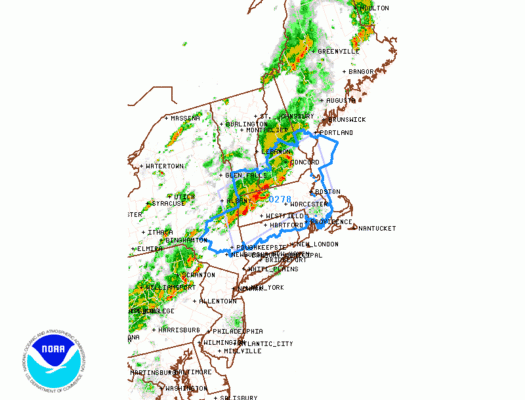
The first SEVERE THUNDERSTORM WATCH has been posted by the Storm Prediction Center for the Hudson Valley north of Putnam County and in Connecticut north of Route 84. In addition the Storm Prediction Center has expanded the area of slight risk to all of New Jersey & Eastern Pennsylvania northeastward through large portion of Southern & Central New England.

The first line is moving into Western Massachusetts however on the regional radar we can see the second line that is firing up across Pennsylvania in a northeast southwest line. All of this is ahead of the cold front. In the meantime the destabilization of the atmosphere continues overhead with daytime heating continuing. Local radars below are as of 11:20 am though you can refresh for a more current view.


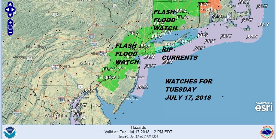
The timing for thunderstorms for New Jersey will be after 3pm..for NYC around 4-5pm and for Long Island and Connecticut after 5pm. For the Hudson Valley northern and western areas from Dutchess and Ulster Counties are getting skimmed by thunderstorms right now and the risk increases across the Hudson Valley all afternoon. Flash Flood Watches continue into this evening for much of the area as well.
From here it is a matter of watching the radar and staying ahead of any warnings. The atmosphere is unstable enough so that a supercell or two is possible according to the Storm Prediction Center though the best chances for this appear to be in New England.
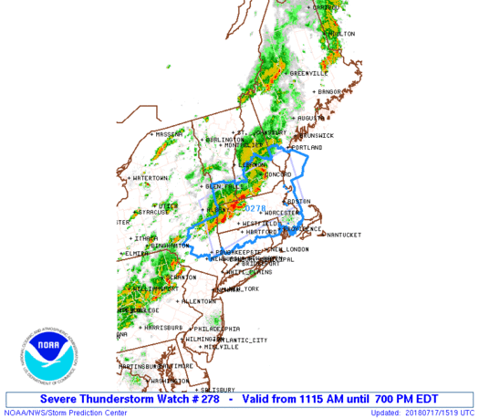
1115 AM EDT Tue Jul 17 2018
The NWS Storm Prediction Center has issued a
* Severe Thunderstorm Watch for portions of
Connecticut
Massachusetts
Southern Maine
Southern New Hampshire
Southeast New York
Rhode Island
Southern Vermont
Coastal Waters
* Effective this Tuesday morning and evening from 1115 AM until
700 PM EDT.
* Primary threats include…
Scattered damaging wind gusts to 70 mph likely
A tornado or two possible
SUMMARY…Within a very moist and increasingly unstable environment,
bands of storms will continue to intensify from late morning into
afternoon and generally spread east/northeastward across the region.
The stronger storms will be capable of wind damage, although some
hail or even a brief tornado cannot be ruled out.
The severe thunderstorm watch area is approximately along and 50
statute miles north and south of a line from 25 miles east southeast
of Portsmouth NH to 30 miles west southwest of Pittsfield MA. For a
complete depiction of the watch see the associated watch outline
update (WOUS64 KWNS WOU8).
PRECAUTIONARY/PREPAREDNESS ACTIONS…
REMEMBER…A Severe Thunderstorm Watch means conditions are
favorable for severe thunderstorms in and close to the watch area.
Persons in these areas should be on the lookout for threatening
weather conditions and listen for later statements and possible
warnings. Severe thunderstorms can and occasionally do produce
tornadoes.
FiOS1 News Weather Forecast For Long Island
FiOS1 News Weather Forecast For New Jersey
FiOS1 News Weather Forecast For Hudson Valley
NATIONAL WEATHER SERVICE SNOW FORECASTS
LATEST JOESTRADAMUS ON THE LONG RANGE