Wet Weather Pattern Looms Long Range
Wet Weather Pattern Looms Long Range
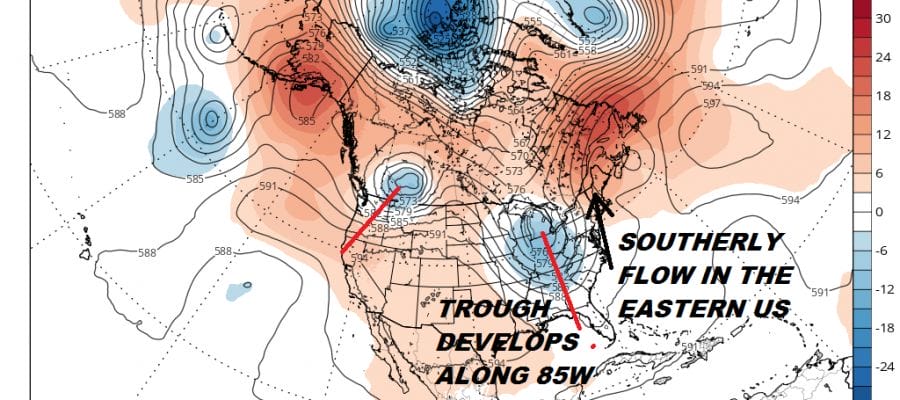
For the last two months much of the rainfall we have seen ( or in some cases haven’t seen) have come from thunderstorm events. Some areas have seen an average amount of rain and others have been rather dry and seem to miss all the thunderstorm threats. We have been talking about the fact that the developing mean trough position in the Eastern US keeps us from getting too hot and too humid for too long. Now we are about to see the trough in the East take shape late this week and park itself to our west for several days beginning on Saturday.
JET STREAM FORECAST SATURDAY JULY 21, 2018
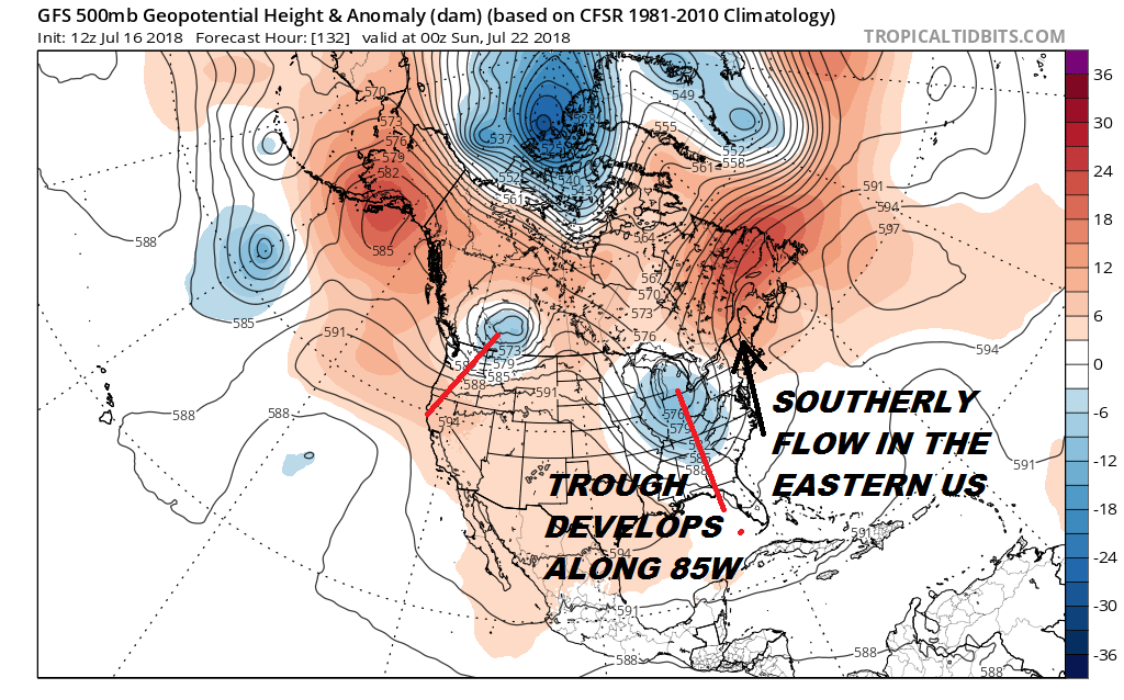
This time of year weather systems tend to move slower so when a trough locks into position like this it tends to hang for awhile. This type of set up creates a southerly flow along the East Coast. This opens the door for tropical moisture and the increasing chance for downpours and thunderstorms.
JET STREAM FORECAST TUESDAY JUNE 24, 2018
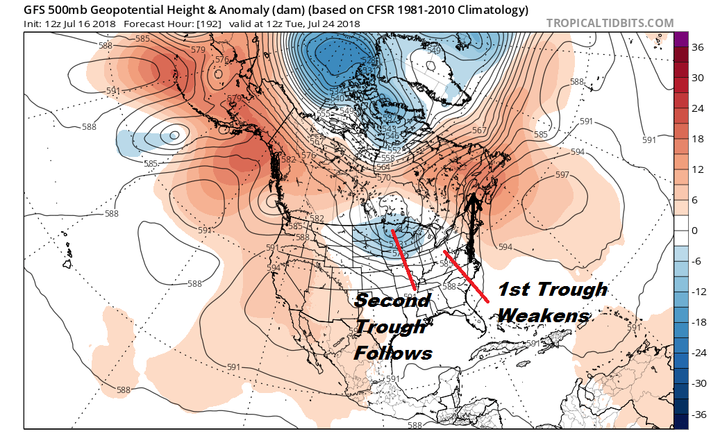
The first trough weakens early next week but another one moves into the Great Lakes and looks to drop into almost the same spot. This should mean more chances for downpours and thunderstorms well into next week. This doesn’t mean it rains all the time but there will be multiple opportunities for rain beginning late Saturday and lasting on and off into the middle of next week. Of course some areas will likely find a way to avoid this and specifics can’t really be hammered out for at least another several days.
GFS 10 DAY RAINFALL FORECAST
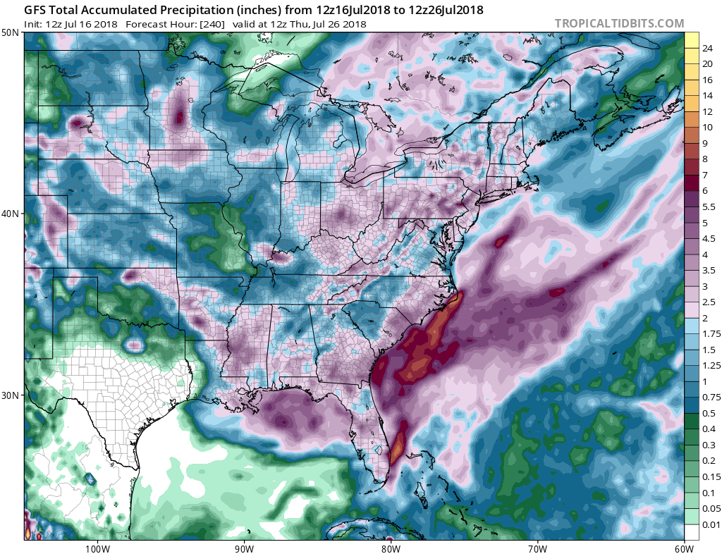
Weather models are rather bullish on rainfall amounts over the next 10 days as the GFS model shows above. Much of the Eastern US is showing several inches of rain or more. We shall see. Before that happens however we have to get through Tuesday’s cold front where thunderstorms seem likely in the afternoon and evening. Wednesday, Thursday and Friday will be days of sunshine and at least 2 of those days, Wednesday and Thursday, should come with low humidity.
One should also take note of a pattern like this. This is the kind of upper air jet stream pattern that could bring any tropical system off the Southeast Coast up the Eastern Seaboard. However that is the big rub. At the moment there are no threatening systems around so there are no worries from this standpoint. At the moment the Atlantic tropics are quiet.
Please consult your local National Weather Service office at weather.gov for the latest information on any tropical or storms or hurricanes that could be a threat to your area. Consult your local government officials regarding action you may need to take to secure life and property
FiOS1 News Weather Forecast For Long Island
FiOS1 News Weather Forecast For New Jersey
FiOS1 News Weather Forecast For Hudson Valley