DOWNLOAD MY NEW FREE JOESTRADAMUS WEATHER APP FOR ANDROID
THE APP IS ABSOLUTELY FREE TO ALL BUT CONSIDERING SUBSCRIBING TO PATREON FOR A WEATHER EXPERIENCE FREE OF ADS, EXCLUSIVE VIDEOS FOR MEMBERS ONLY AND MUCH MORE…STARTS AT $2 A MONTH..MESSAGE ME AT ANY TIME
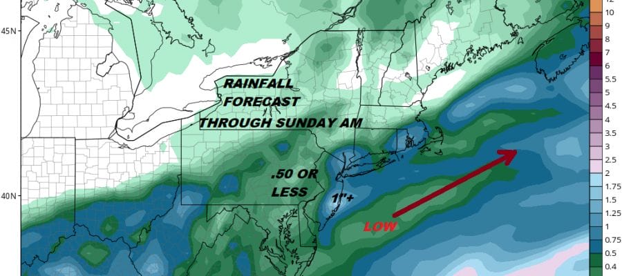
Rain Saturday Dry Sunday Warm Front Snow Rain Late Monday
A 50-50 weekend is forecast with Saturday the loser and Sunday the better day. Today looks fine and dandy to start as we have sunshine for now. High clouds have been persistent and nearby for the last few days thanks to a stalled frontal boundary to the south. It was a chilly start this morning with temperatures in the 20s to lower 30s and we should be headed into the 40s with sunshine giving way to arriving clouds. There is no cold air of importance to speak of so we know this is an all rain event everywhere from start to finish. The satellite loop shows the high clouds to the south getting ready to spread northward.
EASTERN SATELLITE

REGIONAL RADAR

Radars locally are quiet for now but we are beginning to see rain across North Carolina and Southern Virginia lifting northward. This is all part of low pressure heading northeastward from the Gulf States. We don’t expect rain to arrive until overnight as it spreads south to north. Then for Saturday it is simple. On and off rain, heavy at times in some places, a raw northeast winds and temperatures in the low to mid 40s. Rainfall amounts will range from 3/4 inch to an inch with perhaps slightly higher amounts along the immediate coast.
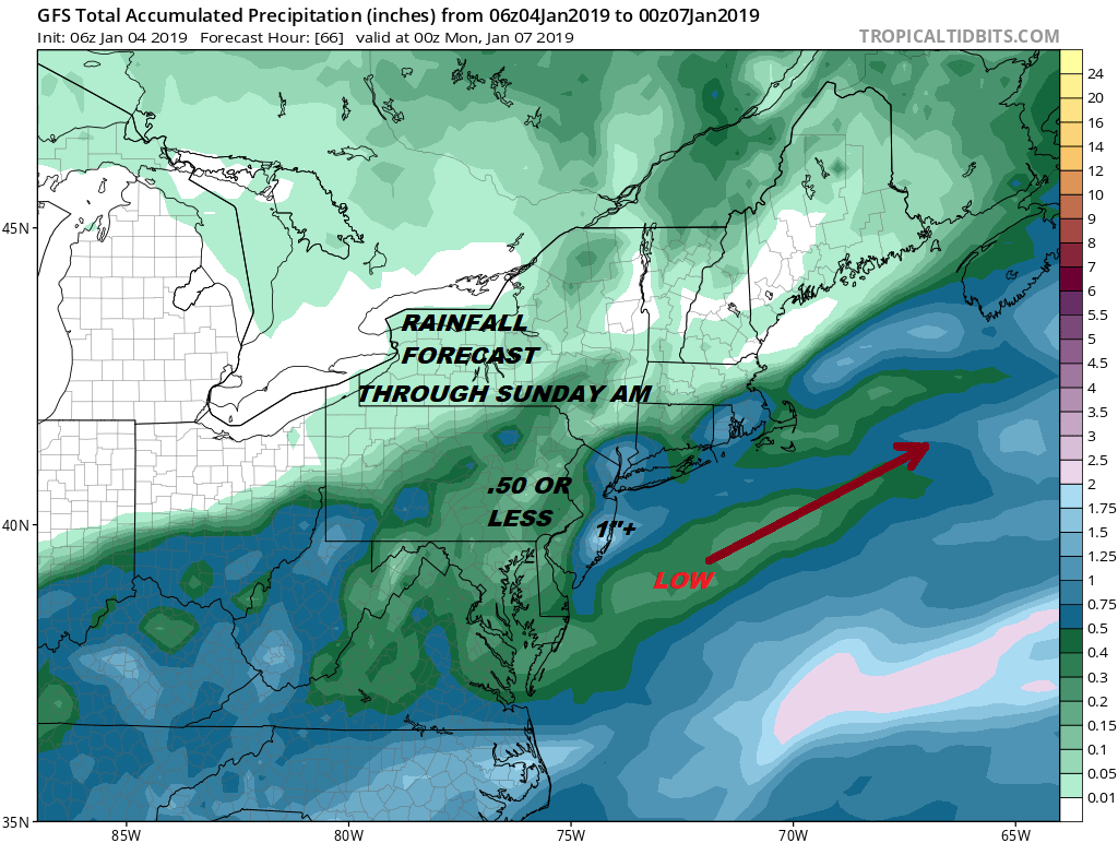
Weather conditions improve Sunday with gusty winds and some sunshine as drier air returns. Highs will be in the upper 40s to lower 50s before it turns colder Sunday night into Monday morning. Most lows Monday morning will be in the 20s. Then the next weather system arrives which is a warm front. Sometimes warm fronts can produce a quick coating to a couple of inches and I think there is a chance for that happening across Northeast Pennsylvania to the Hudson Valley (north of Route 84 and into Northern Connecticut Monday we will see sunshine giving way to arriving clouds with highs in the 30s.
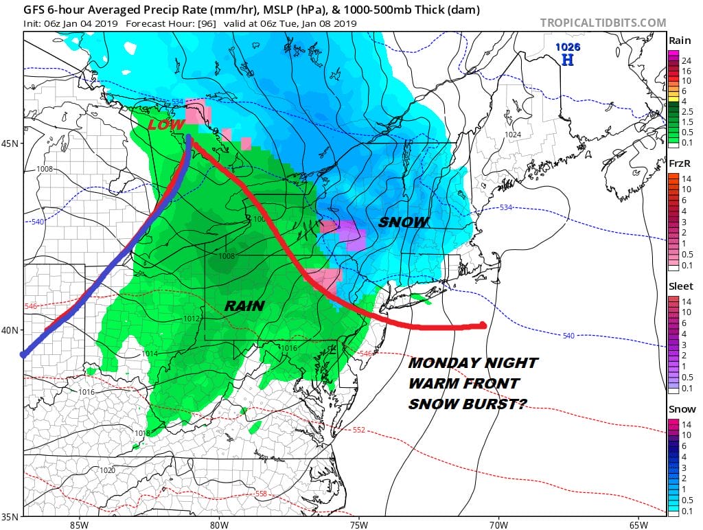
The burst of snow comes Monday night as the warm front goes by. Along the coast and for much of New Jersey south and west it is mostly rain showers that should move out by Tuesday morning. Tuesday’s temperatures will be in the 40s. This is a fast moving relatively benign system though as we head north into upstate NY & into New England this could produce several inches or more in some places. Then a second cold front arrives Tuesday night with a shot of much colder air for the second half of next week.
The longer range pattern change trend continues to show itself in a stair-step grinding fashion going forward with each cold air mass that arrives progressively colder than the one before it. We will see where this ultimately takes us in the long haul as far as cold and snow is concerned.
MANY THANKS TO TROPICAL TIDBITS FOR THE USE OF MAPS
Please note that with regards to any tropical storms or hurricanes, should a storm be threatening, please consult your local National Weather Service office or your local government officials about what action you should be taking to protect life and property.