DOWNLOAD MY NEW FREE JOESTRADAMUS WEATHER APP FOR ANDROID
THE APP IS ABSOLUTELY FREE TO ALL BUT CONSIDERING SUBSCRIBING TO PATREON FOR A WEATHER EXPERIENCE FREE OF ADS, EXCLUSIVE VIDEOS FOR MEMBERS ONLY AND MUCH MORE…STARTS AT $2 A MONTH..MESSAGE ME AT ANY TIME
Polar Vortex Europe Impacts Cold Snow
The split of the polar vortex in the atmosphere is creating all sorts of mayhem in weather across the Northern Hemisphere. The impacts on Europe have begun in Central & Eastern Europe with cold and snow. It hasn’t been overly cold at least not yet but the deep amplified pattern is creating quite a bit of snow in some areas.
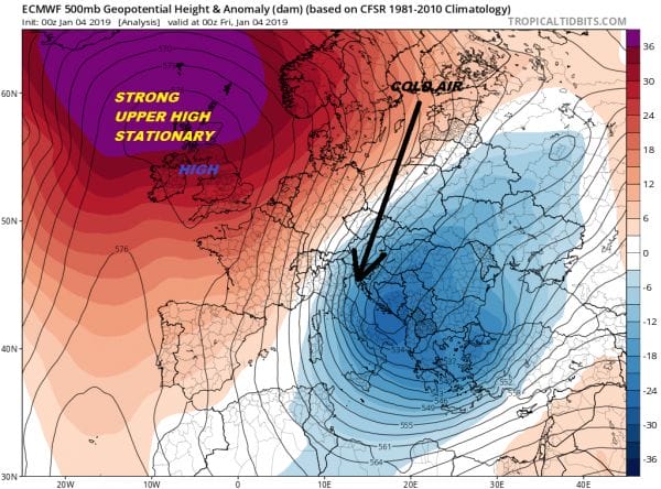
The upper flow is being dominated by two very strong features. Over England sits a big blocking upper air high that has remained locked up over the last week. To the east likes a very strong deep trough from Siberia southwestward into the Mediterranean. This has kept the cold and snow to the east while keeping Western Europe, England, Scotland & Ireland on the dry side. The Atlantic Ocean train of storms is deflected well to the west and north of the blocking high and won’t resume until the high at least weakens and moves or breaks down entirely.
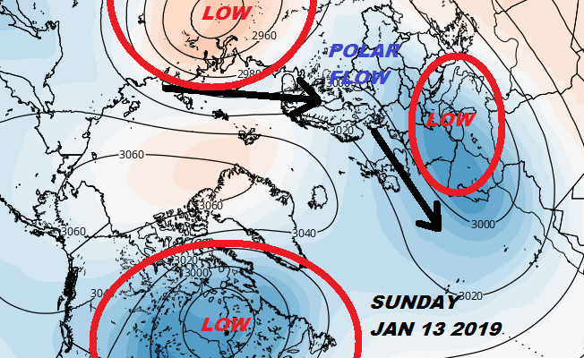
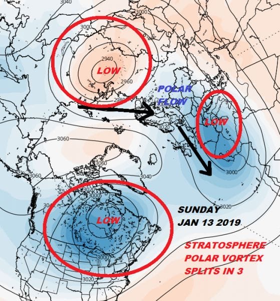
Meanwhile the stratosphere triple split view continues from run to run with incredible consistency. The split in 3 leaves one of those lows parked in Southwest Europe and over Northwest Africa. The result is a shift westward late next week to the west of the cold and snow over Europe. The blocking high over England completely breaks down and a polar flow gets established for areas to the west.
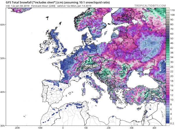
The overall pattern means for cold (but not crazy cold) and snow. Over the next 10 days, the GFS model is very bullish on snowfall over Europe and particularly over areas surrounding the Mediterranean. The map is the snow forecast for the next 10 days but it appears that snow chances for parts of Western Europe, England & Ireland increase after the 10 day period.
NORTH AMERICA IMPACTS CONTINUE TO EVOLVE SLOWLY
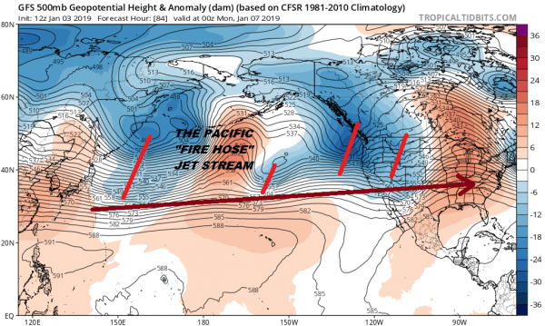
We discussed in detail yesterday regarding the overall pattern in North America and what we need to see happen regarding the upper pattern not just over North America but out in the Pacific. A fire hose east west screaming jet stream running across the Pacific has kept things warm. Combined with a lack of a polar connection of some sort into the East has mean a complete lack of any real cold air.
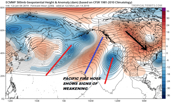
The map above shows the extent of the firehose jet early next week. Weather models yesterday showed this firehose jet weakening in the long range and that weakening continues on today’s model an appears to accelerate later in the forecast period. Today’s European shows that the straight line ruler jet stream is replaced by more amplitude with troughing moving westward toward the Aleutians while a ridge builds from Hawaii to the Canadian Northwest. This allows a polar flow to establish itself back into the US east of the Rockies.
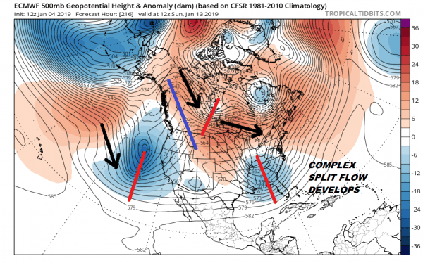
The models do seem to have a complex split flow developing which brings weather systems in from the Pacific and across the South with a polar flow becoming more established. The European seems to be front and center with this today.
The fact is the models continue to slowly plod along grinding out a pattern shift of some sort. We still don’t know what the finish of this mystery is. It is bound to lead to disappointment for someone and elation for others. Right now it is important to focus on the broad picture and not in any specifics until we get a firm handle on where this all winds up.
MANY THANKS TO TROPICAL TIDBITS FOR THE USE OF MAPS
Please note that with regards to any tropical storms or hurricanes, should a storm be threatening, please consult your local National Weather Service office or your local government officials about what action you should be taking to protect life and property.

