
Rain Moving Northeastward Sunday Afternoon Evening Dry Monday Showers Tuesday
The non tropical low that was Tropical Storm Nestor is moving northeast through the Carolinas and will be heading off the Virginia coast later today. Clouds are on the satellite picture this morning and they are beginning to increase from south to north. Any breaks of sun will soon fade away and look for cloudy skies to take over for the remainder of the day. Temperatures this morning bottomed in the 40s. Look for highs to reach the lower 60s but once it starts raining this afternoon, temperatures will likely settle back into the 50s.
SATELLITE

REGIONAL RADAR

Radar shows a wall of steady light rain with some embedded moderate rain across Virginia into Maryland and Delaware. The northern edge of the rain is pushing into Eastern Pennsylvania and we are seeing it show up on the local radars as it moves northeastward.
LOCAL RADAR NEW YORK CITY

LOCAL RADAR PHILADELPHIA


The low will be offshore this evening and since the upper air support with this will be diminishing as it moves offshore, we expect the rain area to weaken as well as the low itself as it sits offshore. Rainfall amounts will be greatest from Southern New Jersey southward where it rains the longest today with less amounts as you head north.
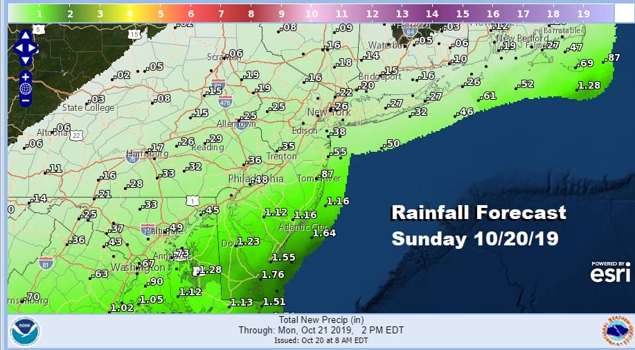
It looks like some one inch amounts will skim coastal and Southern New Jersey south and west with a quarter of an inch or less as you head into Northern New Jersey, the Hudson Valley and Connecticut. Long Island looks to be somewhere in between. This all gets out of here tonight.
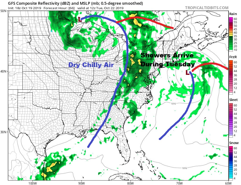
There are no changes in the outlook for the week ahead. Monday will be dry with clouds and some sun. Highs will be in the mid 60s along the coast to the lower 70s well inland. Tuesday brings the next cold front with a solid chance for showers later in the day. Highs will be in the 60s to near 70. Once the front passes dry weather returns Wednesday and Thursday with some sunshine both days. Highs will be in the low to mid 60s by day and lows will be in the mid 30s inland..mid to upper 40s around warmer urban centers. We will check out the longer range later today.
MANY THANKS TO TROPICAL TIDBITS FOR THE USE OF MAPS
Please note that with regards to any severe weather, tropical storms, or hurricanes, should a storm be threatening, please consult your local National Weather Service office or your local government officials about what action you should be taking to protect life and property.


