Rainy Evening, Gets Better Monday Showers Later Tuesday
We have been watching this solid wall of rain moving northeastward as low pressure moves through Eastern North Carolina and off the Virginia coast this evening. Rain has been heavy across Virginia and Maryland with 1 to 2 inches of rain or more fallling in some areas. As the rains fall temperatures settle into the 50s making for a raw rainy evening.
SATELLITE

REGIONAL RADAR

Regional and local radar shows the rain moving northeast. The back edge is now moving out of Northeastern Virginia but it covers all of the Delmarva Peninsula northward in the Eastern Pennsylvania and eastward to Connecticut and Long Island. Moderate to heavy rain patches are embedded in the mix as it all moves northeast.
LOCAL RADAR NEW YORK CITY

LOCAL RADAR PHILADELPHIA


Weather conditions will improve tonight once the low moves far enough offshore and the rains end from west to east. There are no important changes in the forecast for Monday with clouds along the coast and some sunshine inland with highs mostly in the 60s. Warm spots well inland could reach near or just over 70.
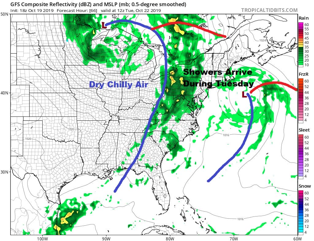
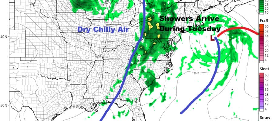
Tuesday it is about the next cold front that will basically absorb the lingering coastal low offshore and set off some showers. Highs will be mostly in the 60s. Wednesday and Thursday still look like two good days with sunshine and highs in the 60s. Another front will start its approach on Friday.
MANY THANKS TO TROPICAL TIDBITS FOR THE USE OF MAPS
Please note that with regards to any severe weather, tropical storms, or hurricanes, should a storm be threatening, please consult your local National Weather Service office or your local government officials about what action you should be taking to protect life and property.


