
Quiet Conditions Next Several Days Colder Temperature Trend
We wound up spending much of the day in clouds which put a lid on temperatures. Every once in awhile the sun poked its nose through but on the whole clouds won the day. The clouds around the Great Lakes and the interior Northeast are due to the remnant storm system from the weekend which has still not gotten completely out of the way. Some colder air will be filtering southward tonight which should take lows down to the upper 20s to mid 20s. Clouds should give way to partial clearing of skies. Radar activity has been minimal today though we are seeing some spotty lake effect snow showers as well as some freezing drizzle from Western Pennsylvania to the lake effect areas of Western NY. This will likely continue on and off into Wednesday. Otherwise the radars are quiet.
SATELLITE

REGIONAL RADAR

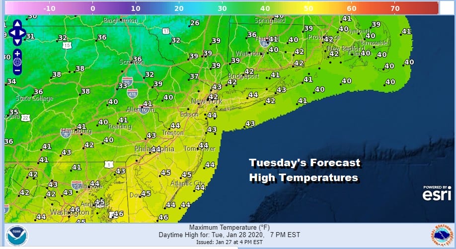
Weather systems will be passing by well to our south for the next several days so it will be about slowly building high pressure Tuesday into Friday and a slow step down in temperatures at least through Thursday. Highs Tuesday will reach the low to mid 40s.
Tuesday night we should clear with lows in the 20s. Wednesday and Thursday will be colder with some sunshine both days. Highs will likely not get out of the 30s. Friday look for sunshine at least for part of the day before we start getting into some high clouds from the south. Highs will be in the upper 30s to some lower 40s.
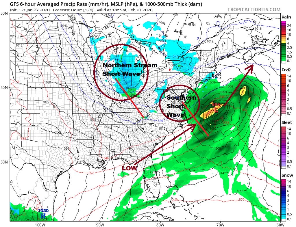
These systems moving across the Gulf States and off the Southeast US coast this week are passing straight east and are of no consequence but the last one in the series will try and make the turn up the East Coast. Weather models continue to waffle back and forth on this and we aren’t seeing any clarity today in terms of how this plays out. You can thank a very chaotic jet stream pattern with half a dozen different weather systems interacting with each other. Don’t expect much in the way of clarity until Wednesday or Thursday regarding whether we will just see clouds around or whether there will be precipitation to deal with at some point over the weekend.
We discuss the long range in detail with a JOESTRADAMUS long range post on our weather platform on Patreon.
BE SURE TO DOWNLOAD THE FREE METEOROLOGIST JOE CIOFFI WEATHER APP &
ANGRY BEN’S FREE WEATHER APP “THE ANGRY WEATHERMAN!
MANY THANKS TO TROPICAL TIDBITS FOR THE USE OF MAPS
Please note that with regards to any severe weather, tropical storms, or hurricanes, should a storm be threatening, please consult your local National Weather Service office or your local government officials about what action you should be taking to protect life and property.


