Weather Pattern Means For Snow Lovers It Has To Be Perfect
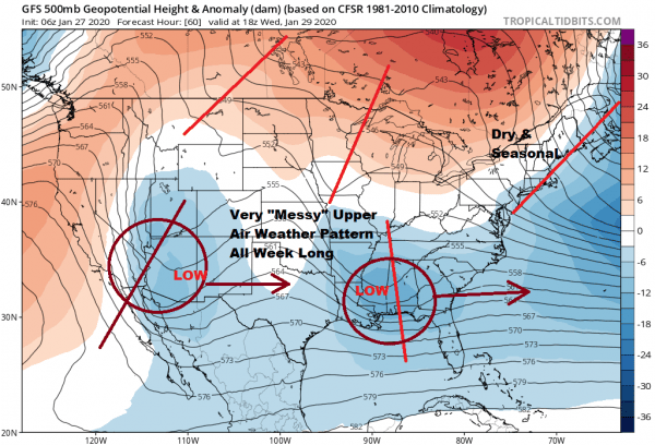
Many of you have heard me say from time to time that the “trend is your friend” and this winter for snow lovers, the “trend has been your enemy!” What we have as far as the jet stream pattern is concerned is chaotic and in general unfavorable for accumulating snow for the I-95 corridor.
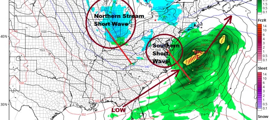
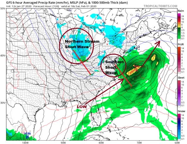
This morning we showed you this view of the jet stream which is a outright mess. There are many shortwaves running around in two chaotic streams. In order for a storm to develop and impact the East Coast the two streams and the shortwaves moving along them would have to match up and time out perfectly. They would have to phase together in the right geographic place to bring a storm up the coast in a perfect track. It would have to be perfect because we have only a minimal amount of cold air. The storm would have to be strong enough to produce dynamic cooling (cooling of the atmosphere from the top down. In other words the storm would have to be strong enough to essentially make its own cold air.
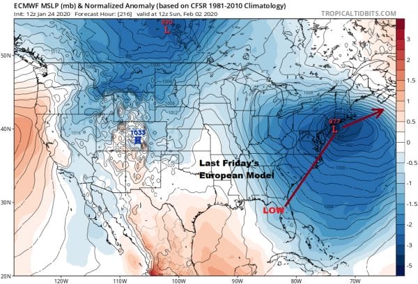
This map was from last Friday’s European model run showing an almost perfect phase creating a major storm just offshore. Since then we have seen different models doing all sorts of different things because of all the energy that is located across the US coming together in different ways.
Notice how the models have changed since Friday. Today’s run phases and times everything differently and you wind up with a much weaker and much faster weather system that comes out of the southern part of the jet stream and races northeastward which by today’s run of the European passes well offshore on Saturday vs having a major storm in our back yard on Sunday.
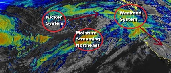
Meanwhile the players here are still out in the Pacific moving into position over the next few days. The shortwave that is the player here is coming ashore in the Pacific Northwest being kicked along by one behind it near the Aleutians while an extra shot of energy is shooting northeastward.
Meanwhile the kicker system on the Pacific satellite above will join the shortwaves in Canada in a few days and that becomes the system in the Northern stream that attempts to phase down the road at the end of the week in the East.
What it boils down to is that you have a grand total of 6 or possibly 7 players here as part of the equation. It is no wonder that the weather models struggle and will continue to struggle for another couple of days before this all becomes clearer. The bottom line is that it would have to be a perfect alignment of strength and timing for anything to happen. It is not impossible but the obstacles are formidable.
BE SURE TO DOWNLOAD THE FREE METEOROLOGIST JOE CIOFFI WEATHER APP &
ANGRY BEN’S FREE WEATHER APP “THE ANGRY WEATHERMAN!
MANY THANKS TO TROPICAL TIDBITS FOR THE USE OF MAPS
Please note that with regards to any severe weather, tropical storms, or hurricanes, should a storm be threatening, please consult your local National Weather Service office or your local government officials about what action you should be taking to protect life and property.

