Pattern Change Lies Ahead As October Begins
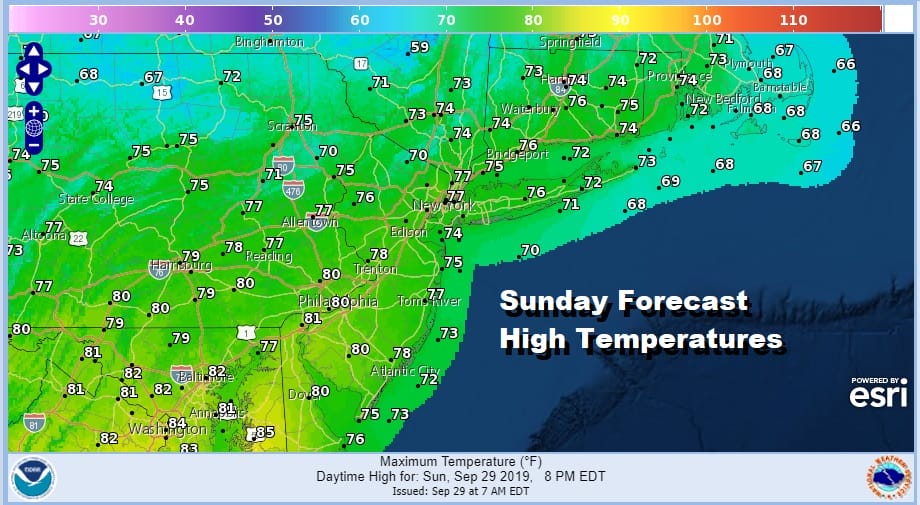
We have enjoyed a spectacular month of weather. This September as provided us with many days of sunshine and reasonable humidity. We have seen some occasional warm weather days. We have also seen very little in the way of rain with most places finishing the month off with less than an inch of total rainfall. A few of you in Central and South Jersey saw some downpours overnight but others did not. We now have a beautiful Sunday of weather ahead of us with a developing northeast wind and temperatures that will be in the 70s.
SATELLITE

REGIONAL RADAR

Satellite pictures this morning don’t show much in the way of clouds and as high pressure builds southward from New England tonight and Monday it will turn cooler with lows by Monday morning in the 50s with temperatures bottoming in the 40s as you head north and west of NYC. Monday it is all about the high to the north, dry air and a northeast wind. We will have sunshine but highs will be rather contained as we reach just into the 70s.
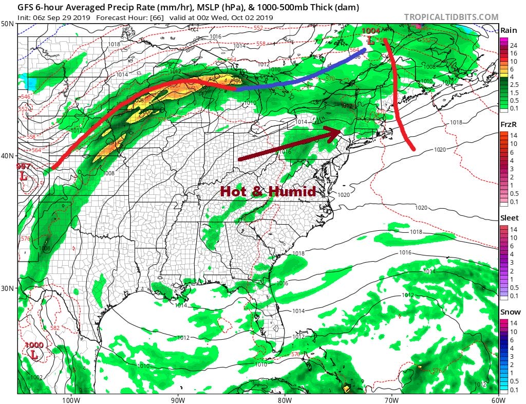
Tuesday begins the process of turning winds to the west and southwest which will start to warm things up. We will have sunshine and some clouds. A warm front will likely cause a few showers well to ur north. Highs will be in the 70s to near 80. Wednesday will be the one day this week where temperatures will be a bit excessive as we wait for two cold fronts to pass. Ahead of it Wednesday we have west winds and some sunshine with highs close to 90 degrees in hot spots from New Jersey south and west with mid to upper 80s in most other places. A cold front arrives Wednesday evening with the chance for showers or a few thunderstorms..
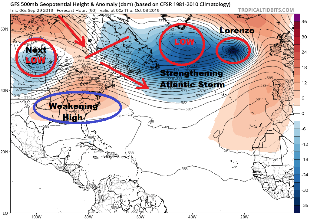
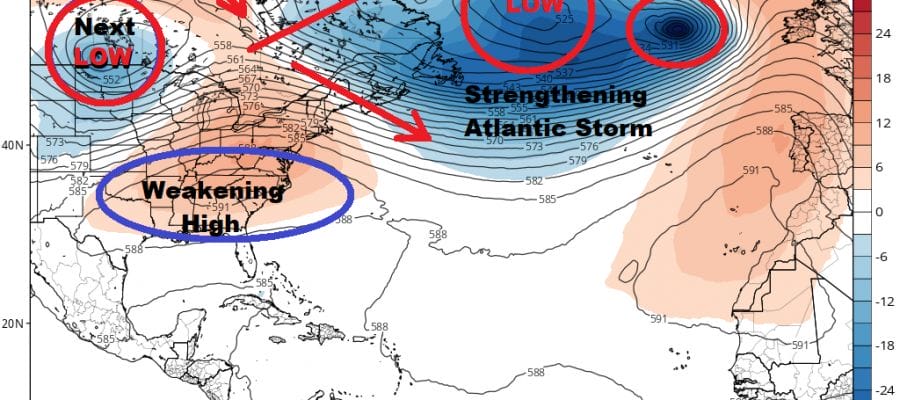
Hurricane Lorenzo became the second category 5 hurricane of this season when winds last night reached 160 mph. It is the strongest storm even observed in the Eastern Atlantic and will be a player in orchestrating pattern change across the Northern Hemisphere. We are basically seeing a chain reaction of events beginning with a strengthening North Atlantic Storm which will eventually absorb Lorenzo or they will move east through Europe in tandem. Meanwhile in the Eastern US the upper ridge weakens in response to a strengthening jet stream across Southern Canada while another system heads east from the Plains. All of this will serve to change the flow across the US longer term which will lead to shots of cold air (relative to the season) coming on a regular basis.
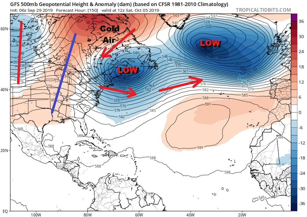
The first of these shots will be setting up at the end of this week with a second cold front and low with a chance we could see some widespread showers here developing on Thursday and lasting into early Friday. We will see cooler tempertures Thursday with the clouds and showers and then much colder temperatures should follow into next weekend. If this verifies we should at least see a couple of days with temperatures having a tough time getting out of the 50s in some places or perhaps just barely into the 60s.
MANY THANKS TO TROPICAL TIDBITS FOR THE USE OF MAPS
Please note that with regards to any tropical storms or hurricanes, should a storm be threatening, please consult your local National Weather Service office or your local government officials about what action you should be taking to protect life and property.


