Watching For A Passing Shower or Thunderstorm Otherwise Back to Sunshine Sunday
What a beautiful start to the weekend it was and even the clouds stayed away for the most part leaving us with sunshine through the entire day. Now we wait for the arrival of a cold front but it appears that the front wont pass until the early morning hours on Sunday, Temperatures today topped out in the upper 70s and lower 80s and the humidity while up a bit today remained rather reasonable in my view.
SATELLITE
REGIONAL RADAR
Time to keep an eye on the regional and local radars. We are seeing a few pop up showers this evening on the NYC & Philadelphia Mount Holly radars but they are few and far between. There is more important activity on the regional radar back in Western Pennsylvania and Western NY. If those showers were to hold together they would reach us until at least midnight or a bit after and we question how much of these showers will actually survive the trip. We have the mentioned in the forecast but I wouldn’t lose sleep over it since chances are you will be asleep when the move through. Most lows will be in the upper 50s to mid 60s.
LOCAL RADAR NEW YORK CITY
LOCAL RADAR PHILADELPHIA

Sunday brings a new air mass and a wind shift to the northeast. Morning clouds should quickly give way to partly to mostly sunny skies. The new high builds down from Eastern Canada as the cold front drops southward into Virginia. High temperatures Sunday will be mostly in the 70s. Sunday night begins Rosh Hashanah in the tradition of being a nice evening of a beautiful sunset as the New Year arrives. This is how it shall be for Sunday evening and skies will be clear Sunday night with lows mostly in 50s with 40s in many interior cool spots.
Monday looks nice with sunshine and an onshore wind with highs in the 70s. The onshore flow will gradually turn more southerly and then southwesterly as we move into Tuesday but clouds and a persistent flow from off the ocean could limit any warm up. Highs will be in the 70s to some lower 80s inland.
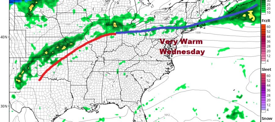
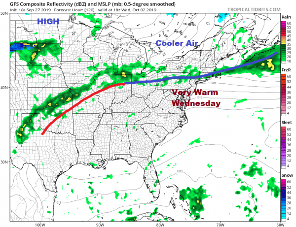
Wednesday looks to be the one very warm day this week with some sunshine and highs in the mid to upper 80s in hot spots inland and upper 70s to lower 80s along the immediate coast. Another cold front brings showers and perhaps a thunderstorm Wednesday evening. Then we start a process of pattern change across the US and in fact across the Northern Hemisphere all thanks to Hurricane Lorenzo.
We continue to see Lorenzo as the driving force for a pattern change. It is a pattern change that looks to bring shots of chilly air every few days from Canada. In other words, we are going into a seasonal weather pattern for the early part of October. That means cooler air masses interrupted by brief warm ups in between but nothing crazy. The change may also allow for better chances for rain since much of September, rain in the Northeast and Northern Mid Atlantic states has been minimal to in some cases non existent.
MANY THANKS TO TROPICAL TIDBITS FOR THE USE OF MAPS
Please note that with regards to any tropical storms or hurricanes, should a storm be threatening, please consult your local National Weather Service office or your local government officials about what action you should be taking to protect life and property.


