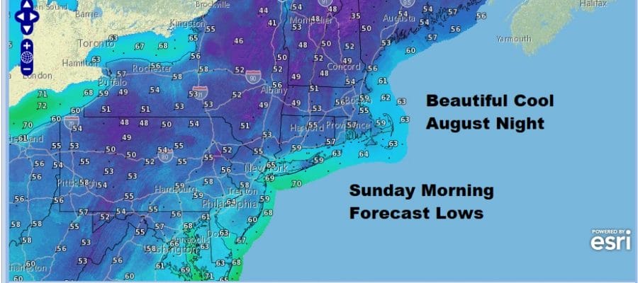
Our Beautiful Weather Weekend Continues With A Great Sleeping Night
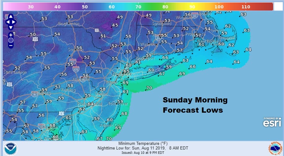
After what was a beautiful day we have a not only a great night of weather ahead but a night where you can sleep with the windows open and the air conditioner turned off. Skies are mostly clear everywhere on the satellite in the Northeast except for Northern Maine. The core of this cool dry Canadian air mass is in the process of moving overhead which is going to allow temperatures to fall. The map above shows most lows in the 50s except for the warmest urban areas which will bottom out in the lower 60s. It should be like this every night in the summer.
SATELLITE

REGIONAL RADAR

There are no radar issues with showers going forward through Monday. Sunday is going to be another winner of a day with lots of sunshine, low humidity and highs mostly in the lower 80s.There won’t be any pop up showers or thunderstorms around to spoil anyone’s day. This dry air mass will begin to pull out on Monday but it should remain comfortable into Monday morning before the humidity starts to rise. Monday look for sunshine but the next frontal system will come close enough to produce some high clouds. It will be warmer and it will start to turn more humid during the afternoon but not unreasonably so. Highs will be in the 80s.
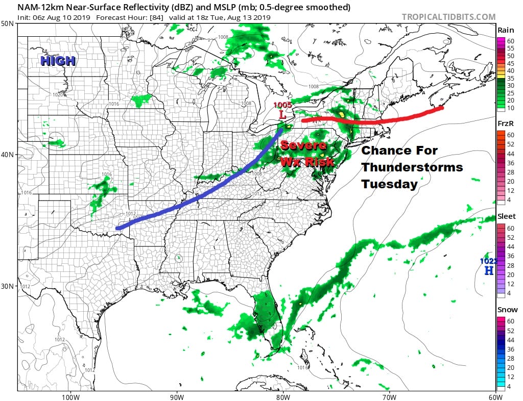
We are still on course for a shower or thunderstorm chance late Monday night into early Tuesday morning as a warm front goes by. Then we wait for the cold front to approach late Tuesday with another round of showers and thunderstorms. How much daytime heating we get Tuesday will determine the severity of those thunderstorms. It will be very warm and humid Tuesday with highs in the 80s to near 90 in some warm spots. 
This next front will move southward along the mid and south Atlantic coast Wednesday and Thursday. There may be some leftover clouds around on Wednesday until the front sinks far enough south. Highs pressure will build to our north which will put us in a northeast flow Wednesday through Friday. It should be mostly dry as long as that frontal boundary to south behaves itself. Clouds will give way to some sunshine Wednesday and we will see a mix of sun and clouds both Thursday and Friday. Highs each of those day will be mostly in the lower 80s on average with highs a bit higher in Southern New Jersey and Southeastern Pennsylvania and a bit lower and less humid north of NYC in the Hudson Valley and Connecticut.
MANY THANKS TO TROPICAL TIDBITS FOR THE USE OF MAPS
Please note that with regards to any tropical storms or hurricanes, should a storm be threatening, please consult your local National Weather Service office or your local government officials about what action you should be taking to protect life and property.


