Best Weekend of the Summer Blue Skies Sunshine Low Humidity
The weekend of August 10-11 will likely go down as the best weekend of weather for the summer. It is a combination of sunshine, low humidity, fresh clean Canadian air, sunny day, and clear cool nights. There is a nice fresh early September feel to the air today. Now there are some streaks of high clouds to the south and some patchy clouds well north in Upstate NY due to the cold unstable air aloft. We had that condition yesterday which triggered a couple of isolated pop up thunderstorms. I don’t expect this to happen today. Highs will reach the upper 70s and lower 80s this afternoon.
SATELLITE

REGIONAL RADAR

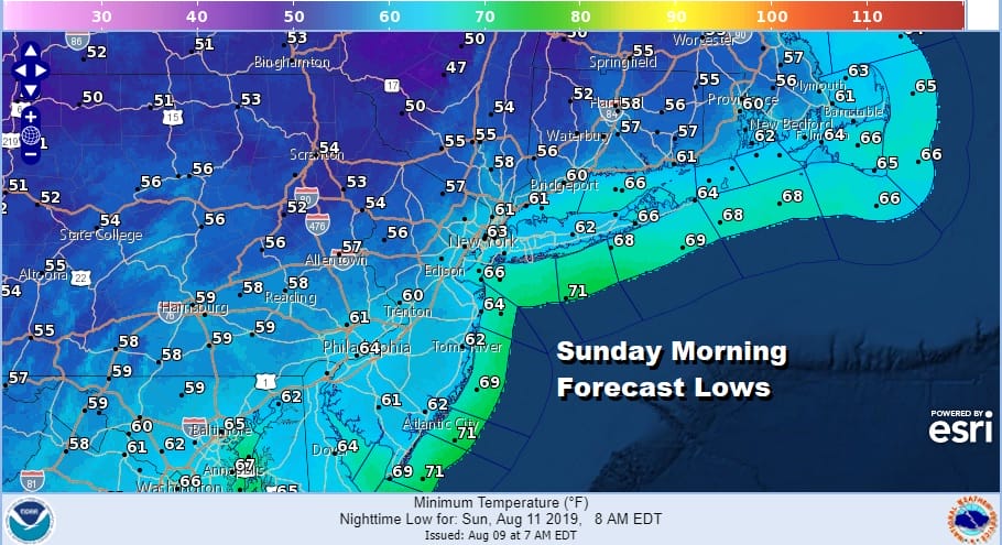
Tonight skies will be nice and clear and it will the perfect night for windows open and air conditioners off. Lows by morning will be in the 50s in many areas. Even the warmer urban centers will see lows down in the lower 60s making it a perfect sleeping night.
Sunday we will do it all over again with lots of sunshine with most highs in the lower 80s. Humidity will remain low. We will likely hold on to the low humidity into Monday morning as high pressure moves offshore. Monday we will start to turn warmer and more humid as the day wears on with sunshine giving way to arriving high clouds. Highs will be in the 80s. Some showers or a thunderstorm are possible as the warm front goes by early Tuesday morning.
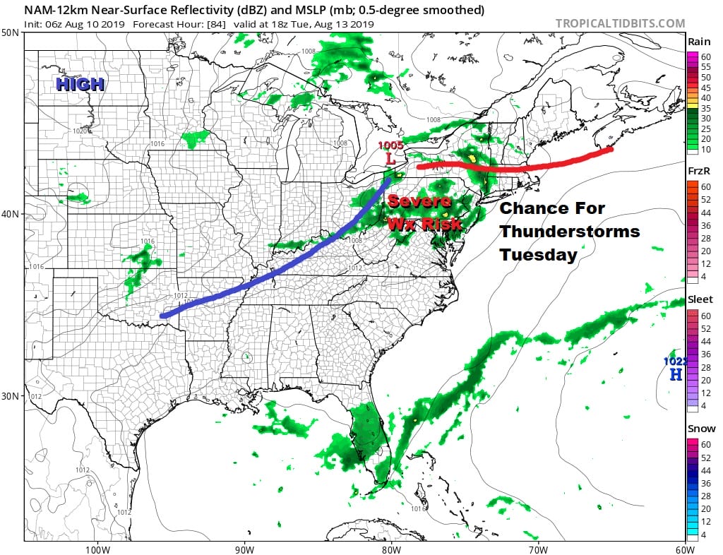
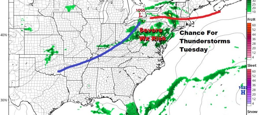
Tuesday brings this warm front cold front combination which puts us back into high humidity and the chance for thunderstorms. This could be another day of severe weather risk for Eastern Pennsylvania to Southern New England as the set up is similar to the severe weather outbreaks we have seen over the last 6 weeks or so. We will pay closer attention to this as we draw closer to Tuesday.

That front is going to move through and stall out along the Southeast coast of the US later next week. It should be far enough south so that dry air returns to some extent Wednesday through Friday but the boundary to the south might be close enough for cloud issues on some days. The high to the north means temperatures that won’t be too warm..just into the 80s Wednesday Thursday and Friday.
TROPICS COULD BECOME MORE ACTIVE LATE NEXT WEEK
The stalled frontal boundary we speak of above will be sitting offshore and over very warm water. This could be a situation where a wave develops on the front which starts off as a cold core system and then gradually transforms into a tropical system over time. These are what we refer to as a home ground tropical system since they don’t originate from the deep tropics.
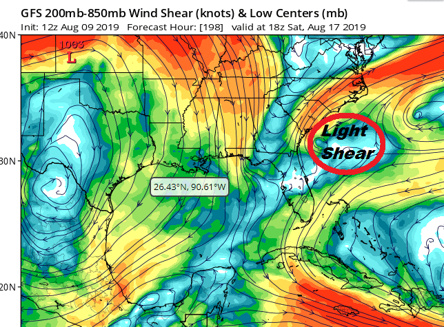
Given the warm state of the ocean off the southeast coast, and given what appear to be conditions that could be conducive for development I think there is a fair chance of something developing off the Southeast US coast late next week or next weekend. Until then the tropics remain quiet through the weekend and through most of next week.
MANY THANKS TO TROPICAL TIDBITS FOR THE USE OF MAPS
Please note that with regards to any tropical storms or hurricanes, should a storm be threatening, please consult your local National Weather Service office or your local government officials about what action you should be taking to protect life and property.


