WEAK BACK DOOR FRONT PUSHES SOUTH TONIGHT
ONSHORE WINDS HIGH HUMIDITY LOWER TEMPERATURES
SEVERE WEATHER THREAT THURSDAY
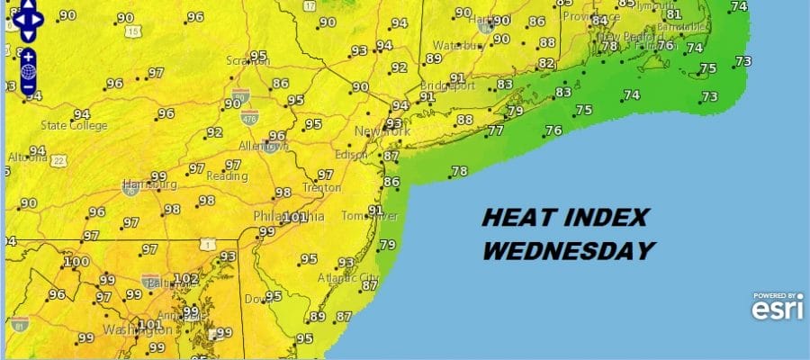
We are going to catch a “slight” break on Wednesday. There is a weak and we do mean weak back door cold front that will be moving through overnight with nothing much with it. We will see a wind shift to the east which will do 3 things on Wednesday. First off it will bring in some clouds along the coast overnight into Wednesday morning. Combine that with an east wind and we will see temperatures lower along the coast and just inland with highs Wednesday in the low to mid 80s. Further inland temperatures will likely reach the upper 80s to low 90s. The 3rd thing is the east wind brings in some moisture at low levels and the dew points are going to be in the 70s making it very uncomfortable indeed.
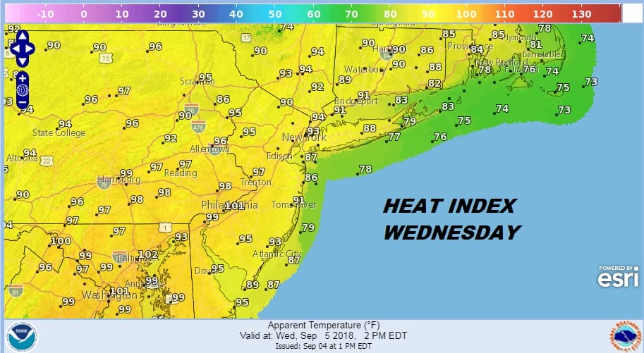
The heat index is lower along the coast so mid 80s will feel like..well mid 80s. But inland it will be a different story with heat indices again reaching 95 to near 100. Thursday it will all even out for everyone ahead of a cold front. Heat indices will be in the mid to upper 90s so everyone will be oppressed. This will be ahead of a cold front which arrives late in the day with thunderstorms
REGIONAL RADAR

Nothing seems to be happening on the radars this afternoon. An odd pop up could develop but even if it does it will be short lived. The front Thursday has the potential to produce widespread thunderstorms in the late afternoon and evening and the Storm Prediction Center has us at a marginal risk for severe weather.

The front will be slowing down and stalling to our south which is going to complicate things for Friday and the weekend. It will be cooler with most highs in the 70s to near 80. Saturday and Sunday it will be in the 70s. There could be some passing showers Friday into Saturday morning but the high that is going by to the north could build down the coast. This could allow some drying later Saturday and Sunday so we could see some sun, especially on Sunday. The cloud line could be close to Southern New Jersey and Southeastern Pennsylvania with rain not that far away.
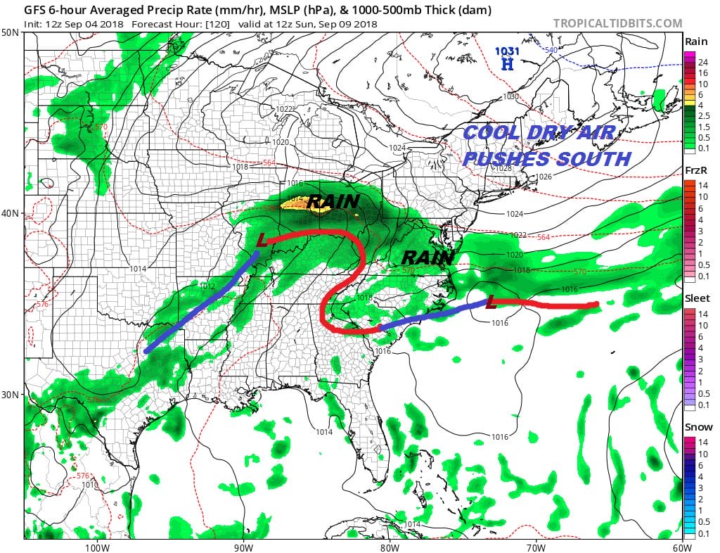
After that the front comes back as a warm front and we could see more numerous showers coming in Sunday night and Monday as the warm front comes back. Drier air should move in during Tuesday as the cold front moves offshore.

The stronger trough coming through Southeastern Canada Friday is stronger on the European and GFS models. This increases the probability that Florence will recurve out to sea along and east of 60 degrees west. If the shortwave trough misses Florence it would likely be picked up by a second short wave behind it moving through the Great Lakes. The upper highs are not a strong and do not cradle the storm preventing the recurvature. This is what the European was doing for days and days until last night’s run when it went the way of the GFS. The two models have gotten consistent as the European seems to abandon the idea of an upper high building around Florence. That would take it further west as it misses the opportunity to recurve. At least that is the plan being laid out at the moment.
MANY THANKS TO TROPICAL TIDBITS FOR THE USE OF MAPS
Please note that with regards to any tropical storms or hurricanes, should a storm be threatening, please consult your local National Weather Service office or your local government officials about what action you should be taking to protect life and property.
LATEST JOESTRADAMUS ON THE LONG RANGE


