
OCEAN WIND BRINGS HIGHER DEW POINTS
HIGHS 80S COAST LOWER 90S INLAND
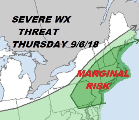
HEAT BREAKS THURSDAY SEVERE WEATHER THREAT LATE DAY
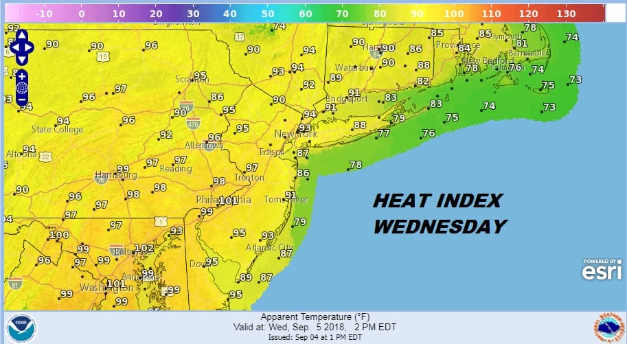
Today we get a bit of a break from the highs in the 90s in most (but not all) of the area. Yesterday we set a few record highs in the lower 90s (in places where the bar was low Islip, JFK). A back door front pushed southward overnight and fell apart. What we are left with is an onshore flow today which will knock about 5 degrees off the high temperatures but at the same time raise the dew points by about 5 degrees. The result are heat indices which are just as oppressive! We will see sunshine today and just the outside chance of a pop up thunderstorm this afternoon and evening. They have been virtually non existent over the last several days.
EASTERN SATELLITE

REGIONAL RADAR

There isn’t much happening on the satellite and radar loops this morning. It is just an old fashion early September late summer day. This recent round of humidity and heat comes to an end late Thursday when a cold front moves through. Highs Thursday will reach 90 to 95 with late day and evening thunderstorms. The Storm Prediction Center has us in a marginal risk zone for severe weather. That zone has been expanded since yesterday and we could see an area of slight risk being added.
This front puts an end to the heat and humidity as we go into the weekend High pressure building strongly in southeast Canada will funnel down very dry air to us but it will only get so far south because the front will stall across the Delmarva Peninsula westward across Virginia. The cloud line gets only so far south and will probably settle across Southern New Jersey & Southeast Pennsylvania by Saturday night. Getting to that point Friday we will see clouds and the chance for showers and temperatures in the 70s to near 80.
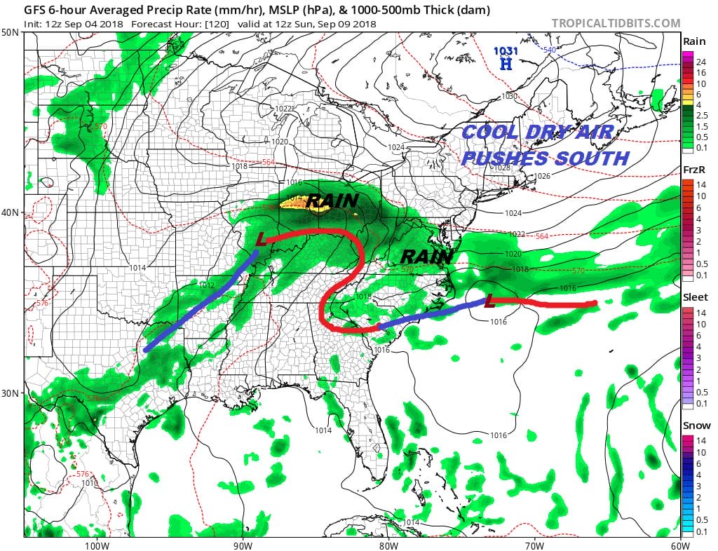
Saturday the cloud rain line will be close. There could be some showers in South Jersey and Southeast Pennsylvania with clouds north and east of there to Southern New England. HIghs will be into the 70s. Of course the front will come back as a warm front so eventually we will see rain coming northward Sunday though it may take all day to advance northward. Highs Sunday will be just into the 70s. Then it looks like we will have some rain or downpours Sunday night into Monday. Eventually we will see higher temperatures and humidity levels returning next week as a ridge builds in the Eastern US. We will also be looking toward the tropics as we wonder about Hurricane Florence and what if any impact it will have on the weather later next week. We will be focusing on that later this morning.
MANY THANKS TO TROPICAL TIDBITS FOR THE USE OF MAPS
Please note that with regards to any tropical storms or hurricanes, should a storm be threatening, please consult your local National Weather Service office or your local government officials about what action you should be taking to protect life and property.
DOWNLOAD THE PATREON APP AND JOIN US
LATEST JOESTRADAMUS ON THE LONG RANGE


