MAJOR HURRICANE FLORENCE 125 MPH WINDS
OBSTACLES AHEAD WITH SHEAR & RIDGE WEAKNESS
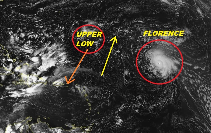
The latest satellite picture shows Major Hurricane Florence well to the northeast of the Leeward Islands. Winds this morning increased to 125 mph making it the first major hurricane of the season. We continue to look at the complex nature of the upper air across the Atlantic and there are issues ahead regarding strength and the forecast going forward.
WESTERN ATLANTIC TROPICAL SATELLITE

With regards to strength we have to the west of Florence a persistent zone of stronger wind shear. This area has not changed much for days. Florence will begin to interact with this in the next 2 days and this should impact the strength of the hurricane. It will be interesting to see whether it has impact since up until now the storm has totally outperformed by strengthening far more than modeled.
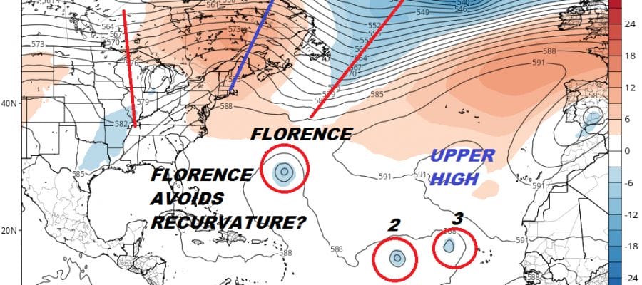
The upper low is forecast to drop southwestward which will create conditions favorable for strengthening as the shear diminishes. Assuming the impacts here are relatively minimal, Florence should maintain hurricane strength and then strengthen further beyond this point. The more important critical question regarding track is whether recurvature will occur east of 60 degrees west.

All the global models as well as a vast majority of the hurricane tracking models all suggest strongly that recurvature will not occur. The all argue that a building ridge to the north off the Atlantic coast will essentially cradle itself around the hurricane and keep it on a west northwest course.
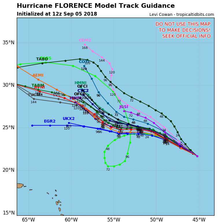
From here (if it gets far enough west) the questions only get larger. The strength of that Atlantic ridge will hold the key to the ultimate track and of course at this point models diverge. It seems pointless at this stage to get too wrapped up about it until we see what happens to it over the next several days regarding the impact of the shear and whether Florence will exploit the weakness in the mid Atlantic and recurve. QUESTIONS QUESTIONS QUESTIONS!
THANKS TO TROPICAL TIDBITS FOR THE USE OF MAPS
Please consult your local National Weather Service office at weather.gov for the latest information on any tropical or storms or hurricanes that could be a threat to your area. Consult your local government officials regarding action you may need to take to secure life and property. Maps shown here SHOULD NOT be used for decision making.
FiOS1 News Weather Forecast For Long Island
FiOS1 News Weather Forecast For New Jersey
FiOS1 News Weather Forecast For Hudson Valley