Nice Weather Continues Very Cool This Weekend Summer Ends Autumn Arrives
WEATHER IN 5 PODCAST
Another nice day is underway as our cool air mass has moved out to the east. We should be experiencing deep blue skies and lots of sunshine however the smoke from the wildfires in the Western US is covering skies over much of the US including the Northeast US. That is reducing sunlight and daytime heating and you certainly can tell when your outside that the sun is not as bright as it usually is. None the less it feels great outside with the low humidity and highs this afternoon should reach the lower 70s. Except for the milky white shading overhead on the satellite that is the smoke layer at 20,000 feet and higher, there are very few actual clouds showing up and there is no rain on the radars nor will there be into Thursday. Tonight we will see clear skies for the most part with most lows in the mid 50s to lower 60s.
SATELLITE

REGIONAL RADAR

Thursday we will see some sunshine and some clouds in the mix. A cold front will be approaching but there is very little moisture for it to work with. All the tropical moisture is pinned down in the Carolinas and points southward thanks to a stalled frontal boundary and the remnants of Sally that will be moving through there. Here it is just a chance for an isolated shower as the front passes Thursday night. Highs Thursday will be in the 70s to perhaps close to 80 degrees.
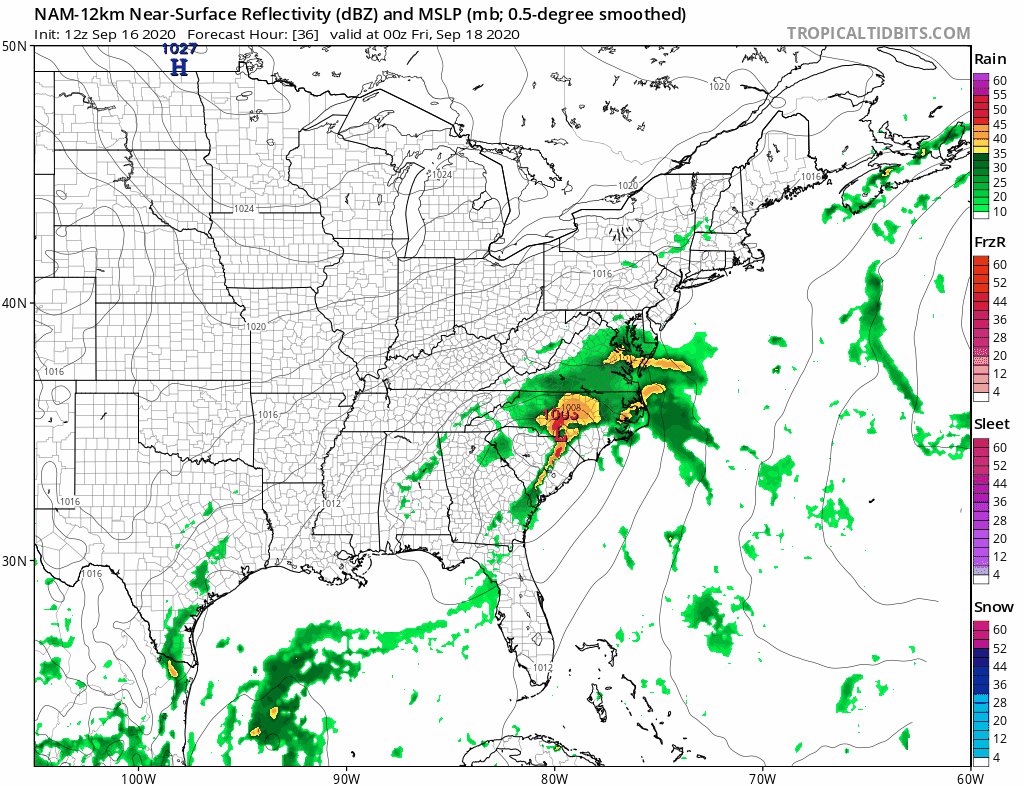
The Nam makes it a close call for the coast Thursday night into Friday morning with a frontal wave that absorbs Hurricane Sally but I think it is too far northwest and too close to the coast. Once the low goes by Friday weather conditions will improve with decreasing clouds, increasing sun, and an increasing wind. Temperatures will likely settle into the 60s and this begins a cool down for the weekend.
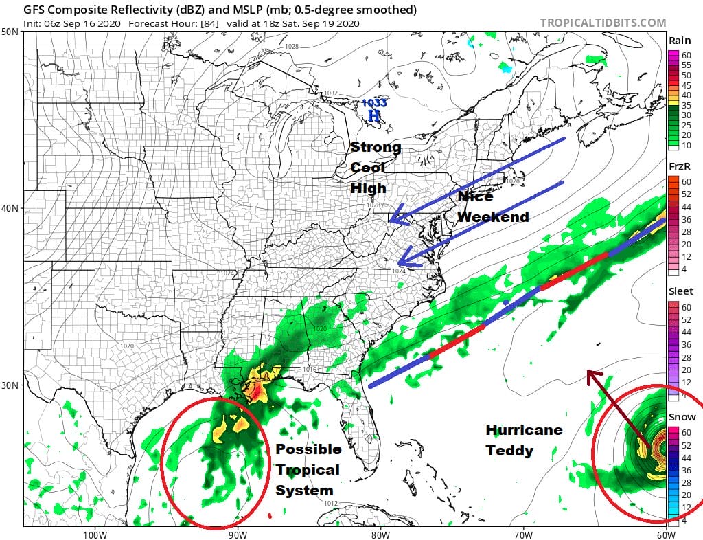
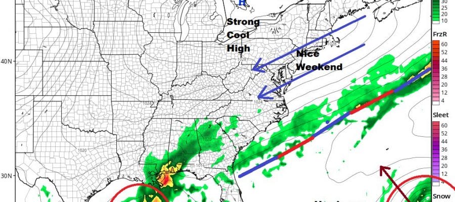
A large cool high builds down from Canada and it will be controlling our weather through the weekend and into next week. South of the frontal boundary lurks Hurricane Teddy that could make a very close pass at Bermuda over the weekend. There may also be another tropical system in the Gulf of Mexico. We here will be very cool as we say goodbye to summer and hello to autumn. We will have sunshine Saturday into Monday. A northeast wind will be on the gusty side at times especially as Teddy moves northward and interacts with it. It will be another weekend of rough surf and rip tides developing. It will be very cool both Saturday and Sunday with highs just in the 60s and nighttime lows in most areas will be in the 40s. Even the warmer urban centers will get down close to 50. If you like autumn weather, this weekend will be right up your alley as we say goodbye to summer.
BE SURE TO DOWNLOAD THE FREE METEOROLOGIST JOE CIOFFI WEATHER APP &
ANGRY BEN’S FREE WEATHER APP “THE ANGRY WEATHERMAN!
MANY THANKS TO TROPICAL TIDBITS FOR THE USE OF MAPS
Please note that with regards to any severe weather, tropical storms, or hurricanes, should a storm be threatening, please consult your local National Weather Service office or your local government officials about what action you should be taking to protect life and property.


