More Rain Today Weather Improves Tuesday Wednesday Rain Late Week
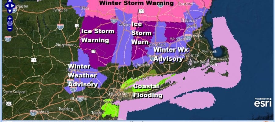
Overnight we saw the first round of rain move through and now we are getting ready for more showery rains to come in later today. Winter Weather Advisories continue for Northeast Pennsylvania and Northwest New Jersey (Sussex County). Ice Storm Warnings continue for Sullivan County in NY, northeast through the Catskills as well as Northwest and Northeast Connecticut. Winter Weather Advisories south along and north of Route 84.
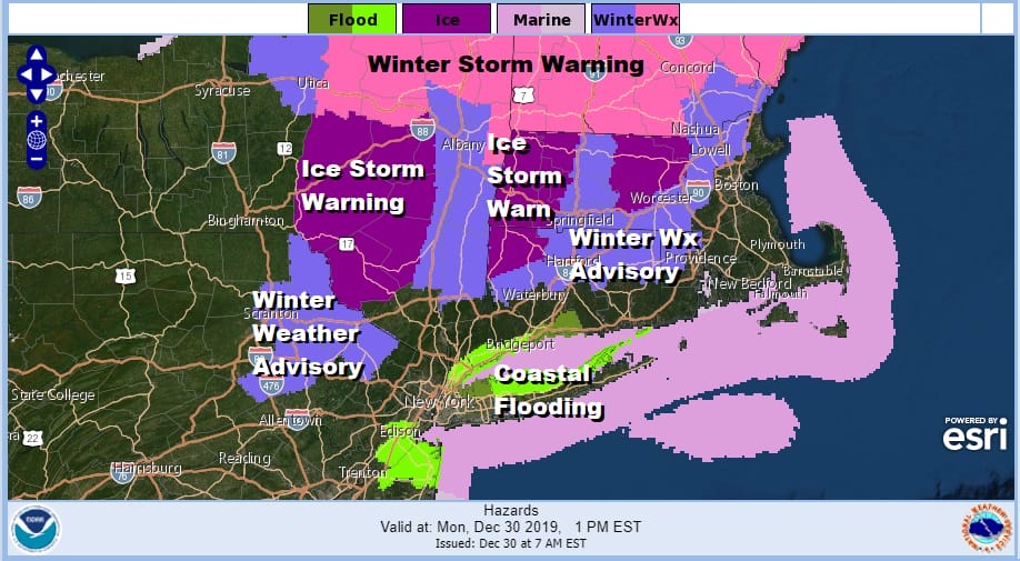
We also will see some coastal flooding issues at high tide today over parts of Long Island the Northern New Jersey coast thanks to the persistent northeast wind. Coastal flood advisories are up for minor coastal flooding at high tides.
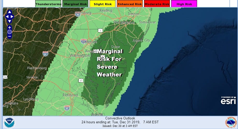
There is also the possibility of severe weather today from Southern New Jersey southward into the Delmarva Peninsula. Low pressure is going to redevelop somewhere near Chesapeake Bay and head northeast to off the New Jersey coast later today and tonight. We can already see the seeds of this on the surface map early this morning.

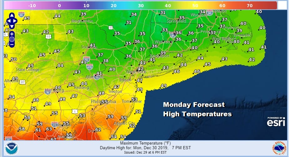
A bit of a warm sector is developing across Southern New Jersey and points south and temperatures at the very least will get into the 50s in this area and probably 60s when you get into Maryland and Virginia. I wouldn’t be surprised to see a strong cell or two develop later today from this scenario.
On to the satellite picture this morning which shows the first arm of clouds that is lifting up and around the main surface and upper feature to the west over the Great Lakes.
SATELLITE

REGIONAL RADAR

Regional and local radars are picking up on the showery rains to the west and the overrunning rains to the northeast as they move along. Dry periods are likely in between bands of rain today as they move from west to east. Watch for thunderstorms from Central New Jersey southward.
LOCAL RADAR NEW YORK CITY

LOCAL RADAR PHILADELPHIA


As far as areas subject to freezing rain and ice accretion this is always a tough cookie to figure out. Overnight there were pockets of icing. Most of the icing was forecast to occur later today and we still think that is the case though the amounts have been cut back somewhat.

All of this moves out tonight and weather conditions improve for Tuesday and Wednesday with a gusty breeze and some sunshine. Highs will be in the 40s for Tuesday New Years Eve with no weather issues at night. New Years Day will be partly sunny and chilly with highs in the upper 30s and lower 40s. Thursday look for sunshine and arriving clouds with highs in the 40s. The next chance for rain or showers will come with a cold front Thursday night into Friday morning.
BE SURE TO DOWNLOAD THE FREE METEOROLOGIST JOE CIOFFI WEATHER APP &
ANGRY BEN’S FREE WEATHER APP “THE ANGRY WEATHERMAN!
MANY THANKS TO TROPICAL TIDBITS FOR THE USE OF MAPS
Please note that with regards to any severe weather, tropical storms, or hurricanes, should a storm be threatening, please consult your local National Weather Service office or your local government officials about what action you should be taking to protect life and property.


