Ice Storm Winter Storm Warnings Advisories NE PA To New New England

It seems that a widespread ice storm is getting underway in upstate NY & New England. Winter Weather Advisories extend down to Northeast Pennsylvania to Sussex County in Northwest New Jersey northeastward into Upstate NY & Interior Central New England. Cold air is wedging southward from the northeast and we have noticed that temperatures this evening are a few degrees colder than what even the coldest models were showing today.
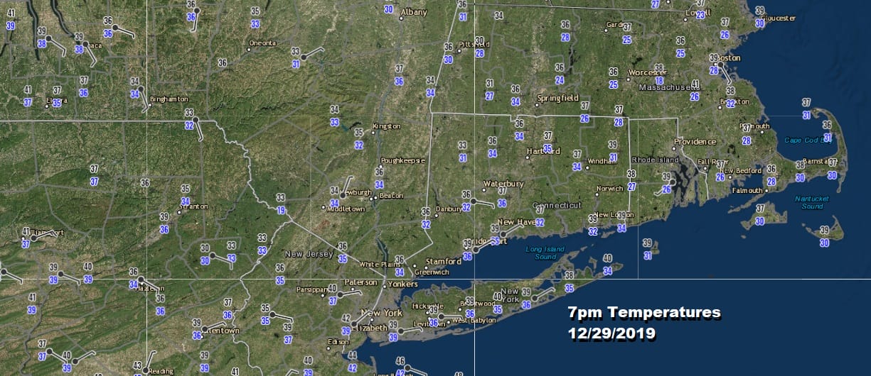
The push of colder air has made it down to the coast though well above freezing with temperatures in the upper 30s as far south as Southeastern Pennsylvania and Long Island but there is no chance the freezing mark gets any where close to the coast.
SATELLITE

REGIONAL RADAR

Rain has spread northeastward much faster than modeled as well with the first round already into Central New England. Local radars are showing rain moving through. Most of the rain is on the light side. It is not continuous as there are breaks but more rain is forecast overnight and on Monday. That is when the worst part of the ice accumulation occurs inland.
LOCAL RADAR NEW YORK CITY

LOCAL RADAR PHILADELPHIA


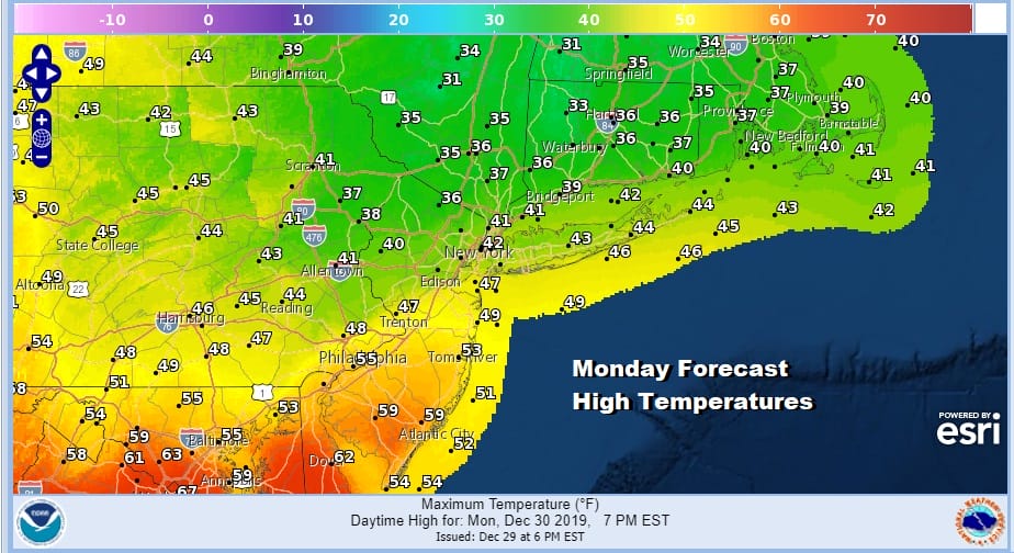
For Eastern Pennsylvania to Southern New England (south of Route 84) it is a miserable raw rainy affair tonight into Monday. Temperatures Monday will be in a wide range. Areas north of NYC may have a tough time getting out of the 30s while temperatures in South Jersey and Southeastern Pennsylvania could see temperatures up into the 50s as the southern portion of the cold wedge of air weakens.
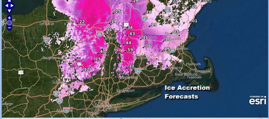
While it won’t be raining straight through into Monday night, there will be enough rain to produce a general 1 to 2 inch rainfall for the entire area. Of course this means major ice accretion for areas to the north where warnings and advisories are posted with up to 1 inch of ice accretion. That is more than enough to produce damage from fallen trees, tree limbs, and power lines.

Weather conditions are set to improve on Tuesday as low pressure heads northeast into the Gulf of Maine and beyond. A gusty northwest breeze and some sunshine for New Years Eve will mean temperatures in the 40s and no weather issues Tuesday night when the ball drops in Times Square. Temperatures should be near or just under 40 at midnight.

The NAM model as well as all the others support a nice New Years Day though a chilly one with some sunshine and a gusty breeze. Highs will be in the upper 30s and lower 40s. Dry weather should hold on for Thursday before another cold front and low head our way with some rain developing later Thursday night into Friday. Temperatures will be on the mild side Thursday in the 40s and perhaps into the 50s on Friday. Colder air follows in stair step fashion next weekend. Two cold fronts will be moving through though at this time no important rain or snow chances appear on the table in the longer range. Models have been struggling with the idea of something happening early in the first full week of January. We will be watching how the pattern evolves in the coming days.
Ice forecasts from local National Weather Service offices and snow forecast maps are available on the free weather app so be sure to download it if you haven’t already so that you are prepared for any winter weather.
BE SURE TO DOWNLOAD THE FREE METEOROLOGIST JOE CIOFFI WEATHER APP &
ANGRY BEN’S FREE WEATHER APP “THE ANGRY WEATHERMAN!
MANY THANKS TO TROPICAL TIDBITS FOR THE USE OF MAPS
Please note that with regards to any severe weather, tropical storms, or hurricanes, should a storm be threatening, please consult your local National Weather Service office or your local government officials about what action you should be taking to protect life and property.


