Monday Downpours Dry Nice Tuesday Wednesday
We finished off a very nice weekend of weather. Clouds held off today for the most part. Much of the area enjoyed a good deal of sunshine with reasonable temperatures thanks to an ocean wind. Now it is on to Monday and back to work. The moisture that has been parked to our south for the last 3 days now as the opening it has been waiting for to move up the coast. Clouds will start increasing from south to north overnight. Temperatures are in the 60s in most places thanks to the ocean wind which will now start to get moisture laden as the night wears on.
SATELLITE

REGIONAL RADAR

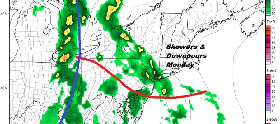
Not much is happening on the radars tonight nearby though some showers are beginning to show up offshore as well as to the south in Virginia. The showers are moving northward but most of the area should be dry until the early morning hours. North and east of NYC the rains won’t come until after daybreak.
LOCAL RADAR NEW YORK CITY

LOCAL RADAR PHILADELPHIA


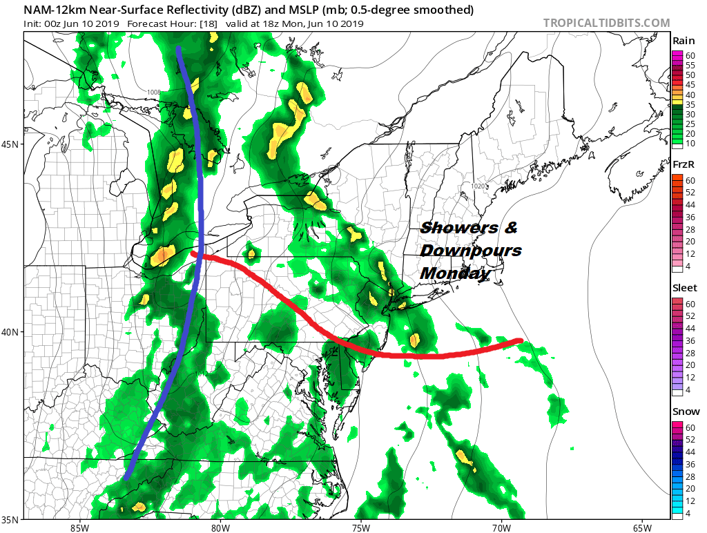
Downpours on Monday will not be continuous. There will be breaks in between. Models are suggesting a band of rain coming through during the morning hours and into early afternoon from south to north. Other patches of rain will be around during the day. Then as the cold front approaches from the west there will be another round of rain and some heavier downpours tomorrow night as they move from west to east. Monday will be a muggy day with temperatures reaching the 70s in most places.
Once the front passes weather conditions should improve rather quickly on Tuesday with developing sunshine and highs in the 70s. High pressure will be along the East Coast Tuesday night into Wednesday keeping it dry through Wednesday with some sunshine and late day arriving clouds. Highs again will be in the 70s.
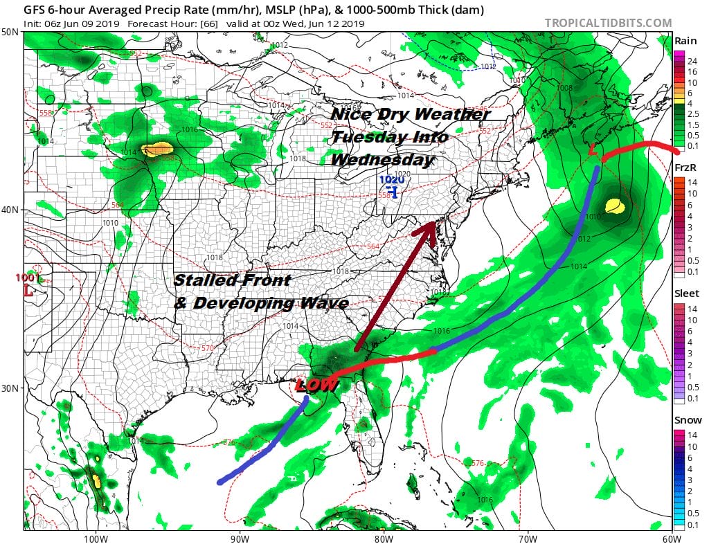
Monday night’s cold front stalls and another wave develops in the Northeast Gulf of Mexico. At the same time a systems swings in from the Great Lakes and lifts the wave northeastward. This will likely bring more rain or showers on Thursday until the front passes Thursday night. Dry warm weather follows for Friday and Saturday. We shall see if it holds on for Sunday Father’s Day. Right now indications are that Father’s Day will be warm and humid with another front approaching. Showers and possible thunderstorms with a little luck could hold off until Sunday night.
MANY THANKS TO TROPICAL TIDBITS FOR THE USE OF MAPS
Please note that with regards to any tropical storms or hurricanes, should a storm be threatening, please consult your local National Weather Service office or your local government officials about what action you should be taking to protect life and property.