Downpours Later Today Tonight Week Ahead & Father’s Day Weekend Outlook
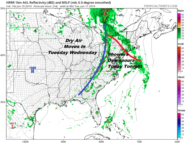
Clouds increased overnight now that the upper air ridge has weakened and moisture to the south is moving northward. To the west we have a cold front and an upper trough that is moving toward the east coast. Combining those two factors and you have the recipe for some downpours. later today. Temperatures will be in the 60s along the coast and into the 70s inland this afternoon.
SATELLITE
REGIONAL RADAR
Regional and local radars are bothin seeing an increase in shower activity to the south but it is not a solid wall of rain. I don’t think the rain will be continuous but rather it will come in waves later today. Tonight it will be about downpours and thunderstorms coming in from the west.
LOCAL RADAR NEW YORK CITY
LOCAL RADAR PHILADELPHIA

With the absence of a solid wall of rain obviously rainfall amounts are going to vary widely. Whoever gets into the heavier downpours could wind up with a quick inch or so of rain. Many have asked about the Yankees Mets series which begins tonight. If the radars behave themselves I think they may be able to get the game in.
There may be some rain still around for the start of the morning commute on Tuesday but weather conditions should improve rather quickly with decreasing clouds and increasing sunshine for Tuesday. Highs will reach into the 70s. Wednesday looks good with sunshine much of the day with highs into the 70s before clouds arrive late in the day.
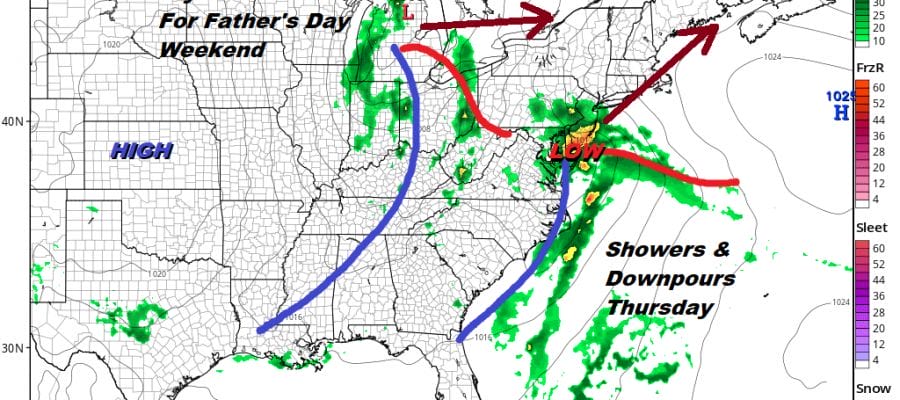
Wednesday night into Thursday looks like a repeat performance of today and tonight with another round of downpours and thunderstorms with a southern system moving northward while another system swings across the Great Lakes. Once this system is through high pressure and dry air come in for Friday, Saturday, and for at least part of Sunday Father’s Day. I think overall it will be a nice stretch of days with highs in the 70s Friday and reaching into the 80s over the weekend. The next warm front/cold front combination will likely arrive for Sunday night and Monday.
MANY THANKS TO TROPICAL TIDBITS FOR THE USE OF MAPS
Please note that with regards to any tropical storms or hurricanes, should a storm be threatening, please consult your local National Weather Service office or your local government officials about what action you should be taking to protect life and property.


