Miserable Sunday Rain Weather Improves Monday Noreaster Late Next Week
Miserable Sunday Rain Weather Improves Monday
Noreaster Late Next Week
Not a nice day at all out there; in fact it is downright miserable with cloudy skies and rain. The rain has been going on since the early morning hours and it continues today with a loaded radar this morning to the west. There are some heavier downpours in the mix and when it is all said and done most areas will finish off with an inch to an inch and a half of rain. Low pressure is in the Great Lakes now and heading northeast into Canada. The rain should end from west to east late this morning or early this afternoon as a cold front moves offshore. Weather conditions from there should begin to improve slowly but surely. Thanks to a warm front to the south of us temperatures are in the upper 30s to mid 40s this morning with an east northeast wind. Once the cold front passes and winds back around we should see temperatures warm somewhat into the 50s later this afternoon.
US SATELLITE

REGIONAL RADAR

LOCAL RADAR NEW YORK CITY

LOCAL RADAR PHILADELPHIA


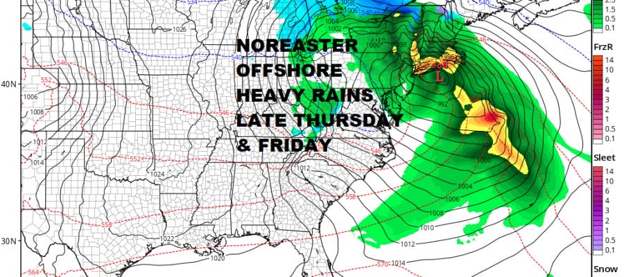
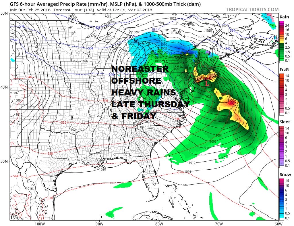
Skies will clear out tonight and the first part of next week, Monday through Wednesday look very nice with some sunshine each day and highs reaching the 50s. Everything seems on course for a noreaster impacting the area late this week. Low pressure moves across the Ohio Valley and redevelops to our southeast. As we draw closer to this event it seems that cold air is lacking for this to be anything other than a rain wind and coastal flooding event depending on track. The European model has the scenario that is the most problematic here with a track further south which exposes the area to more rain and wind. It also winds up with a more intense storm then the other models. Be careful however since the European has not had a very good winter season. Snow does not appear to be an issue here as the cold air in Canada will not be able to drain southward in time, though it is possible it could happen near the end of the event.
By Saturday it all begins to pull away as this storm moves out into the ocean though it will be dominant feature offshore for a few additional days. Weather conditions should improve next weekend at least.
 GET JOE A CIGAR IF YOU LIKE

FiOS1 News Weather Forecast For Long Island
FiOS1 News Weather Forecast For New Jersey
FiOS1 News Weather Forecast For Hudson Valley


