Rain Overnight Into Sunday Afternoon Storm Heads To Great Lakes
Rain Overnight Into Sunday Afternoon
Storm Heads To Great Lakes
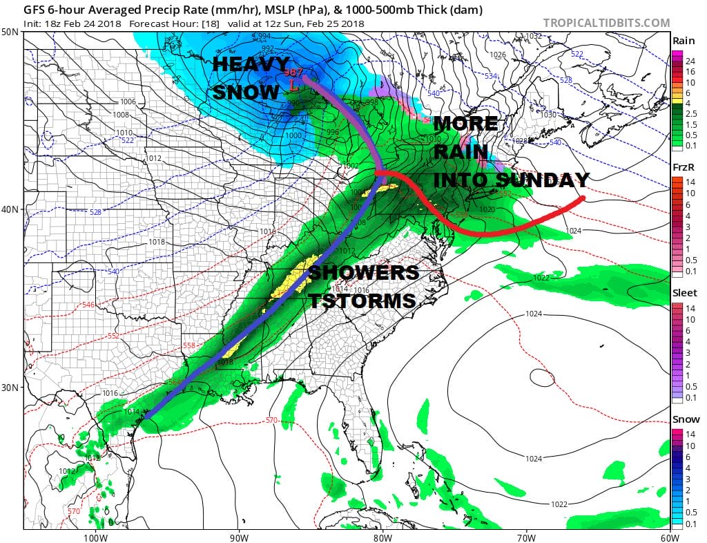
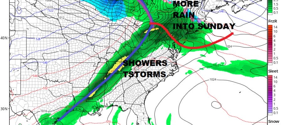
We have seen some rain move through parts of the area late this afternoon and this evening and radars are showing those showers moving out to the east at the moment. It appears that we will get a bit of a short break in the action as we wait for the main area of rain that will be approaching later tonight and lasting into Sunday afternoon. A warm front sets up to our south as a storm heads for the Western Great Lakes. The cold front with this system will pass through later Sunday afternoon and once it does so weather conditions will improve. The satellite picture below shows the storm with clouds from the Great Lakes swinging down into the Ohio & Tennessee Valleys where we are seeing some heavy rain and severe weather going on this evening.
US SATELLITE

REGIONAL RADAR

LOCAL RADAR NEW YORK CITY

LOCAL RADAR PHILADELPHIA


Temperatures tonight will likely settle in the 40s and then they will head back into the 50s on Sunday. Weather conditions will improve Sunday night. The first of next week looks dry and rather nice with sunshine for Monday through Wednesday with daytime highs in the 50s.
Late next week with a strong blocking pattern setting up we will be watching for the possibility of a noreaster developing near our coastline. There are a number of variables at play here and JOESTRADAMUS has all the latest on this in his long range post.
 GET JOE A CIGAR IF YOU LIKE

FiOS1 News Weather Forecast For Long Island
FiOS1 News Weather Forecast For New Jersey
FiOS1 News Weather Forecast For Hudson Valley


