
March Lamb Arrives Sunshine Warmer Into Midweek Lake Week Ocean Storm Develops
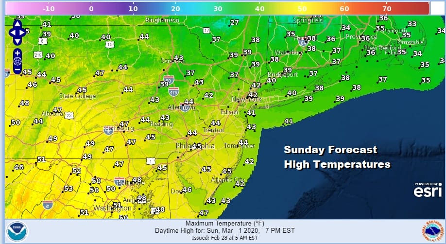
Half the weekend is done as is the month of February. A few snow showers developed yesterday and produced trace amounts of snow in some places. As a result many places avoided going down in the record books with a snowless February by getting trace amounts. Now we begin March cold but dry and with sunshine. Skies are generally clear for today and we should see a fair amount of sun. This should boost temperatures to the upper 30s and lower 40s.
SATELLITE

REGIONAL RADAR

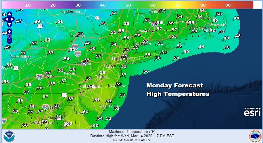
We will see temperatures bounce higher as we move into the new week. High pressure moves out and a southwest flow takes over on Monday. We actually should warm up quite nicely on Monday assuming we get enough sun. If we do that highs should reach the mid 50s to lower 60s. This is higher than what we though a few days ago.
Let’s view Monday as a day of sunshine giving way to arriving clouds. We do have a cold front that will be moving through slowly Monday night and Tuesday. The character of the weather for the week has changed somewhat as this front is going to come through a bit faster and stall out to our south across the Gulf States later this week. Monday night into Tuesday could bring the chance for a few passing showers, and again Tuesday night into early Wednesday. This makes Monday the warmest day of the week and that we will actually see temperatures cool down as the week moves along. Rain amounts from the passing showers should be minimal. Tuesday’s highs will be in the upper 40s to mid 50s.
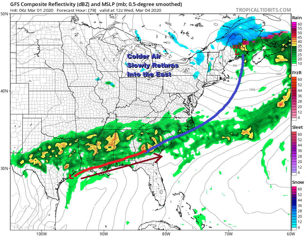
The colder trend continues for Wednesday and for Thursday. Wednesday’s highs will be in the mid 40s to near 50 and Thursday’s highs will be in the low to mid 40s. There will be leftover clouds on Wednesday and then some sun and clouds likely on Thursday. Highs Thursday will be in the low to mid 40s.
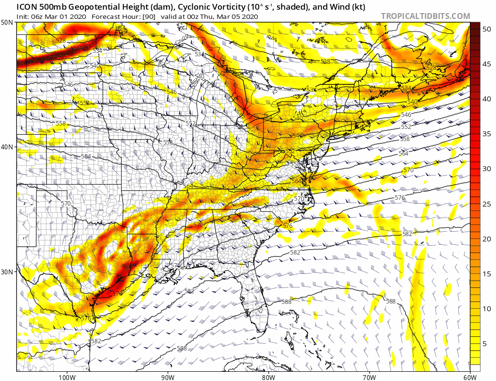
The end of the week is proving to be a bit more interesting as we watch two separate streams in the upper air pattern attempt to get together along the East Coast for Friday. Timing is interesting here on some of the weather models.
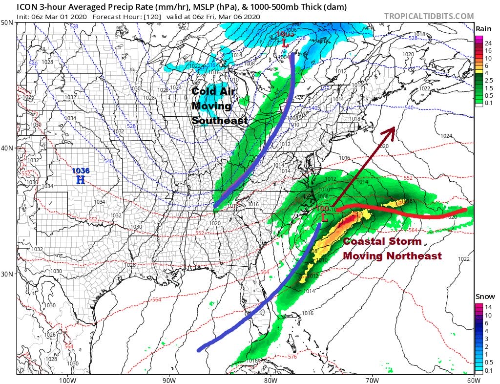
The European, Icon and Canadian models all seem to have a much closer call with the idea of some phasing of the two streams and a developing coastal storm moving northeast. The European model actually brings accumulating snows to Eastern Long Island and Southeastern New England making this a near miss. Given the way the winter has gone it probably will be. However this does have my interest given that it would not take much for this to time out differently. Dynamics would suggest that we would have enough top to bottom cold air if this plays out correctly. Perhaps this could be one of those windows of opportunity that snow lovers have been waiting for. The window is opened a crack.
BE SURE TO DOWNLOAD THE FREE METEOROLOGIST JOE CIOFFI WEATHER APP &
ANGRY BEN’S FREE WEATHER APP “THE ANGRY WEATHERMAN!
MANY THANKS TO TROPICAL TIDBITS FOR THE USE OF MAPS
Please note that with regards to any severe weather, tropical storms, or hurricanes, should a storm be threatening, please consult your local National Weather Service office or your local government officials about what action you should be taking to protect life and property.


