DOWNLOAD MY NEW FREE JOESTRADAMUS WEATHER APP FOR ANDROID

THE APP IS ABSOLUTELY FREE TO ALL BUT CONSIDERING SUBSCRIBING TO PATREON FOR A WEATHER EXPERIENCE FREE OF ADS, EXCLUSIVE VIDEOS FOR MEMBERS ONLY AND MUCH MORE…STARTS AT $2 A MONTH..MESSAGE ME AT ANY TIME

WINDY COLD TUESDAY SUNSHINE DRY LESS WIND WEDNESDAY INTO THURSDAY
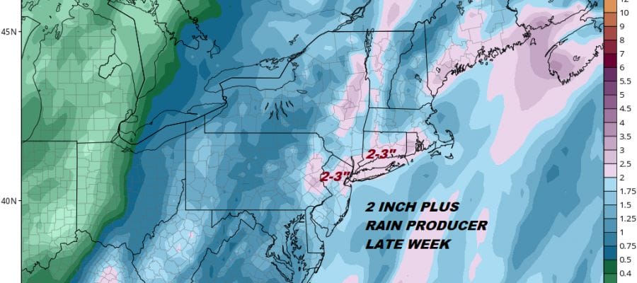
MAJOR STORM WIND RAIN COASTAL FLOODING FRIDAY
Today we are dealing with a howling northwest wind thanks to a deepening storm to the east of Nova Scotia and a strong high over the Great Lakes. The pressure gradient is very tight so look for winds to be cranking today at 20 to 30 mph with higher gusts. Temperatures wont be going much of anywhere today with highs just in the mid to upper 30s and wind chills that will be down in the 20s. At least we will have some sunshine though some clouds will pop up mid morning to late afternoon before going mostly clear for tonight. Winds should ease somewhat overnight as the gradient relaxes.
EASTERN SATELLITE

REGIONAL RADAR

There are no radar issues today nor will there be through the first part of Thursday. Wednesday looks nice and sunny with highs in the 40s. Thursday we will see sunshine giving way to arriving clouds as the next storm takes shape for Thursday night into Friday night. Low pressure will be developing in the Eastern Gulf States and then taking a track straight up the Appalachians. There is no cold air so there are no issues regarding snow or freezing precipitation. It will be rain from start to finish and that rain could be heavy along with strong southeast gales that will develop Thursday night into Friday morning.
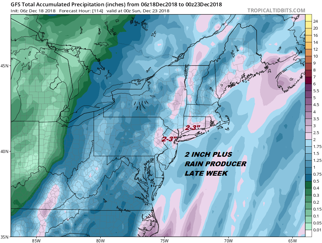
There could be some coastal flooding issues at high tide on Friday though we are going to be past the peak tides from the full moon which occurred on December 15th. Rain will continue Friday. We may get a bit of a break as the warm front pushes north and we wait for a cold front to move on through. More showers are possible late Friday into Friday night. Temperatures will be headed up to the 50s Friday and possibly even some 60s should the warm front move northward (always a dicey propostiion).
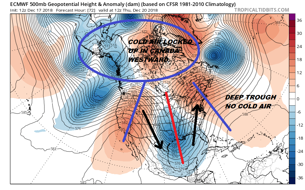
We should be drying out for the weekend. The European weather model was holding out for some snow Christmas Eve but that system has now disappeared on the European model but they all now seem to want to bring something out for the night of December 25th into the morning of the 26th though how much cold air is around remains to be seen. We will look at this situation further later today.
MANY THANKS TO TROPICAL TIDBITS FOR THE USE OF MAPS
Please note that with regards to any tropical storms or hurricanes, should a storm be threatening, please consult your local National Weather Service office or your local government officials about what action you should be taking to protect life and property.

