Low Humidity Transitions to Higher Humidity Thunderstorms Thursday
Low Humidity Transitions to Higher Humidity
Thunderstorms Thursday
Another terrific day for most of the area with this dry air mass covering the Northeast, just some passing high clouds came into the mix and mostly in areas to the south across Southeast Pennsylvania and Southern New Jersey. Temperatures topped in the 70s to near 80 and the humidity was low. We will attempt to squeeze out a few more precious hours of this before changes begin to get underway during Wednesday. A nice clear night is ahead of us with most lows in the 50s to lower 60s.
EASTERN SATELLITE

REGIONAL RADAR

Radars remain quiet and there are no showers in the forecast through Wednesday until late in the afternoon and evening on Wednesday when some lead showers reach Northeastern Pennsylvania and possibly into Northwest New Jersey. Sunshine starts Wednesday and then clouds roll in and increase throughout the day. Highs will be in the 70s to near 80.
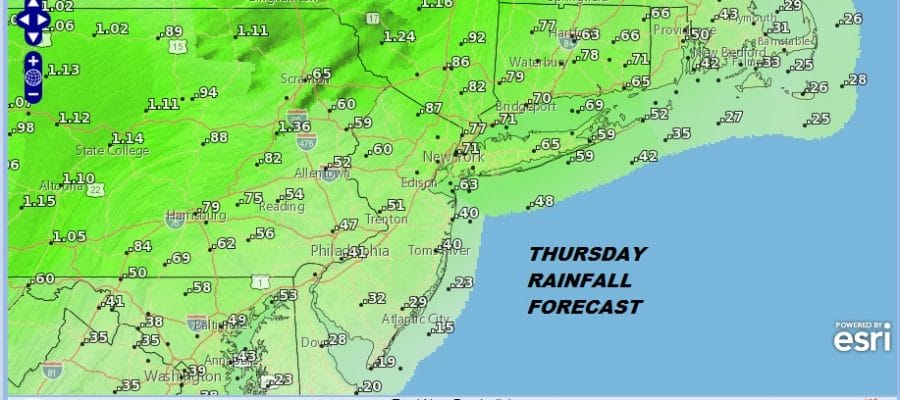
THURSDAY RAINFALL FORECAST

Thursday morning we will see some downpours and thunderstorms running around and there will be a few more during the day on Thursday as it turns warm and humid with highs in the 80s. Rainfall amounts are mostly under an inch and in some places well under but a thunderstorm could create some locally higher amounts. Everything continues on course for very warm to hot weather Friday.
FRIDAY FORECAST HIGH TEMPERATURES

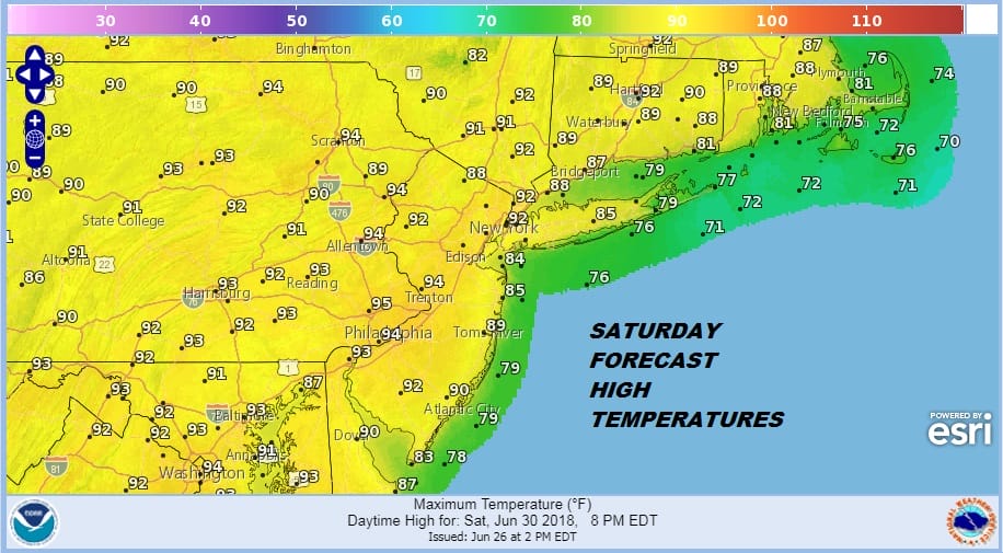
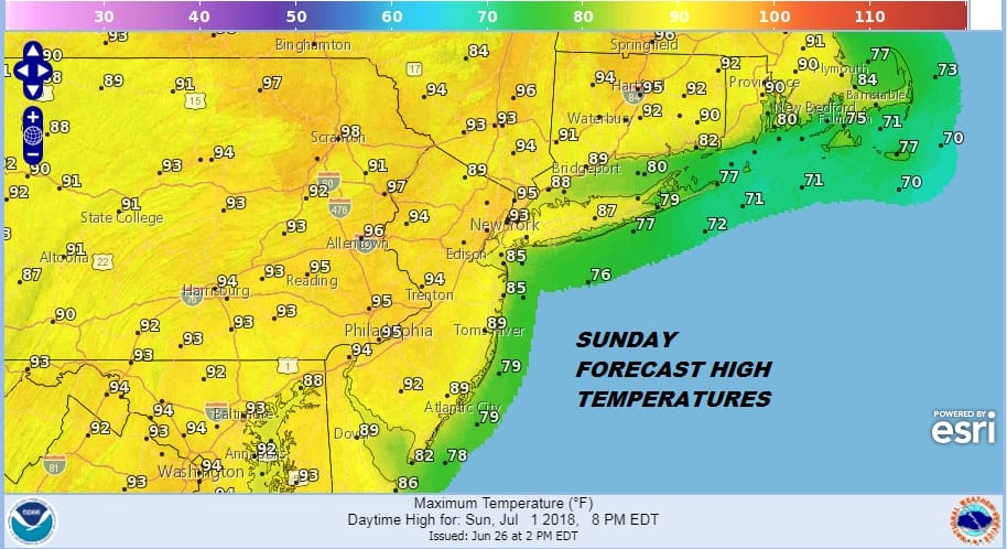
Friday we will some areas touch 90 degrees with sunshine. Temperatures will increase a little each day peaking on Sunday which should be the hottest day with highs in the low to mid 90s. Temperatures should be cooler along the immediate coast when sea breezes develop.
SATURDAY FORECAST HIGH TEMPERATURES
SUNDAY FORECAST HIGH TEMPERATURES
Hot humid weather will continue into next week but it may be tempered somewhat by an onshore flow that will develop on Monday. This will at least lower temperatures along and just inland of the coast though it could still be above 90 just inland.

Pop up thunderstorms are always possible but they should be minimal Friday through Sunday. They could pick up a bit on Monday and then become a bit more numerous Tuesday and Wednesday as a weather front approaches.
 GET JOE A CIGAR IF YOU LIKE

LATEST JOESTRADAMUS ON THE LONG RANGE


