
Clouds Downpours Thunderstorms Before Heatwave Begins Friday
Clouds Downpours Thunderstorms Before
Heatwave Begins Friday
Clouds are rolling in from the west and they seem to be coming in a bit faster then previously advertised. This is the change in the pattern that is occurring across the Eastern US as we replace a trough with a ridge. Look for clouds to thicken up today and watch for some showers. There are already some on the radar across parts of Pennsylvania this morning and we could see some of those push eastward late this afternoon and this evening. Temperatures today are starting out in the 60s and they probably won’t get far at all in the 70s given the cloud cover and an ocean wind.
EASTERN SATELLITE

REGIONAL RADAR

It appears that the first band of showers on the regional radar will try to go north and west of the coast and bypass Southeast Pennsylvania and South Jersey but it could clip North Jersey & the Hudson Valley as they move northeastward.
LOCAL RADAR NEW YORK CITY

LOCAL RADAR PHILADELPHIA


Tonight look for more downpours or a thunderstorm though they will not be continuous. Some of the downpours could be heavy. This threat continues into Thursday afternoon before this weather system clears the coastline tomorrow evening. Thursday will be noticeably more humid as highs reach into the 80s.
HEATWAVE BEGINS FOR SOME AREAS FRIDAY
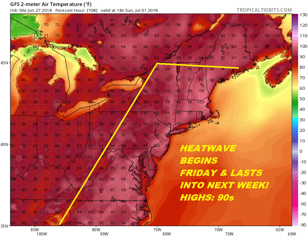
90 degree temperatures begin for most (but not all ) areas on Friday as sunshine returns. This is going to be a heatwave of 5 plus days for most (but not all) areas and should carry us into the 4th of July. Sunshine will be the rule Friday through Monday with just a minimal chance of a pop up shower or thunderstorm. Temperatures along the coast will be cooler with sea breezes developing. The hottest day of the stretch should be Sunday with highs reaching at least the middle 90s in many areas. Early next week we will have to keep an eye on the wind direction. If it turns more southerly that will temper the heat a bit. Humidity of course stays wretched all the way through. Thunderstorm risks will likely increase next Tuesday and Wednesday with an approaching weak weather front. Basically folks summer is here and this is beach and pool weather going forward.
 GET JOE A CIGAR IF YOU LIKE

LATEST JOESTRADAMUS ON THE LONG RANGE


