CHILLY CANADIAN AIR MID TO LATE WEEK
STORM SYSTEM FOR THE WEEKEND STILL IN FLUX
We didn’t expect much clarity in the storm system for the weekend today and we didn’t get much clarity. At least models are consistent in remaining inconsistent in how all that evolves. We are sure of the weather until then which will feature a sub par warm up on Tuesday as a weak cold front comes through. Temperatures will make it into the 60s for the last time this week and possibly for the month. At least Tuesday’s warm up comes with clouds and some sunshine and no showers are forecast as there isn’t much moisture available for the front to play with.
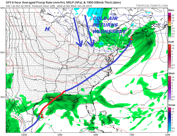
If this were winter time no doubt that the snow and cold weather weenies would be excited about a cold high to the north and a Hudson Valley wind. This is usually the recipe for consistent cold that could set the table for snow if and when the next storm system approaches. This however is late October. The cold air for this time of year is indeed cold with temperatures forecast to be 10 to 15 degrees below average for the rest of the week. No rain is forecast through Friday. Dry weather and some sunshine is forecast but highs will only be in the lower 50s Wednesday and in the 40s to near 50 at best Sunday and Monday. Thursday and Friday morning will be cold and we may see the few remaining areas that have avoided lows of 32 or less finally capitulate.
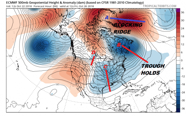
Now comes the issue for the weekend and we will use the European model to illustrate the forecast dilemma. There are 4 main players here. First and probably the most important player at this stage is the blocking ridge in the North Atlantic (A) which is keeping the trough off the East Coast (B) in place. This ensures us being cold and dry Wednesday through Friday. To the west are troughs C & D which represent the approaching systems that will create the storm system. It starts in the Gulf States and then moves up the Eastern Seaboard over the weekend. The blocking ridge needs to weaken enough to allow the trough off the East Coast to pull out somewhat. That allows room for troughs C & D to head into the East.
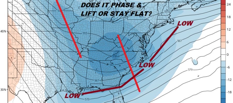
Now we jump to the GFS which offers one possible outcome. If the trough off the East Coast doesn’t get out of the way enough it will keep the next 2 short waves weaker, which will bring a low up the East Coast and keep it offshore. The GFS has been struggling with this for a week going back and forth on whether we see a deep system ride up the coast or flatter and further offshore with far less impact.
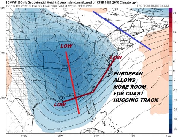
The European model today strongly supports the notion that there will be room as it creates a stronger flow with low pressure lifting northward up the East Coast. The trough off the East Coast gets out of the way. This would bring rain and wind here Saturday into Sunday as the low moves northward. The European also has other issues as there isn’t one powerful shortwave in play here. Yes we will see low pressure move up the coast but it won’t be any sort of powerhouse.
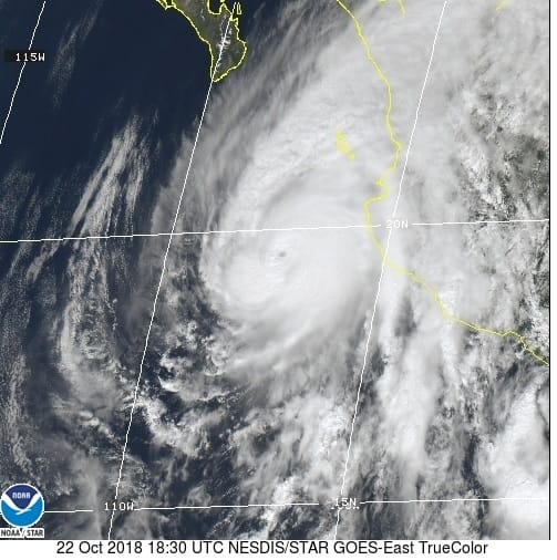
There is one other player in here and that is Hurricane Willa which is a category 5 hurricane in the Pacific that will make landfall along the west coast of Mexico. Moisture and the remnants will likely get involved with this system as it develops in the Gulf of Mexico. While there is nothing about this weekends system that is tropical. the moisture from Willa does add an extra feature to keep a watch on as this could enhance rainfalls.
In summary we are still in a state of flux. We need to resolve how all the upper air pieces come together or perhaps don’t come together at all. It was my feeling yesterday that we wouldn’t have clarity on this until Wednesday of this week and nothing today causes me to change my mind. As to the snow question which came up in the last few days as models did some strange things in the past several runs, it is late October and not late November. For snow to be an issue in the rare cases that it has happened you have to have a perfect set up and a lot of dynamic cooling from strong features aloft. While some of those features are present, I don’t see that becoming at issue at this time. An argument might be made for wet snow in elevated areas in Upstate NY and Central & Northern New England but this is not the time to figure that out. That would be a short range (inside 3 days) issue. If it winds up becoming an issue we can discuss it at the end of the week.
SUBSCRIBE TO PATREON FOR A WEATHER EXPERIENCE FREE OF ADS, EXCLUSIVE VIDEOS FOR MEMBERS ONLY AND MUCH MORE…STARTS AT $2 A MONTH..MESSAGE ME AT ANY TIME
THANKS TO TROPICAL TIDBITS FOR THE USE OF MAPS
Please consult your local National Weather Service office at weather.gov for the latest information on any tropical or storms or hurricanes that could be a threat to your area. Consult your local government officials regarding action you may need to take to secure life and property
FiOS1 News Weather Forecast For Long Island
FiOS1 News Weather Forecast For New Jersey
FiOS1 News Weather Forecast For Hudson Valley

